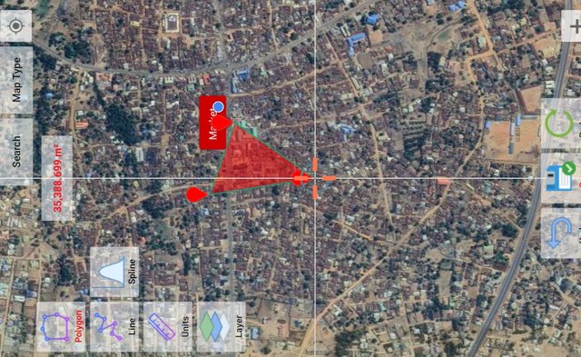
Make a polygon and draw the main roads near that site.
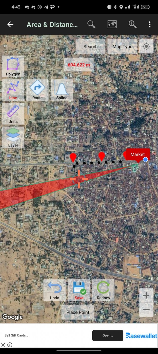
To perfect this task I went to one of the busiest places in my town which is the Akwanga market. The market is one of the central hubs in Akwanga Local government area of Nasarawa State. I was able to use GTM GEO MAP to outline the route surrounding the areas which you can see from the image.
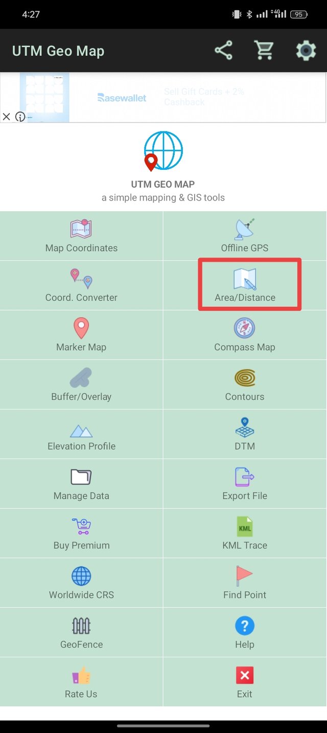
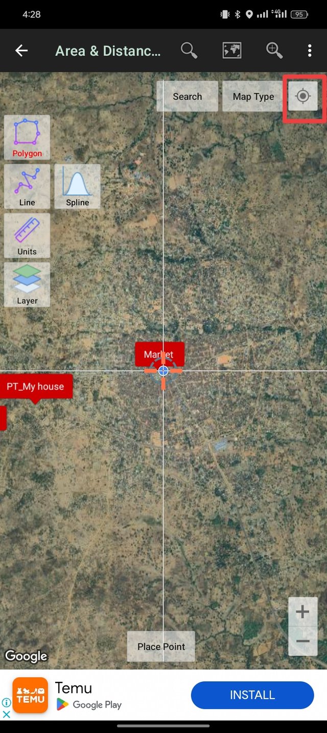
In accessing the key routes surrounding the market, I open my GTM GEO MAP and select Area/Distance which I then click on the circle at the top right-hand side to spot my location (Goodiya Palaza).
 |  |
|---|
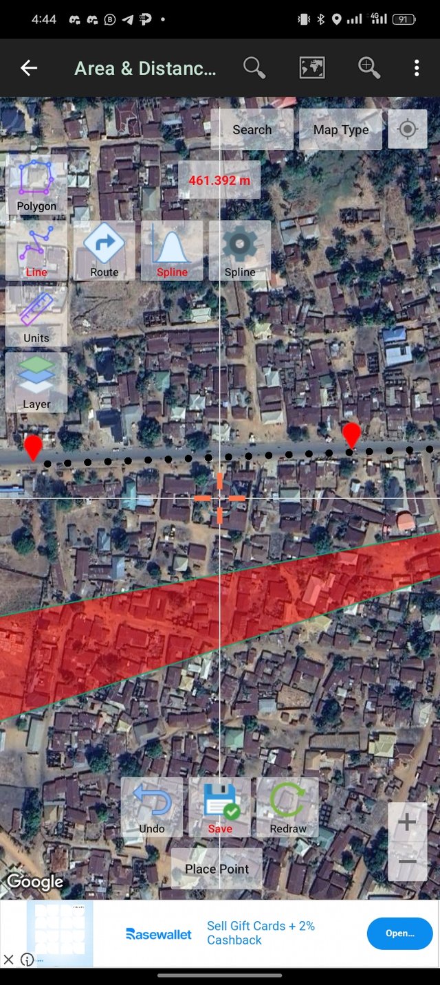
Based on the information, the main road that surrounds the market is; A234 Highway which is the major road that runs through Akwanga connecting other important cities and towns. The Lafia Road is the road leading southward which connects to the state capital. Wamba Road is the road that extends towards the northeast and the Keffi Road which is the road heading to the southwest, connects to the federal capital territory (Abuja).
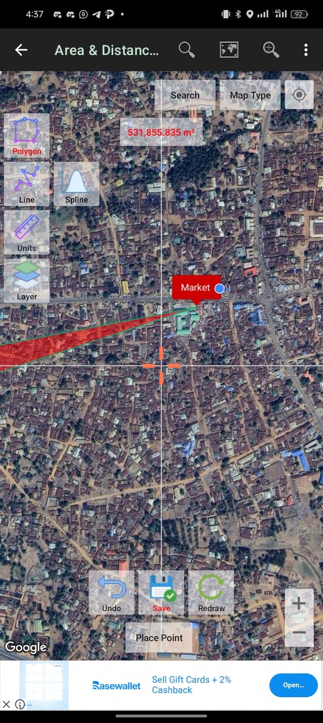
I further used a polygon to draw the main roads near the Plaza that I was, which you can see in the images.
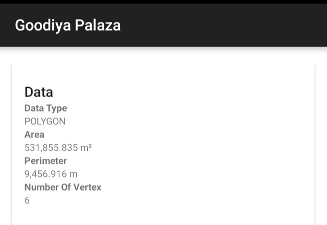
When creating the polygon, at the top, the surface area in hectares (ha) appears and when you draw the road, the distance appears in meters (m). What is the surface area of the polygon you created and how many meters is the road you drew?
The surface area of the polygon that I created is 531,855.835 m². The road is 9, 456. 916 m.
Customize both the polygon and the road by assigning color, line width, and appearance. Everything to your liking.
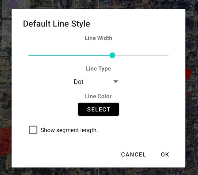
At this point, I select the line width, line color, and type, and I use dot to highlight the major road that links to other major roads.
 |  |
|---|
Create a 200-meter Buffer.
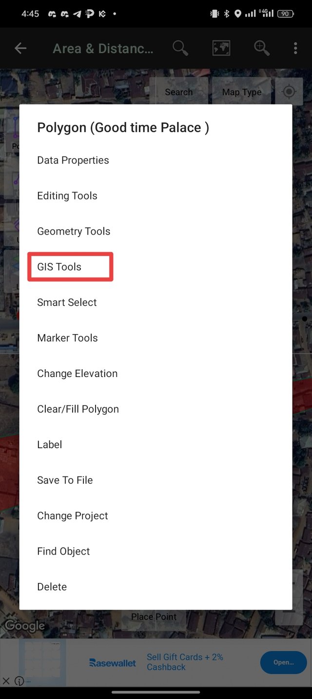
What I did, was double-tapping the polygon that I have already created and select GIS Tools at the gh dialogue box that pop-up.
 |  |
|---|
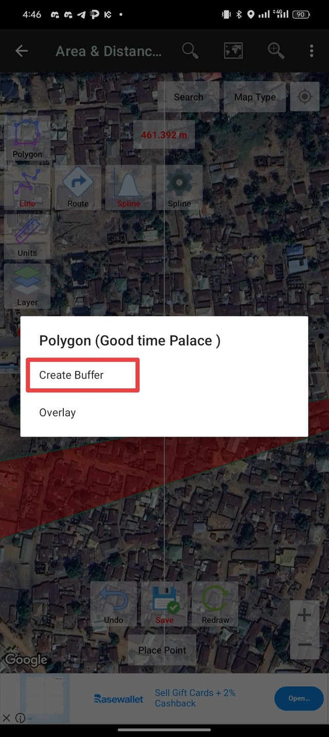
After tapping on the GIS Tools another dialogue box opens again which I then select Create Buffer and select Fix Length.
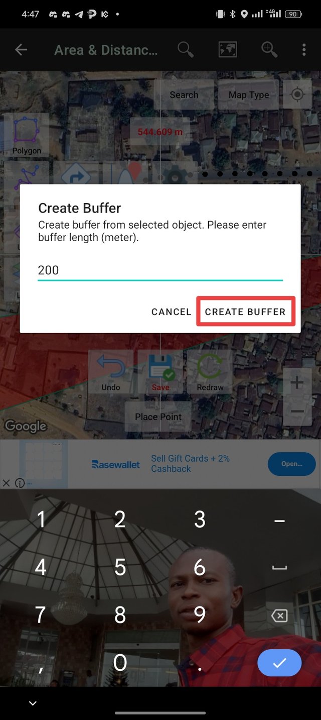
I then set the length to 200 meters and tapped on Create Buffer and the buffer was then created.
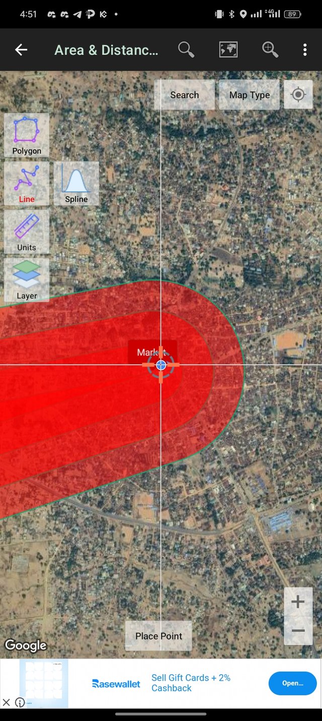
Why did you choose that place and what things are around it?
I chose that place because it was the place that I was at which I went to buy a wristwatch. It is one of the busiest places in the market and Akwanga market is a well-known market that Is one of the commercial hubs in the town. There are a lot of things that are around the place which most of the things are shops, motor park, chemist and other things
Is it easy to get there? How can you access it?
Yes, it is very easy to get there. The place can be accessed from any of the major routes I access the place from the keffi road where I enter an Okada that drowns me down to the market. As I stopped at the market side I then used my leg to walk to the place which is just close to the roadside that links to Wamba.
Looking at the buffer you created, how would you define its area of influence? That is, is it a good commercial or residential area? Is it close to an area with vegetation? Is it a busy area?
The Goodiya Palaza is located in a good commercial area which is very close to the major road. It is in a strategic area and the most influence is in the place due to the kind of items that are sold in the plaza almost everyone who usually visits the marketplace does get to know the area.
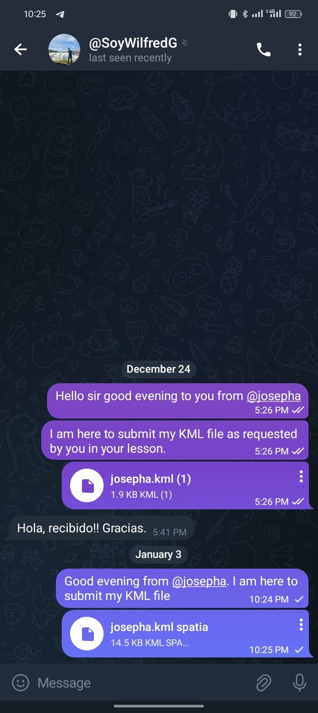
Export the project to kml and share it with me to my SoyWilfredG telegram
I am inviting; @dove11, @simonmwigwe, and @ruthjoe
Cc:-
@soywilfredg