Drone Deploy is an app that allows turns your drone into a 3dmoddeling, 2d mapping agricultural scanning machine. It has been developed in LA but over the last couple of years has gained serious momentum. What it can do is brilliant and even more so that when you set up what you want to do. It can be programmed so the drone will take off, fly the required path to acquire the data and land autonomously.
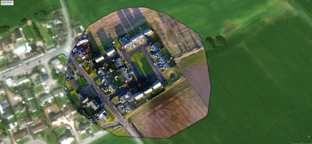
This was one of the first maps and flights i completed. As you can see i placed it over a google map picture and the drone deploy image is more detailed.
It is proven by to be a real game changer and turns what was once seen as a toy into a great tool. Now what I will recommend is you don't advertise your services as a surveyor or crop survey expert remember these services are very different and will require skilled and trained personnel. What you are offering or could do is team up with some of these people you have been through your own training you have got your permission and you have the drone and the software. Drone Deploy give you a great trial period so do not hesitate to miss the opportunity to at least give it a try. See what it's like, get in the valuable practice you can save your work and show it to building contractors, farmers, groundwork firms. You are offering a valuable asset a view of their work sight they probably could not see otherwise. Drone Deploy also have great webinars and help on their website they love to keep everyone up to date with what is happening and experienced company's over have input as well so soak up as much information as you can.
You can try the software for free, so get out and start madding maps playing with the autonomous flying modes and see what great fun you can have. It can be scary at first watching your drone fly off into the distance but mine did return and I managed to get some nice map overlays. Be very careful of your surroundings and watch for any telephone wires and power cables etc, even though some drone have sensing capabilities these can be missed by the drone.
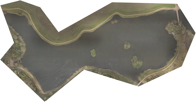
This is one of the maps I created with Drone Deploy

Overall I found drone deploy quite easy to use and the app and computer interface is great. The processing time of small projects was quick and they are always improving and developing.
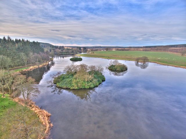
This is a HDR picture I created after I was finished played with the drone deploy app.

Congratulations @muzza989! You have completed some achievement on Steemit and have been rewarded with new badge(s) :
Click on any badge to view your own Board of Honor on SteemitBoard.
For more information about SteemitBoard, click here
If you no longer want to receive notifications, reply to this comment with the word
STOPDownvoting a post can decrease pending rewards and make it less visible. Common reasons:
Submit