The shape of the earth. image source
Greetings, how are you steemit friends? glad to see you again and hopefully healthy always.
Today I will discuss a misconception that we have been using for more than 400 years, this post also affirms that science is an ever-evolving knowledge, what you know and think about science 100 years ago could be now no longer valid or even considered heretical, hopefully useful.
For more than a few hundred years ago, we have used the map as we know it today. Scientists who previously believed that the flat earth finally found some new evidence stating that the earth is not flat or spherical, but is it true?
I really do not want to argue whether the earth is really ball-shaped or flat, but in accordance with the general knowledge that I currently know, it is more emphasizing a knowledge that the earth is spherical. But as a follower of science, I can not only believe in some kind of knowledge and I also believe that science will continue to change, it could be what we currently believe just a few years ahead cannot be trusted because it has found new evidence that undermines knowledge long.
As I mentioned above, that current knowledge generally believes that the earth is spherical, but whether believing the spherical earth can benefit us? certainly does not benefit anything for ordinary people like me. It's just that a researcher from Japan mentioned that if true we believe that the earth is true round-shaped then we have used a wrong earth map.
In fact, the history of the flat earth is much older than those who believe that the earth is spherical. It is Pitagoras who states the theory that the earth is spherical, Pitagoras itself lived in the 6th century AD so we can know that before humans believe the earth is flat.
When the theory of the spherical earth is finally believed to be like today by many people, we finally find a silliness to it. Many experts make a spherical earth map in 2D media or paper finally make us mistaken for some things that are considered important, why did it happen?

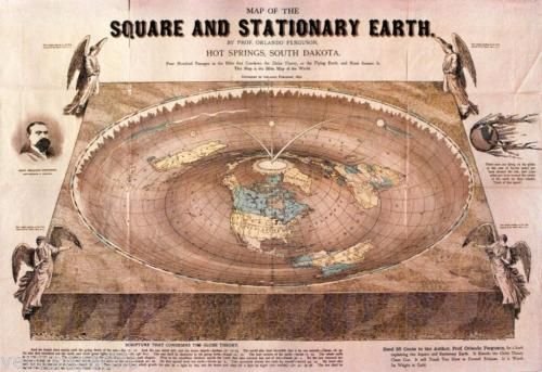
Flat earth map. image source
I will not discuss the understanding of flat earth in this post because as we have agreed that only knowledge that has been trusted in commonly I will discuss, that is spherical earth.
As a commonly knowledge, that the earth is round/spherical and there is no boundary or end of the earth as is believed by flat earth society but will ultimately make it difficult for mapmakers to determine the size of a particular area, it has happened for hundreds of years and strangely we believe in the map even teach our children about the weirdness.
I will ask you, how do you describe a surface with real size with a round object? I mean drawing on 2D media with round model.
We will take an example of a ball, if a split ball becomes eight parts and spread on a flat surface then you will find a stretchy or contracted surface, it can make us lose the exact extent of every surface we have stretched on a flat surface, as well as a spherical earth map.
One of the facts that the map of the earth we are using today is mistakenly a map of UK.

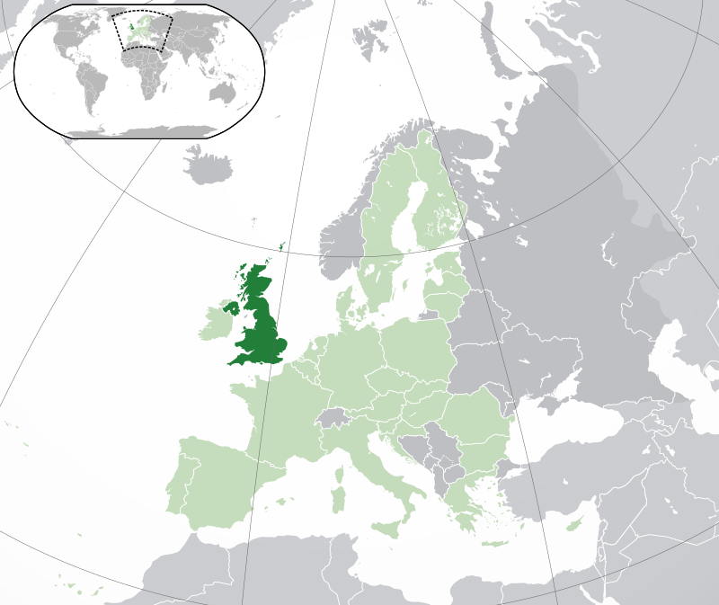
UK maps that we still use today. image source

The current world map we use. image source
The world map we use today illustrates that the UK is bigger than some of the other islands,
In fact the UK has a total area of 242,495 km2[1] and the Philippines has a total area of 343,448 km2[2].
Why on earth's map now UK look bigger? it happens because of accidental projection mistakes made by experts, not just the UK, but almost all regions adjacent to north and south poles experience something similar.
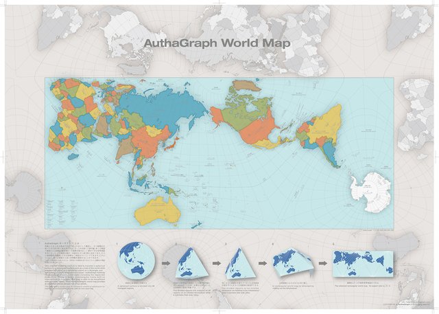
Until an architect who came from Japan to realize it, from research with some models of the earth he finally found the size and shape of the map in accordance with conditions of an earth.
Hajime Narukawa successfully projects the earth map and is currently considered most accurate by scientists and experts. He named it the AuthaGraph map and has earned many international awards [3].

As we know, that many ships have gone astray and the problems caused by the circular/spherical earth map projected onto 2D media, it is due to errors of coordinates and locations to be found.
With the AuthaGraph map is expected all a problems caused by an understanding of the wrong world map can be resolved immediately. Currently, the AuthaGraph map has been marketed and has spread throughout a country.
We have been using earth maps of the wrong size for more than 400 years, it has made many losses every year, such as the difficulty of finding places, getting lost, and so on.
Currently, experts agree that AuthaGraph map is the most accurate map, it is expected that the presence of AuthaGraph map can help and justify the mistakes that we have been doing.
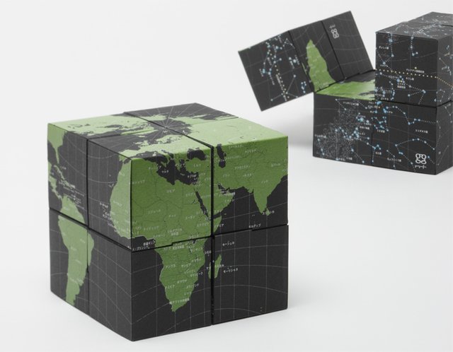
In accordance with the projection of Hajime Narukawa with the AuthaGraph map he finds, he gives a more aesthetic form of a globe, not flat or round/spherical but many surfaces. Hopefully, the form does not trigger a new debate about a shape of the earth. LOL
This is the only thing I can write on this occasion, over all the mistakes and lack of unintentional writing as a servant of God, I apologize.
Thanks to friends who have visited this blog and provided constructive comments, as well as scientists who are willing to sacrifice their time for a better civilization.
Active link reference:
[1] www.wikipedia.org
[2] www.wikipedia.org
[3] www.science.idntimes.com
Do you love science? by respecting the work of others and not plagiarism then you are welcome to join steemSTEM by using #science tags, you can also chat with us in steemit chat/steemSTEM channel.

Very good discussion, especially about experiences that very few people know. thanks @kharrazi
Downvoting a post can decrease pending rewards and make it less visible. Common reasons:
Submit
Intersting article ! Thanks for sharing :)
Downvoting a post can decrease pending rewards and make it less visible. Common reasons:
Submit
Hi my dear friend @valentinas
I'm so glad you visited my simple blog
Thanks :)
Downvoting a post can decrease pending rewards and make it less visible. Common reasons:
Submit
I think your post very good information for the people, specially for the sea travelers or flights. Many ship and aircraft can use the correct Authagraph map so that not to be lost when they go to somewhere.
Downvoting a post can decrease pending rewards and make it less visible. Common reasons:
Submit
History :
Muslim scientists who made sure the Earth was round in the 10th or 6th century sooner than Sir Francis Darke in 1577.
Downvoting a post can decrease pending rewards and make it less visible. Common reasons:
Submit
Nice post. Really informative
Downvoting a post can decrease pending rewards and make it less visible. Common reasons:
Submit
Very nic post .I liked your posts
Downvoting a post can decrease pending rewards and make it less visible. Common reasons:
Submit
Good post @kharrazi
Downvoting a post can decrease pending rewards and make it less visible. Common reasons:
Submit
very useful, before I do not and I really want to know the continuation of your post
Downvoting a post can decrease pending rewards and make it less visible. Common reasons:
Submit
Congratulations! This post has been upvoted from the communal account, @minnowsupport, by kharrazi from the Minnow Support Project. It's a witness project run by aggroed, ausbitbank, teamsteem, theprophet0, someguy123, neoxian, followbtcnews, and netuoso. The goal is to help Steemit grow by supporting Minnows. Please find us at the Peace, Abundance, and Liberty Network (PALnet) Discord Channel. It's a completely public and open space to all members of the Steemit community who voluntarily choose to be there.
If you would like to delegate to the Minnow Support Project you can do so by clicking on the following links: 50SP, 100SP, 250SP, 500SP, 1000SP, 5000SP.
Be sure to leave at least 50SP undelegated on your account.
Downvoting a post can decrease pending rewards and make it less visible. Common reasons:
Submit