Land Ops is a unique Amateur Radio, Navigation, and 4x4 club based out of southern California. Their events are called "Ops" and typically take place over a weekend, with the Op conducted during one day (or sometimes night), with camping before and/or after.
This weekend my Son (Ivan) and I attended our second Op. This Op was conducted in an area of the Mojave Desert between Interstate 10 and Interstate 40, near the Arizona border; an area that we have not really explored before. The Op was set to start at 10am, and was about 4 hours from our house. Not wanting to get up a "0'dark thirty", we decided to head out after work Friday. That would put us in camp pretty late, but we figured it would be better to sleep in a bit before the Op then add 4 hours of driving to the beginning... Plus, neither my Son, nor I are exactly 'morning people'
We arrived in camp at about 11:30pm. We tried several times to raise basecamp on the radio on the way in, but got no response. We figured everyone had already turned in for the night, and we where right. Camp was dark with the exception of a dim LED illuminating the Land Ops flag on the main antenna mast. We did our best to set up camp quietly, and turned in for the night.
Morning came and upon exiting the tent, I was greeted with an amazing view of the jagged mountain range that was completely obscured by the darkeness on our arival.
Rock towers
Our home away from home
I introduced myself to our neighbors, and Checked in with 'Net Control' before making breakfast (Sausage and egg burritos) and rousing my Ivan (not an easy task. That boy sleep like the dead, even in a tent in the middle of the desert). After breakfast, we emptied the rest of the camping gear out of the truck in preparation of the days adventure, then headed back to Net Control for the briefing. When we arrived, Chris (the founder of Land Ops) asked me if I could lead one of the teams. "Sure, why not?" after all, I've done this once before... in the dark, lol. It turns out, Leading a team was not that hard. Mostly, I was in charge of communication and was the team's point of contact. Everyone on this Op was a licensed Amateur Radio operator, but we where running a 'controlled' net- meaning we had a main station that controlled all communications on the primary frequency. You where only supposed to use it for 'official' transmissions; this is good practice for larger situations when you might have hundreds of stations on the net during an emergency or other event.
During the Briefing, we all introduced ourselves and where given our team assignments. Turnout was small for this Op, but we had enough people to run it. I was assigned to team "Alpha" and was given the tactical callsign "Alpha Lead". I would have one other team member (Pat, "Alpha 1") as well as my son, who would primarily be navigating for me. We where given a departure time about 25 minutes from now, and decided to head back to the truck and make final preparations (mostly just finishing stowing gear and throwing a ratchet strap on the box in the bed of the truck that held all our tools and recovery gear). We decided to drive over to our team mate and visit with him while we waited for team "Bravo" to depart (our official departure time was "Bravo departure +10 min").
We Stopped by net control on our way to Pat's camp to get our first set of coordinates. With our first destination known, we programmed it into our various GPS devices and gathered around Pat's tablet to look at the maps and decide our route. Pat is running Backcountry Navigator on his android tablet, and we are running Gaia GPS on my iPhone. WE have both prepared for the Op by downloading the maps for this area before leaving home. There is no cell coverage here, so all the maps have to be pre-downloaded. With us running different software and maps, we where able to verify our route using multiple sources (always a good idea). This area has a lot of areas that are designated wilderness. Some of the wilderness areas where not designated that long ago, and the maps still show roads that are no longer accessible. Fortunately, this route appears pretty straight forward and there are not many options on how to get to our destination. As we prepare to depart, the third vehicle that will be joining our group joins us. Mike will be running "Overwatch" for our team in his Jeep Cherokee. Mike helped set up the event, so he is aware of all the cache locations, and the basic routes our team will need to take. He will not really be participating with our team, but is there to make sure that we don't get too lost...
Bravo team departs at 11:00 and we start our countdown. at the 10 minute mark, I call in to Net control (this is an example of a typical conversation on a controlled net):
Me: "Net Control, Alpha Lead"
Net Control: "Alpha Lead, Go Ahead for Net Control"
Me: "Alpha Team departing for first waypoint"
Net Control: "Copy, Net Control has Alpha Team departing at 11:09, one minute early. Net Control clear. KI6xxx"
Me: "Alpha Lead clear. KM6xxx"
Doh!!! An experienced Rally co-driver should be better than that... need to sync watches next time.
(Call signs masked to protect the... innocent??)
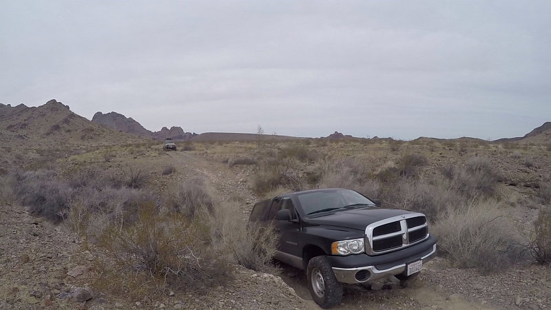
So, off to a great (slightly early) start! We take lead vehicle position, as there are 2 people in our vehicle and Ivan can navigate while I drive. Alpha 1 follows with Overwatch bringing up the rear. Our route winds through the desert, between the tall spires of rock, and crosses many washes. Most of the trail is fairly easy, there are some rocky sections and a bit of sand when the trail and wash become one, but it is mostly passable in 2 wheel drive. One of the creek crossing has a 'step' coming out of it, and we stop to make sure Alpha 1 Makes it out OK. His truck is longer and lower than mine:
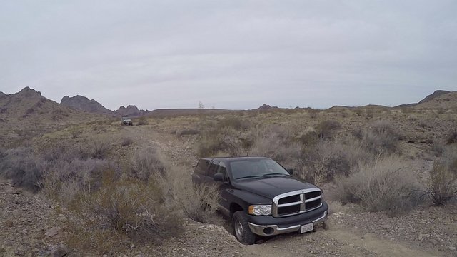
But he makes it just fine
We make our way to the GPS coordinates, but find that the coordinates are somewhere up a road that is now closed due to wilderness designation. We park and grab our handheld GPS units to locate the Cache on foot. luckily, the location appeared to be just a hundred feet or so into the wilderness. The area is strewn with what I think are Calcite rocks. some of them are unique and I grab a few to add to our rock collection.
After a few minutes of searching, Ivan located the cache; a small plastic box with instructions inside. We walked back to the trucks and Ivan read the instruction aloud to the team. We where instructed to contact net control and advise them that we had recovered cache "A1" and request permission to contact Team Bravo directly to provide them with the coordinates of their next cache. Team Bravo's coordinates where written on the instruction sheet, along with the coordinates for our next cache.
While we where going over the instructions, we heard Team Bravo come over the radio and call in that they had recovered their first cache "B1"; and where awaiting contact from our team. After they completed their check-in, Ivan called in our check in. While we where en-route to our cache, Net Control had contacted us informed us that they where assigning Ivan the tactical callsign "Alpha 3" and that they would like to hear him on the radio today. Unlicensed individuals are allowed to operate amateur radio as long as the licensed 'control' operator is present at the control point and continuously monitors the operation of the radio. So, Ivan made his first contact on Amateur Radio and checked in to Net control for our team. He got permission to contact Team Bravo directly, and successfully passed along the coordinates to their next cache. He is interested in getting his license, but being 18, he has 258,000 (estimate) things he would rather do then study for the exam... Ill continue to work on him about this ;)
So, with new coordinates in hand, we once again refer to our (electronic) maps and plan our route. The route takes us back to basecamp, and out toward the main dirt road we came in on last night. Alpha 1 notes that there was a particularly bad wash that he would like to avoid, and it appears there is an alternate route that wont add much to the distance, so we decide avoid the wash and take the more westerly route. We saddle back up, and I inform Net Control we are leaving the first cache site and are en-route to our second location.
As we approach basecamp, I inform Ivan that I am going to make a movie reference, and see if net control gets it... During an emergency or other 'official' controlled net, this would probably not be advisable, but we are out here to have fun right? So, as we crest the last ridge before basecamp, I call in to net control:
Me: "Net Control, Alpha Lead - requesting a Fly By"
Net Control: "Please don't fly over Net Control"
Net Control: "Permission for a Fly By granted"
Sad Trombone :( they missed the movie reference... Sorry Mav
We "Fly By" basecamp and make our way to our second location. The GPS on my phone is lagging bit, and we overshoot the location a little, turn around, and promptly overshoot it again in the opposite direction. We decide to just park and continue on foot. After informing Net Control that we have arrived and are continuing the search on foot, we follow the GPS readouts and begin searching along the bank of a creek. After a bit of a search, Ivan finally locates the cache and we head back to the trucks to read our next instructions. Ivan again reads the instructions to the team:
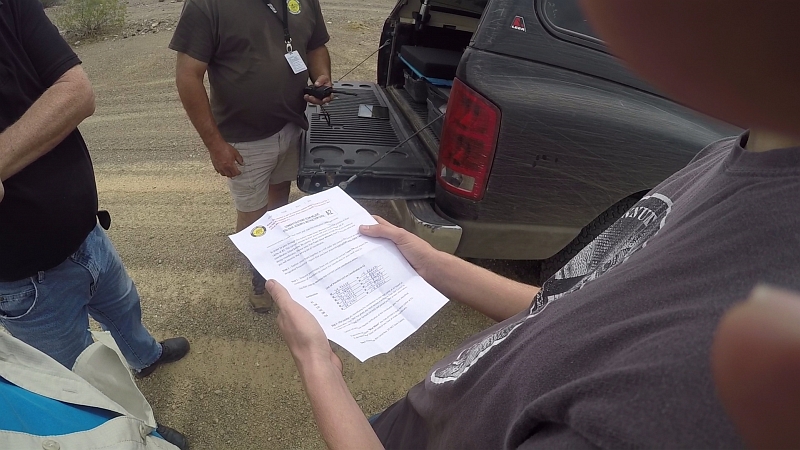
This time, after contacting Net Control and informing them we have located the cache; We are to receive a code from Team Bravo (after they solve some sort of puzzle), which will indicate which set of coordinates on our sheet are correct for our next objective. We are to get the code from Bravo, and then verify the coordinates with net control. Net control will verify coordinates with "Blue Moon" to signify they are correct, or "Buster" if they are incorrect. Team Bravo once again beats us by a few seconds and checks in with Net Control as we are finishing going over our instructions. We hear Net Control advise Team Bravo to take a lunch break, as the Op will resume shortly. We call in our cache, and Net Control advises us to take a lunch as well. We all agree that a 20 minute break should suffice, and we break contact and break out our lunches.
After 20 minutes, I call in to Net Control and inform them we are 'back on the clock' and request permission to contact Team Bravo to receive our 'code'. With permission, I contact Team Bravo and receive the code '31'. This matches one of our coordinate choices, so I call in to Net Control to verify, and am told the coordinates are "Buster"... Something is not right... I repeat the coordinates to make sure I didn't pass them incorrectly, and Net Control re-confirms the coordinates are "Buster". I ask net control permission to contact Team Bravo directly again... I inform Team Bravo our coordinates are "Buster" and ask them to check their puzzle and code again. After a minute, Team Bravo provided us with a corrected code of "256". This code also matches one of our choices, so I call in to Net Control with the new coordinates and they are verified "Blue Moon". We are good to go! So, once again, we gather around the Alpha 1's tailgate and study the maps. Our net route appears very straight forward this time, with very few turns to navigate, so Alpha 1 takes the lead vehicle position (I figured he could use a break from eating my dust), and Alpha Lead (Ivan and I) takes the middle position, with Overwatch still trailing us.
The third cache was a bit harder to find. It is located at an old ruins site. All that remains of the building is the fireplace and chimney, but there is a lot of debris ("Historical artifacts") strewn about the location, so there are many hiding places for the tiny (~4" square) box. Ivan finally locates it behind a rusty steel drum (That's 3/3 for Ivan). This time, along with instructions to inform Net Control we have located the cache, we are provided with half of a set of coordinates. We have the latitude, and apparently Team Bravo has the longitude, of our rendezvous location. We heard Team Bravo call in to Net Control as we approached our third cache, so we knew they where waiting to exchange information with us. Alpha 1 called this one in, and got permission to exchange coordinate halves with Team Bravo. With the final set of coordinates in hand, we once again hit the maps. the final location was a few miles further up the trail we had traveled between caches 2 and 3, so Alpha 1 continued to lead the way.
As we approached the coordinates, Ivan spotted a suspicious looking pole at the base of a hill about 100 yards off the road.
After consulting the GPS, he concluded that was likely our destination. We parked the trucks along the road nearby, and called in to Net Control and informed them that we had arrived at the rendezvous location, and that we would be approaching the coordinates by foot. We also decided that, as this was the rendezvous location, we would wait for Team Bravo and head to the final location together.
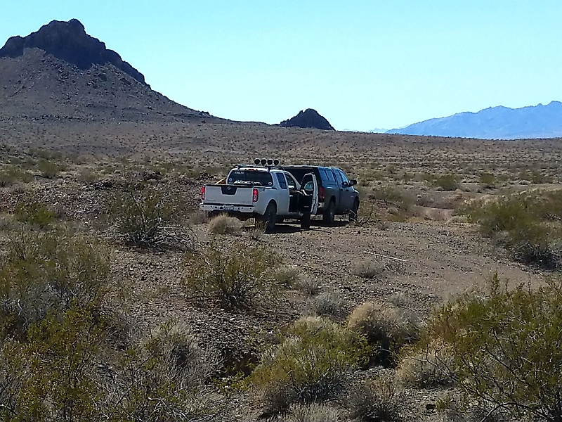
Photo by M. Rozenstraten
Team Bravo arrived shortly after, and we all grabbed some water (it was approaching 80f by this time) and headed towards the mysterious pole...
upon arriving at the pole, we found...
A telephone! and as we approached, it rang!. Here we are in the middle of the desert, miles from civilization, and there is a phone ringing. Ivan answers it and it is Net Control calling from Basecamp! A third team, "Special Comms" had been busy setting up a mesh network. This off grid, Wide Area Network was connecting our remote location to basecamp; about 8 miles away and definitely not "line-of-sight". Special Comms had set up a "node" here, and at basecamp, with a pair of nodes acting as a repeater on a hilltop that separated the two locations. This mesh network was supporting Voice over IP, as well as a streaming webcam at basecamp. We where able to log into the webcam almost 10 miles away and view a live stream of what was happening at camp. Pretty cool stuff.
Net Control informed us (over the phone), that the phone was not, in fact, our final objective and that there was a cache nearby. Consulting the GPS, they where right, the coordinates we had where still a bit further up the wash. Moments later, Ivan spotted the box (4/4 Ivan!) and the final instructions where given. We where to return to basecamp as a group, with a small contingent to separate off the main group and recover the 'repeater' nodes with Russ (Special Comms). We got 2 volunteers to hike up the hillside to assist with the equipment recovery. It wasn't a long hike, less than 1/2 mile, but it was 500+ feet up!
Being the only vehicle with a navigator, Alpha Lead once again took the lead vehicle position, with Overwatch once again "tail-gunner", now with the entire operating team between us (minus the 2 Net Control operators who where already in basecamp). We arrived at basecamp and Ivan and I decided to pack up and head home rather then camp another night in the desert. We like camping, but it was early (around 4pm) and spending another night out would mean that most of Sunday was spent driving home. If @Creationofcare was with us, we might have spent Sunday exploring the area more (there are springs and petroglyph sites in the area), but she had stayed home for this one. after packing up camp, and stopping in Needles AZ, for a Fuel stop, it was about 9:45pm when we got home. It was a long day, but we where still able to get home at a reasonable hour, and I would not have all day Sunday to recover and get ready for another work week. We had a lot of fun and I am already looking forward to the next Op!
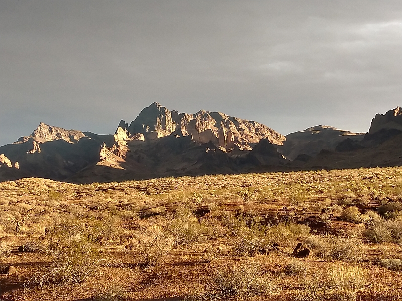
Photo by M. Rozenstraten

73 de LY1A (AB4UW)
Downvoting a post can decrease pending rewards and make it less visible. Common reasons:
Submit
Hi @onealfa, If you are interested in the Ops, you should sign up and follow along with the Land Ops group. On their Level 3 Ops, they include HF. I think our next Level 3 Op is mid June and we will be high in the Sierra Nevada Mountains (Monache Medows area). Might be able to get in a QSO...
73,
KM6LSV
Downvoting a post can decrease pending rewards and make it less visible. Common reasons:
Submit
whoa, this sounds like such a cool adventure! we've got to get a few off road trips under our belts then maybe we can graduate to something of this caliber. I credit Ivan's special eye sight for being able to pick out the anomalies in the landscapes that ended up being your caches. Ive heard of similar games in NYC that dont sound nearly as fun as your crawl around the city looking for coordinates.
Downvoting a post can decrease pending rewards and make it less visible. Common reasons:
Submit
Its a lot of fun! Just consider it camping and geocaching combined with a little puzzle solving and Radio communication. You don't have to be licensed to participate, we can use FRS radios (walki-talki type) to talk between vehicles.
I have no doubt that Ivan's special eye sight helps him. It's interesting how things that blend in to me stand out to him, and things that stand out to me blend in for him...
Downvoting a post can decrease pending rewards and make it less visible. Common reasons:
Submit
Maybe we can do a practice run when we figure out a camping trip to go on :D
Downvoting a post can decrease pending rewards and make it less visible. Common reasons:
Submit
Love it! Some nice rigs there with the new friends.
Downvoting a post can decrease pending rewards and make it less visible. Common reasons:
Submit
Thanks! It was a lot of fun. Funny thing, both 'off roaders' and 'HAM radio operators' refer to their equipment (vehicles and radios, respectively) as 'rigs'; so we had rigs in our rigs :)
The 'off-roading' was light... nothing really challenging- just desert roads; Rough at times, but nothing very challenging.
Downvoting a post can decrease pending rewards and make it less visible. Common reasons:
Submit
Really should have gone... but health... or lack thereof...
Downvoting a post can decrease pending rewards and make it less visible. Common reasons:
Submit
The next one conflicts with a rally I want to go work. the one after that is a longer event in June that I mentioned above (in the Serra Nevada Mountains)...
Downvoting a post can decrease pending rewards and make it less visible. Common reasons:
Submit
so now we know what all those antenna on the truck are really used for. So Cool !
Downvoting a post can decrease pending rewards and make it less visible. Common reasons:
Submit
Hiya, just swinging by to let you know that this post made the Honorable Mentions list in today's Travel Digest!
Downvoting a post can decrease pending rewards and make it less visible. Common reasons:
Submit
I just saw that, Thank you very much for your support!
Downvoting a post can decrease pending rewards and make it less visible. Common reasons:
Submit
Congratulations, Your Post Has Been Added To The Steemit Worldmap!
Author link: http://steemitworldmap.com?author=mattlovell
Post link: http://steemitworldmap.com?post=land-ops-navigation-communications-teamwork
Want to have your post on the map too?
Downvoting a post can decrease pending rewards and make it less visible. Common reasons:
Submit