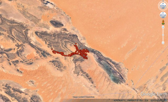
Hamada Du Draa Desert , Algeria presents hundreds of Mystery X markings that can be found within an area that is 500 square miles . What are they for ? When were they created and by who.
This is an Updated version of the Map singled out, for it is presented as-well in the Moroccan Map of Eyes of Sahara .
This is what it looks like upon the land mapped out..

The main wonders of these other than the wonder itself , is they were very hard to find upon the ground from the air , how were they off any use to anyone else if they truly were made in the past to be seen on the ground naturally unless precisely mapped in some form . They are a mystery...
These were only updated because a program I use to see the Earth from above, provides a clear view in certain areas compared to Google Earth which blurs some areas now and then , and that program is arcGIS Earth https://www.esri.com/en-us/arcgis/products/arcgis-earth . A great program ...