INTRODUCTION
Taraba is a state in North Eastern Nigeria, named after the Taraba River which traverses the southern part of the state. Taraba's capital is Jalingo. The inhabitants are mainly the Fulani, Jukun, Chamba,Kuteb and the Ichen who are found predominantly in the southern part of the state while Wurkum, Mumuye, and Kona tribes are predominantly located in the northern part of the state. The central region is mainly occupied by the Mambila people, Chamba,Fulani and Jibawa. There are over 40 different tribes and their languages in Taraba State.
Taraba State is bounded in the west by Nasarawa State and Benue State, northwest by Plateau State, north by Bauchi State and Gombe State, northeast by Adamawa State, and south by Nord-Ouest Province in Cameroon.
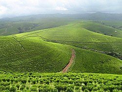
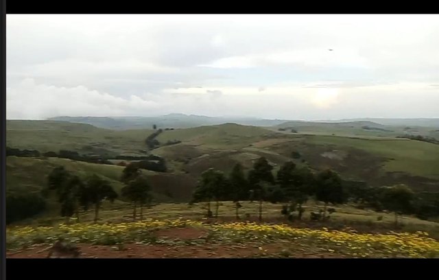
Taraba State lies largely within the middle of Nigeria and consists of undulating landscape dotted with a few mountainous features. These include the scenic and prominent Mambilla Plateau. The state lies largely within the tropical zone and has a vegetation of low forest in the southern part and grassland in the northern part. The Mambilla Plateau with an altitude of 1,800 meters (6000 ft) above sea level has a temperate climate all year round.[citation needed]
The Benue, Donga, Taraba and Ibi are the main rivers in the state. They rise from the Cameroonian mountains, straining almost the entire length of the state in the North and South direction to link up with the River Niger.
MY JOURNEY TO TARABA STATE
In contrast to the rather steamy and humid climate of most other parts of southeastern Nigeria, the climate in this part of the country (owing to its altitude) is relatively cool; most days in the dry season the temperature will reach 20-23 C and drop to 16-18 C at night, whilst in the wet season these averages fall a couple of degrees.NYSC was the one who made my journey to Taraba state possible. When I was posted, I was discouraged at first, but later created interest in seeing the nations beauty.
Coming from Ibadan in oyo state to this far away north is not easy, I spent two days on the road, where we had to stop in benue the first night🌃
We started our journey again the next day, but we had a stop over at the benue river. The only way to move from the river to the other side is through canoe, so our bus was passed to the canoe, we also board the canoe.

JOURNEY TO SARDAUNA LOCAL GOVERNMENT.
My place of PPA is sardauna local government, though I was posted to GDSS Ngouroje. Coming to this place made me realize the name "Nature's gift to the nation is derived" is derived from the sardauna local government
Sardauna Local Government Area is located in the extreme southeast of Taraba State in Nigeria. It sits atop the Mambilla Plateau, which is dotted by other towns such as Maisamari and Nguroje. The capital of the LGA is Gembu, which is the principal town of various ethnic groups, such as Mambilla, Kaka, Fulani, Ndola, Tigon, Kambu, Chamba and Panso. Other ethnic groups from the mainstream Nigeria and the bordering Cameroon republic such as Hausa and Kanuri also live there.

THE CLIMATE OF SARDAUNA
In contrast to the rather steamy and humid climate of most other parts of southeastern Nigeria, the climate in this part of the country (owing to its altitude) is relatively cool; most days in the dry season the temperature will reach 20-23 C and drop to 16-18 C at night, whilst in the wet season these averages fall a couple of degrees.
CONCLUSION
Though it all seems like an excursion, but believe me, coming here made me realize there's a lot of beautiful place in nigeria too, why going on a tour to other countries to see things like this. The climate is totally different, equivalent to that of abroad, the surroundings also differs from other states of the country.
I believe with this few points of mine, you will want to come here and see the "Nature's gift to the nation

Downvoting a post can decrease pending rewards and make it less visible. Common reasons:
Submit