Rain Continues This Evening Front Buckles Again Thursday
<iframe style="border: none;" src="//rcm-na.amazon-adsystem.com/e/cm?o=1&p=12&l=ez&f=ifr&linkID=431c1e7be66bc52a4e7193969dcff192&t=meteorologisj-20&tracking_id=meteorologisj-20" width="300" height="250" frameborder="0" marginwidth="0" scrolling="no"></iframe>
Rain Continues This Evening Front Buckles Again Thursday
Moisture continues to flow northward along the East Coast which has put us in rain today. That rain should continue into the evening hours and then gradually wind down to some light rain or drizzle. Temperatures today are having a tough time with readings in the upper 50s and lower 60s along with a northeast wind. We will probably see these temperatures hold for awhile and then settle in the low to mid 50s in most places overnight.
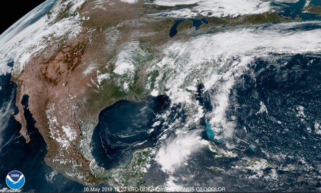
EASTERN SATELLITE
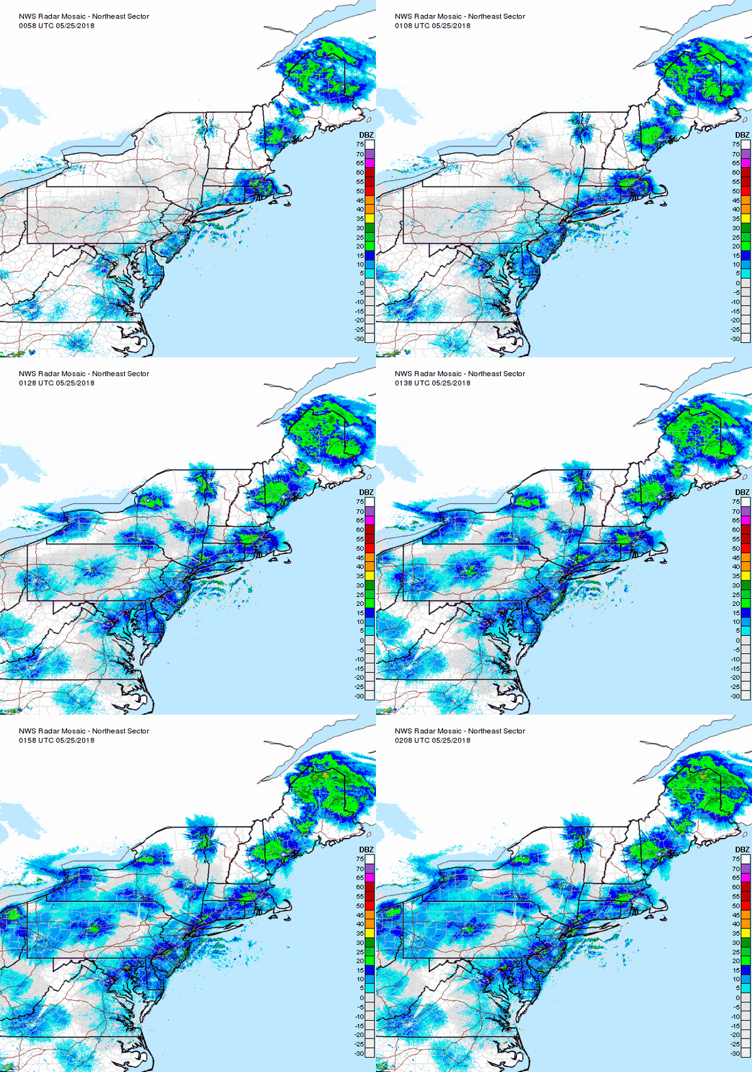
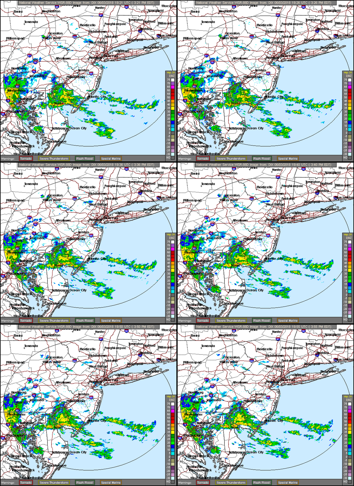
REGIONAL RADAR
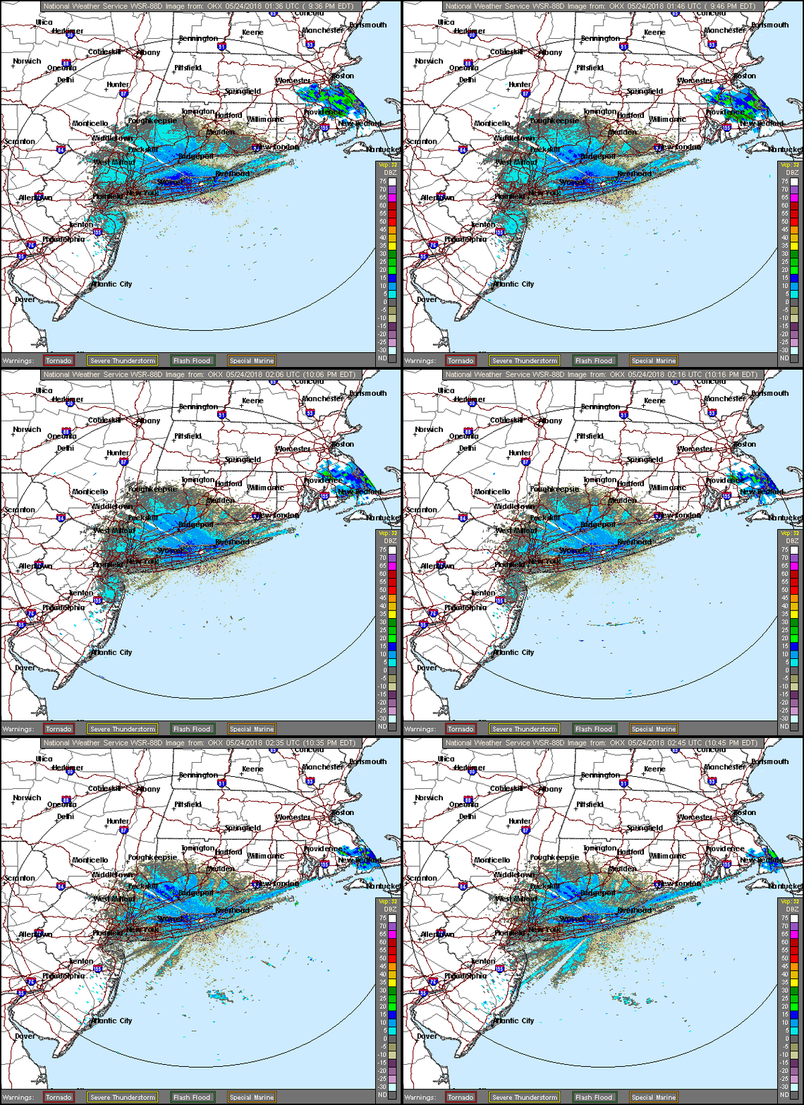
Most of the rain is steady but light. There are a few bands of moderate rain showing up in some places but this is nothing compared to the severe weather of yesterday and there are no severe weather issues to worry about over the next few days.
LOCAL RADAR NEW YORK CITY
LOCAL RADAR PHILADELPHIA
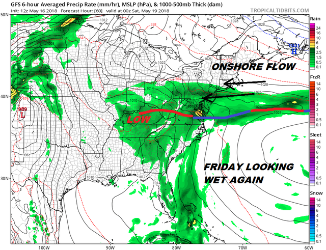
Even though our weather front buckles northward on Thursday it does not have the same impact like it did yesterday. We may see some brightening of skies or even a few breaks of sun but we can't rule out the chance for a shower. Thursday's temperatures will reach into the 70s. The front sinks back southward later Thursday and Thursday night as a high builds to the north. A stronger onshore flow develops Friday which looks like another day of lots of clouds and rain with temperatures just in the 50s.
GFS FORECAST FRIDAY MAY 18, 2018
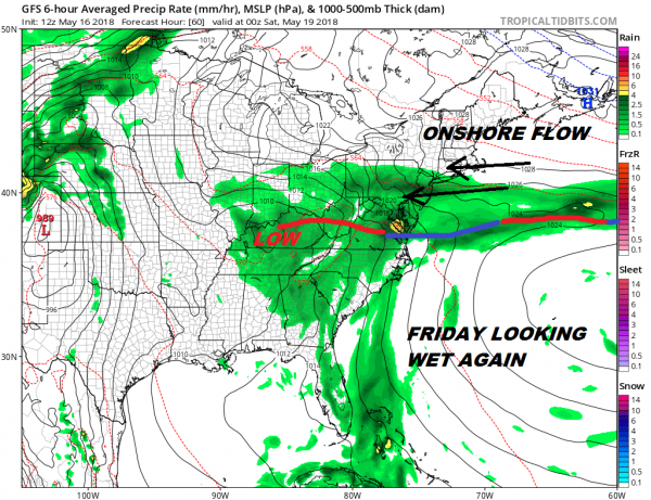
The weekend is a bit tricky. That low on the map above will move through our west and a warm front will try to make it through. If it succeeds we could see warm and humid conditions develop during Saturday with some showers early and the risk of a shower or thunderstorm in the afternoon and evening. The cold front with that low arrives on Sunday with warm and humid conditions and the chance for thunderstorms in the afternoon and evening. If the warm air makes it which I think will be the case in New Jersey and points south, temperatures will be in the 80s. Where the warm front doesn't make it (Connecticut & Long Island) it could just stay in the 60s to near 70. Everyone should reach the mid 70s to mid 80s north to south on Sunday.
<iframe style="border: none; overflow: hidden;" src="https://www.facebook.com/plugins/post.php?href=https%3A%2F%2Fwww.facebook.com%2Fmeteorologistjoecioffi%2Fposts%2F10160293154820387&width=500" width="500" height="547" frameborder="0" scrolling="no"></iframe>

GET JOE A CIGAR IF YOU LIKE
FiOS1 News Weather Forecast For Long Island
FiOS1 News Weather Forecast For New Jersey
FiOS1 News Weather Forecast For Hudson Valley
NATIONAL WEATHER SERVICE SNOW FORECASTS
JOIN JOESTRADAMUS ON YOUTUBE!
LATEST JOESTRADAMUS ON THE LONG RANGE
<script type="text/javascript">
amzn_assoc_placement = "adunit0";
amzn_assoc_search_bar = "true";
amzn_assoc_tracking_id = "meteorologisj-20";
amzn_assoc_search_bar_position = "bottom";
amzn_assoc_ad_mode = "search";
amzn_assoc_ad_type = "smart";
amzn_assoc_marketplace = "amazon";
amzn_assoc_region = "US";
amzn_assoc_title = "Shop Amazon Via JOESTRADAMUS for anything. Just Use The Search Box";
amzn_assoc_default_search_phrase = "fishing gear";
amzn_assoc_default_category = "All";
amzn_assoc_linkid = "400feb49ec86e057a1495ab9f8e2ac47";
</script>
<script src="//z-na.amazon-adsystem.com/widgets/onejs?MarketPlace=US"></script>
Posted from my blog with SteemPress : http://www.meteorologistjoecioffi.com/index.php/2018/05/16/19806/
