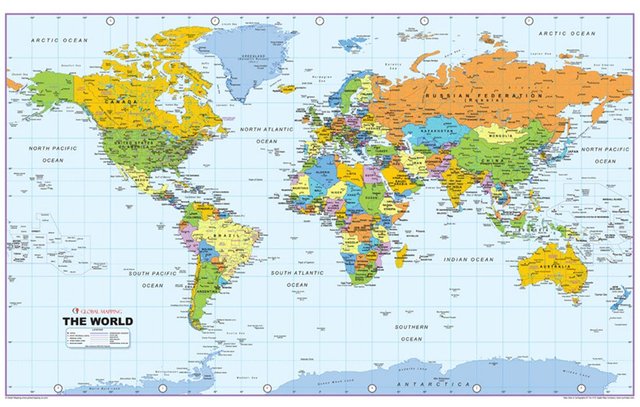
Whats a Mercator? ... from Wikipedia ... "The Mercator map became the standard map projection for nautical navigation because of its ability to represent lines of constant course, known as rhumb lines or loxodromes, as straight segments that conserve the angles with the meridians. Although the linear scale is equal in all directions around any point, thus preserving the angles and the shapes of small objects (making it a conformal map projection), the Mercator projection distorts the size of objects as the latitude increases from the Equator to the poles, where the scale becomes infinite." (loxodromes .. distorts .. "conformal" ... huh?) https://en.wikipedia.org/wiki/Mercator_projection
Here is a typical example of the Mercator Map, note that Greenland appears equal to the size of Canada ("the Mercator projection distorts the size of objects as the latitude increases from the Equator to the poles"):

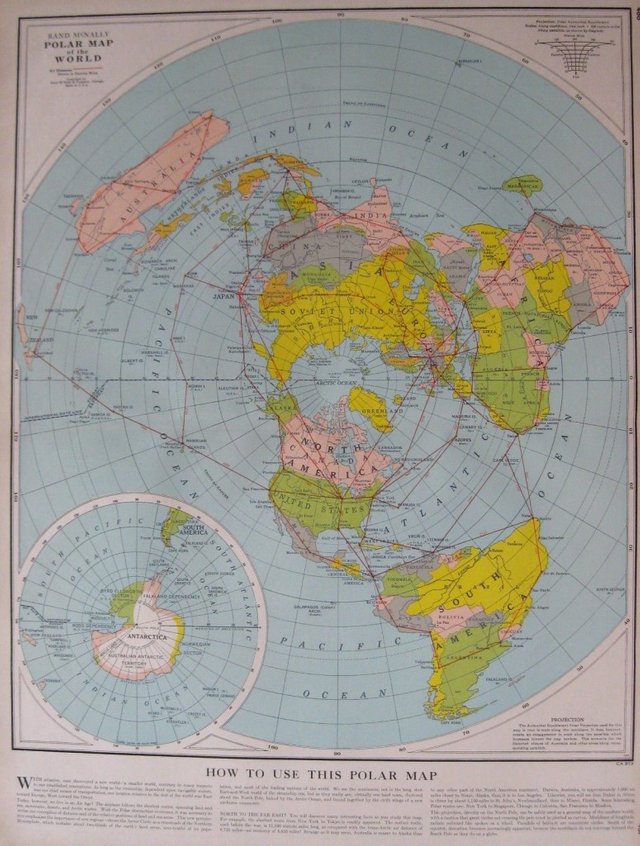
Whats an Azimuth? ... again from Wiki .. "The Azimuthal equidistant map (projects that) .. all points on the map are at proportionally correct distances from the center point, and that all points on the map are at the correct azimuth (direction) from the center point. A useful application for this type of projection is a polar projection which shows all meridians (lines of longitude) as straight, with distances from the pole represented correctly. The flag of the United Nations contains an example of a polar azimuthal equidistant projection." https://en.wikipedia.org/wiki/Azimuthal_equidistant_projection (proportionally correct ... distances from the pole represented correctly .. got it)
Here is an example of the Azimuthal Equidistant Map, note that Greenland is much smaller ("distances from the pole represented correctly"):

Here is a terrific website where you can drag, drop, and overlay one county over any other to visualize its TRUE proportions here .. Greenland and India are especially fascinating: https://thetruesize.com/
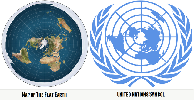
And here is your Azimuth map branded within the United Nations logo -- 'they' know!

For more observations of the flat Earth in plane view visit our Blog at www.GalileoLied.com
Hi! I am a robot. I just upvoted you! I found similar content that readers might be interested in:
https://en.wikipedia.org/wiki/Azimuthal_equidistant_projection
Downvoting a post can decrease pending rewards and make it less visible. Common reasons:
Submit