
Greetings Steemit friends
I decided to make the polygon and road of the area in my town, which is the Amour Mezam Bus station. It is one of the oldest urban transport agencies in my locality. It is found in almost all urban centers in Cameroon.
Let's launch the UTM Geo Map application, and select area/distance on the dashboard. A new window is launched. I'm hoping you have created a new project, just like we did last week. I have to do so so that my new task will be registered on a new project.
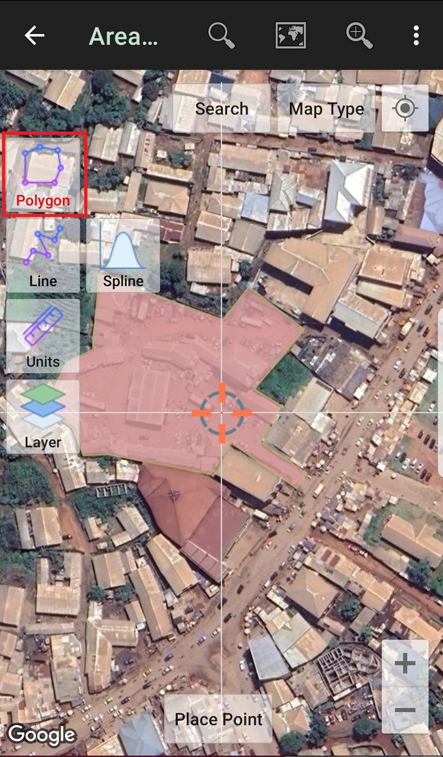
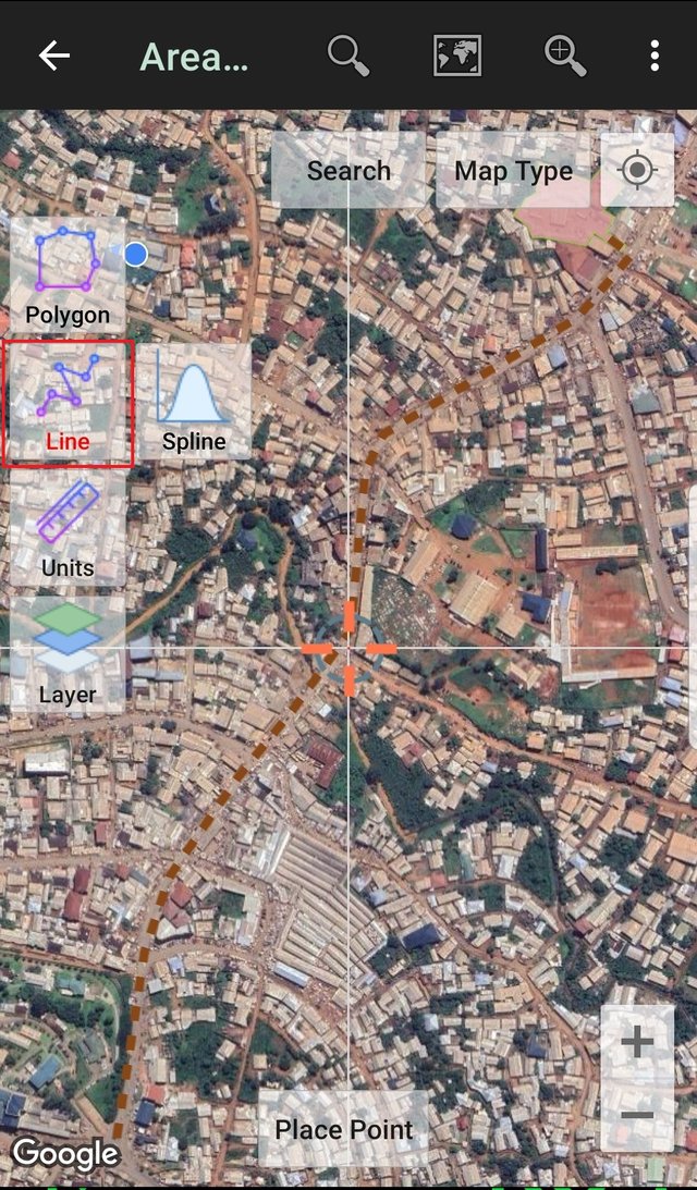
As you can see the agency is located in Bamenda 3, along a major road. Easy for those coming into or going out of Bamenda town. I have trach the road from Finance Junction, passing through the Nkwen market, mile II Junction, and New-road junction to get to the Agency.
When creating the polygon, at the top, the surface area in hectares (ha) appears and when you draw the road, the distance seems in meters (m). What is the surface area of the polygon you created and how many meters is the road you drew?
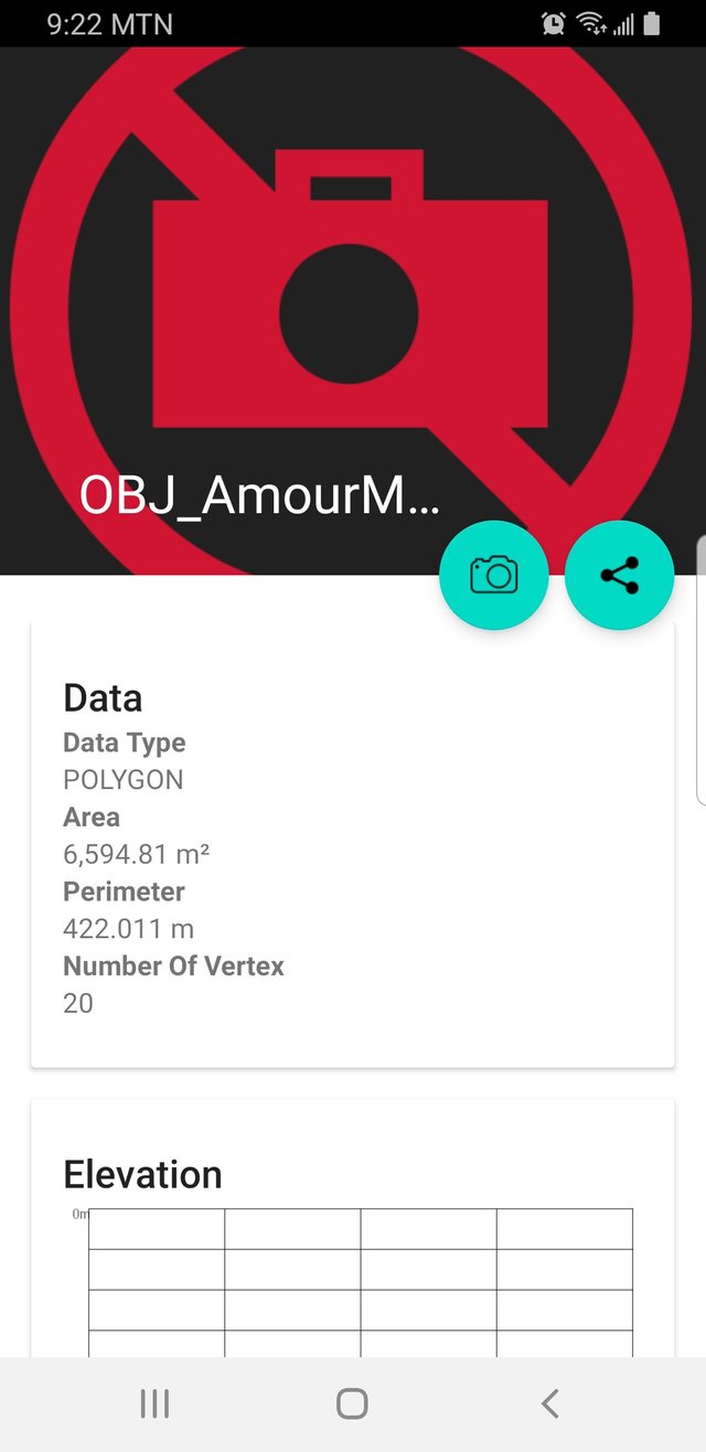
The surface area =6594.81m²
Convert m² to ha manually using the formula:
Area in hectares = Area in square meters/10000
6594.81/10000 = 0.659481 ha
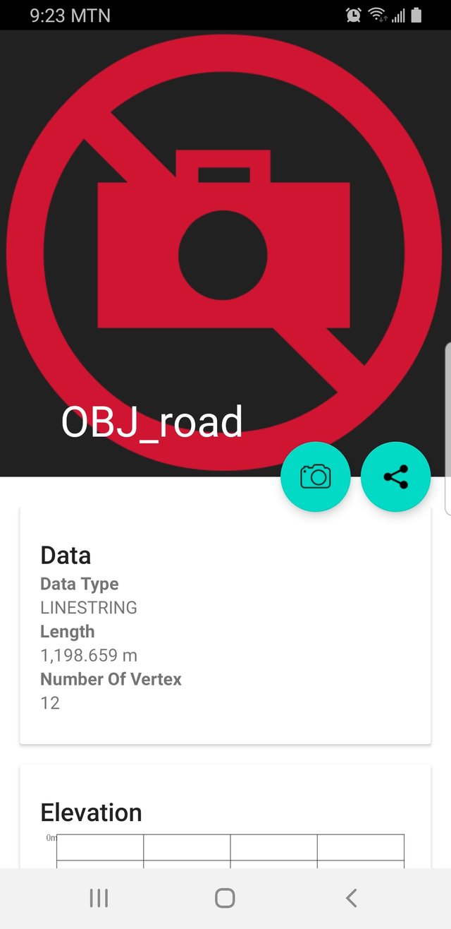
Road =1198659m
Customize both the polygon and the road by assigning color, line width, and appearance. Everything to your liking.
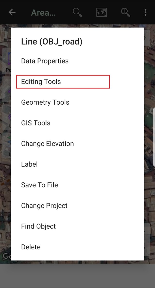
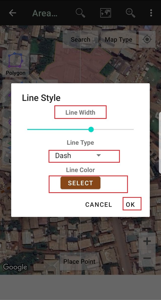
To Customize either the polygon or the road, click on any of the points. A new popup, select the editing tool, and next click change style. Now you have a new window, in which you can customize the line width, line type, and line color. I have selected the dash line type as you can see in the images below. When you are done, click Ok to apply the changes done
Create a 200-meter Buffer.
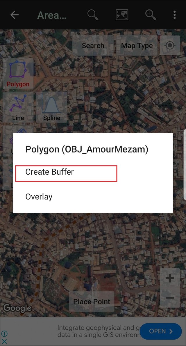
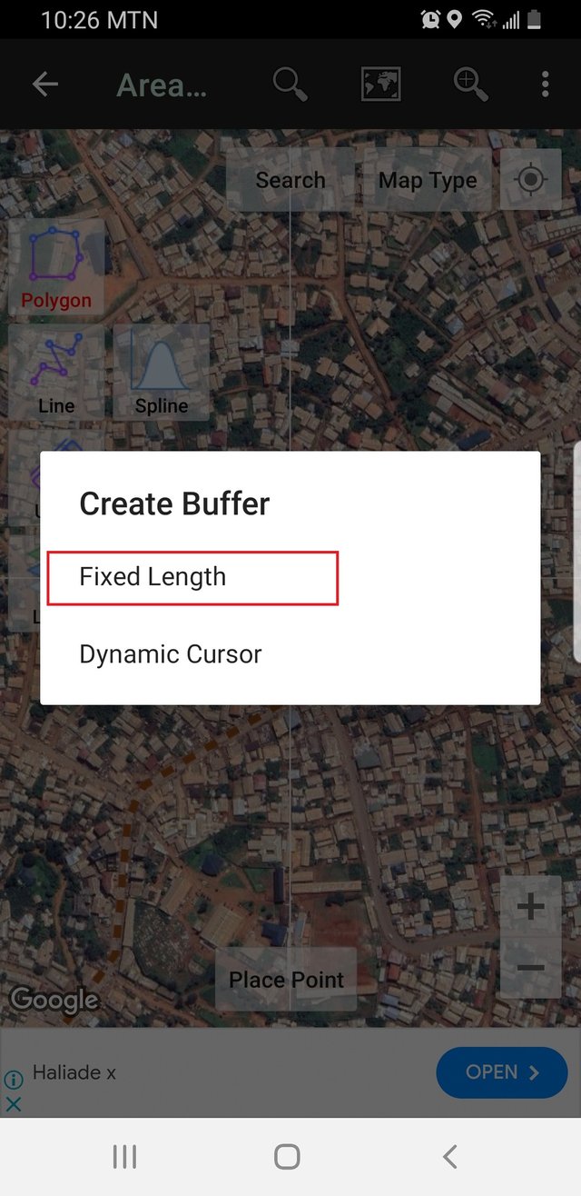
To create the buffer for the area 200 meters away from the Amour Mezam, I will click on the polygon area. A window will pop up. Select the GIS tool, select Create buffer, select fixed length, insert buffer length (200m), and click Create buffer.

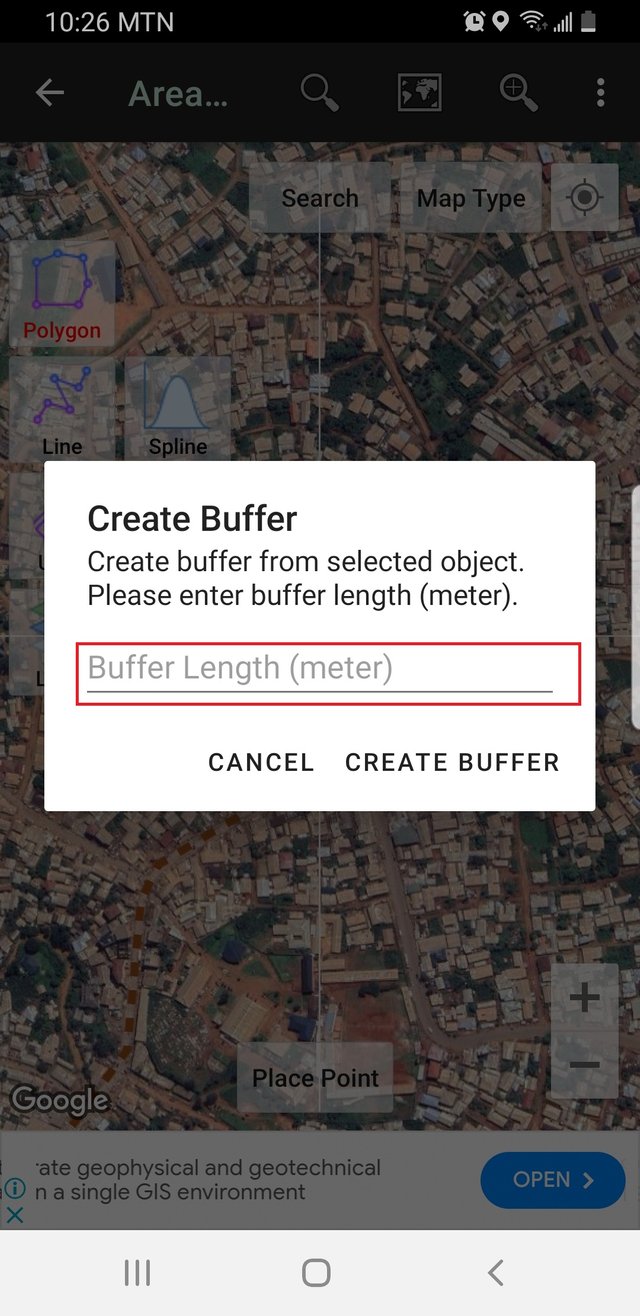
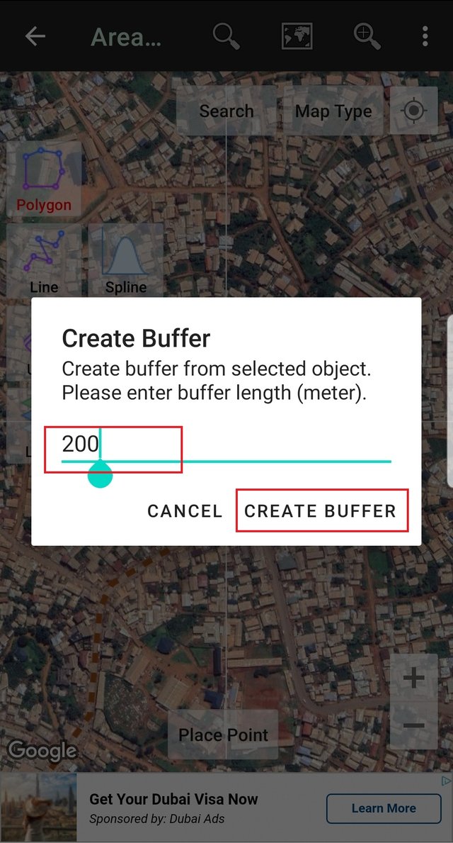
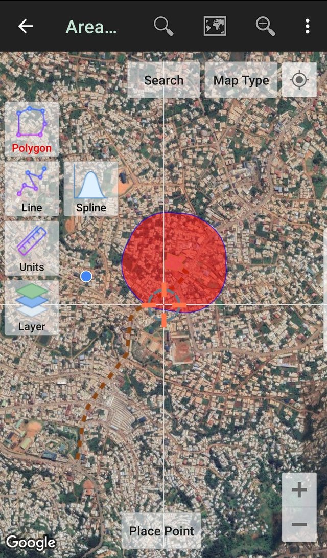
Why did you choose that place and what things are around it?
Bamenda Municipality is made up of three subdivisions and Amour Mezam Express is located in the Bamenda III subdivision. Bamenda III is one of the safe areas when visiting Bamenda. So I choose this place because of the security of any person coming to town. You might not have a good understanding, but my region has been a crisis zone for the past six years. So many people are scared of visiting the region because of the high rate of activities from the separatists.
Secondly Amour Mezam Express is one of the oldest travelling agencies with VIP buses transporting to other urban centers.
Is it easy to get there? How can you access it?
It is located close to the road and at the center of the town. Amour Mezam is located in Bamenda III and is one of the safe areas in the region. So you can arrive from your trip at any time and not fear being kidnapped or arrested by the separatists.
Looking at the buffer you created, how would you define its area of influence? That is, is it a good commercial or residential area? Is it close to an area with vegetation? Is it a busy area?
Bamenda is an urban city and Amour Mezam is located in a residential area making it easy for individuals to easily get to the park when traveling. That is one of the advantages of the agency over the other agencies in Bamenda municipality.
Cheers
Thanks for dropping by
@fombae
Upvoted! Thank you for supporting witness @jswit.
Downvoting a post can decrease pending rewards and make it less visible. Common reasons:
Submit