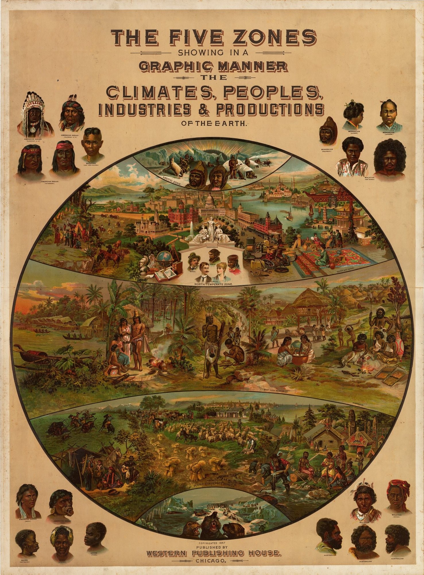
The Five Zones Showing in a Graphic Manner the Climates, Peoples, Industries and Productions of the Earth
By: Walter Levi Yaggy
Date: 1887 (Published) Chicago
Dimensions: 44 x 32.5 inches 111.8 cm x 82.6 cm)
This spectacular pictorial chromolithograph poster features a schematic map of the earth’s five ‘zones’, with each zone bearing illustrations reflecting its characteristic climate, population, and economic activities. Yaggy’s enthusiasm for bringing education to all and sundry is obvious in all his works, and this particular work, taken from his teaching atlas, summarizes several strands of thought.
The division of the world into five broad climatic zones ranging from frigid to temperate to torrid had first been done in ancient Greece and Yaggy employed the idea in his ambitious atlas.
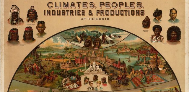
The Arctic Zone features Eskimos, polar bears, reindeer and igloos.
The North Temperate Zone names contains what were at that time the rapidly industrializing nations, North America, plus a vignette in tribute to American indigenous peoples, and China and Japan.
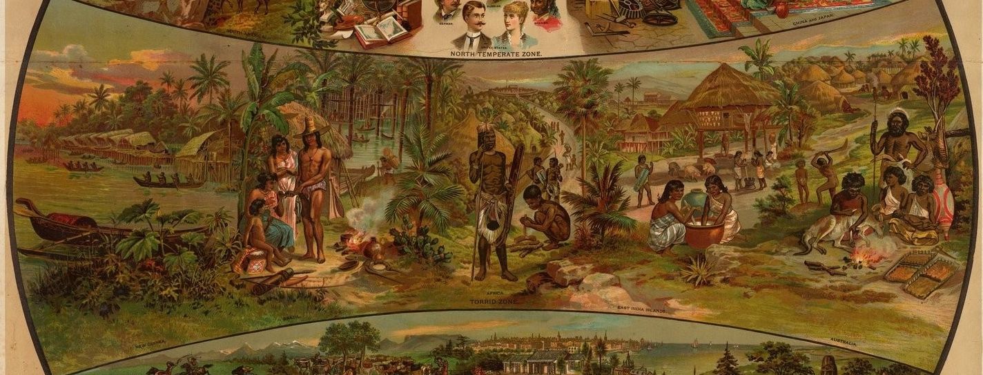
The Torrid Zone contains New Guinea, Brazil, Africa, the East Indian Islands and Australia and is peopled by indigenous peoples only, along with the housing and undertakings which occupy their lives.
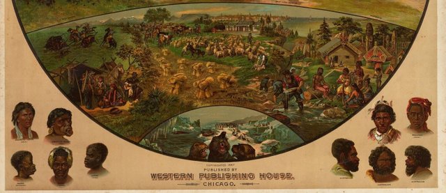
The South Temperate Zone names South America, Australia and New Zealand. Here we see agriculture as practiced in Europe and the US, gold mining, vaqueros on the pampas and indigenous peoples with fancifully carved wooden trim adorning their homes. In the background is a vignette of a European-style city.
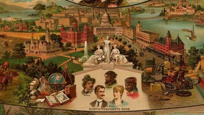
In the North Temperate Zone, the map is illustrated with easily recognizable iconic architectural edifices from magnificent palaces in China and Japan to Hagia Sophia in Istanbul, the Kremlin in Moscow, the White House in the USA. Also pictured in this zone is a group of marble statues under which is the heading ‘Caucasian’, and beneath the heading are featured five portraits labeled German, Spanish, Russian and United States (two portraits).
In addition, in the northern zone Yaggy included a vignette which suggests scholarly and artistic pursuits including a globe, a telescope, several books, a marble bust and an easel replete with brushes and paints. The concentration of these edifices in this zone is evidence of his world view. Yaggy considered the northern and southern frigid zones to be inhospitable frozen wastes, the torrid zone around the equator as the appropriate climate for the world’s indigenous peoples, the northern temperate zone as the home of the world’s advanced civilizations and the southern temperate zone as the proper site for colonial settlement.
Portraits of individuals of myriad races of indigenous peoples fill the spaces which otherwise would be void.
Questions? Reply Below.
Like old maps? Follow me and/or visit my website (https://www.hjbmaps.com)
Hi! I am a robot. I just upvoted you! I found similar content that readers might be interested in:
https://www.hjbmaps.com/products/five-zones-map-yaggy-1887
Downvoting a post can decrease pending rewards and make it less visible. Common reasons:
Submit
wow this is perfectly titled! lol it's a very intriguing though, time-specific, map. The art itself is beautiful and I think the 5 temperate zones do offer a visually interesting map configuration.
I love old stuff - maps are very cool, it's like time travel :)
thanks for posting this historically awesome content!
Downvoting a post can decrease pending rewards and make it less visible. Common reasons:
Submit
One of my favorite aspects of geography is the variety of people across the world, which is a direct result of thousands of years of evolution, dictated by their immediate surroundings. This map provides a great visual representation of that idea.
If you ever ask yourself why people from Scandinavia, Kenya, Papua New Guinea, and Thibet look so different, the short answer is Geography!
Downvoting a post can decrease pending rewards and make it less visible. Common reasons:
Submit
yes! evolution is very interesting ! It's one thing to see how geography and niche effect say Darwin's finches but when you adjust the scope and open it up to humans it gets even more intriguing (probably because we are humans lol )
Downvoting a post can decrease pending rewards and make it less visible. Common reasons:
Submit
You received a 10.0% upvote since you are not yet a member of geopolis.
To read more about us and what we do, click here.
https://steemit.com/geopolis/@geopolis/geopolis-the-community-for-global-sciences-update-3
If you do not want us to upvote and comment on your posts concerning earth and earth sciences, please reply stop to this comment and we will no longer bother you with our love ❤️
Downvoting a post can decrease pending rewards and make it less visible. Common reasons:
Submit