Hi steemians,
I really appreciate the organizer for bringing this amazing assignment so that everyone can participate. Geography is not my favorite subject because I consider it as one of the difficult subjects back then in secondary school, but through what the author wrote, I can be able to put something down.
Make a freehand map of your country (It can be on paper, a computer or on your cell phone, the only condition is that it must not be traced. That is to say: The map does not have to be perfect)
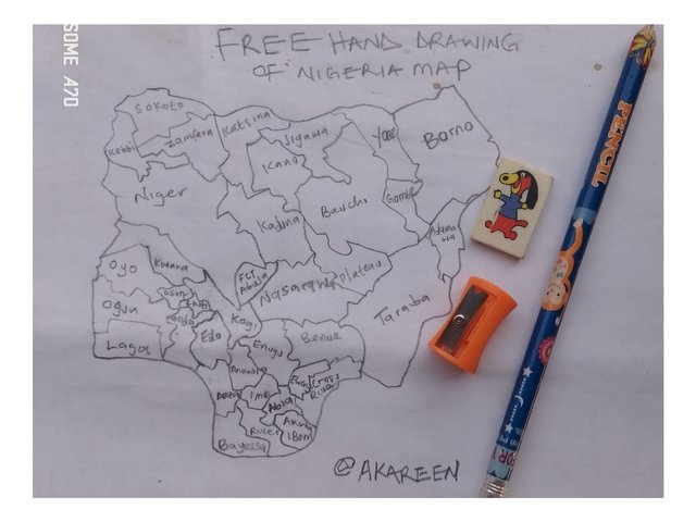
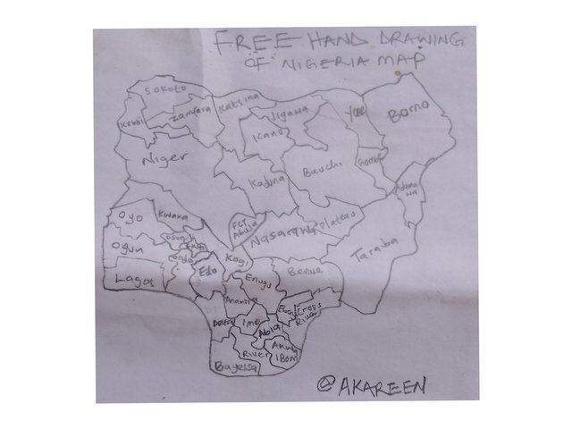
The picture above shows the freehand drawing I specifically drew for the purpose of this assignment. This shows all the 36 states which make up the whole world-recognized Nigeria as a country. My drawing may not be perfect, but I did my best to draw the picture.
Within the freehand map you made, locate where the capital of your country is and where the state/department/province where you live is.
 |  |
|---|---|
| 1st Image | 2nd Image |
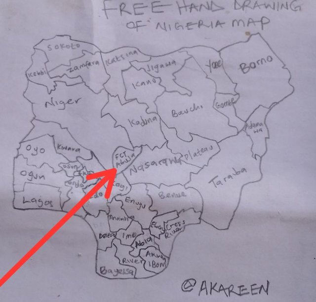
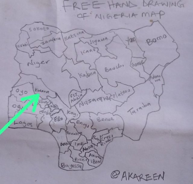
The arrow in the first image indicates the Federal Capital Territory (FCT), also known as Abuja. This particular place is the capital of Nigeria where the president and other government officials control the affairs of the country. The second image indicates my state, which is Kwara State. It consists of different tribes such as Hausa, Yoruba, Nupe, and so on. Kwara State is not far from Abuja, and both states fall in the same geopolitical zone (North Central). The road distance is 323 km compared to other states.
Locate within the map you made, some states/departments/provinces that you know by heart (Only the ones you know/remember at that moment, do not fool yourself by cheating)***
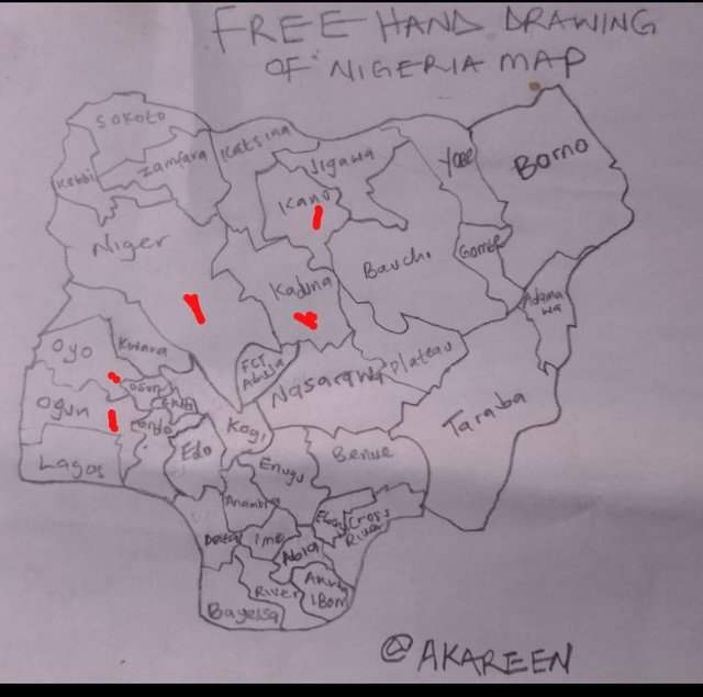
In the above image, the red dot indicates some states I have traveled to, such as Kano, Niger, Kaduna, Oyo, and Ogun State. I have traveled to 5 states out of 36 states, and if I have the opportunity, I want to reach other states to know their way of life.
Mention 3 places that you still don't know in your country and that you would love to visit and why.
I will give the appropriate answer to this question. The places or states I would like to visit are Lagos, Borno and Bauchi. I will visit Lagos State someday because it's a commercial center of Nigeria where both local and foreign investors engage in various businesses to earn a living. I have heard many times that Bauchi and Borno are good places to visit in terms of accommodation and food, which are also cheaper in those state.
Durbar celebration in the northern side is so fascinating. I have only watched the celebration on television. I want to see it with my own eyes, and I believe it will happen one day.
a. what is a map?
Map is the symbolic representation of a particular place. The signs on the map tell us what the region has in common, such as mineral resources. Maps contain information on the political and cultural aspects of an area. They also show the geographical area to which each state belongs. Maps have many advantages in terms of easily locating certain places that we may find difficult to locate.
b. In your opinion, what are the most relevant elements to understand a map and why?
Map element is important because it serves as a guide to explore new areas we haven't seen before. Here are the elements a map must have before we consider it a map:
1. Title: A map title is the name given to a map so that readers can easily recognize which map it is, usually written at the top of the map.
2. Scale: Scale ratio is used by map readers to understand distances and relationships that may occur.
3. Legend: Also known as a key, it helps us identify map features. The colors shown on the map explain the unique symbols they represent.
4. North arrow: is another element we use to read a map. It consists of cardinal direction to determine the specific location of an area.
5. Columns: Columns are used to divide the legend into 2 or more columns to accurately place the legend on the map. Columns eliminate occurrences that may cause confusion whenever there's a problem in the legend.
c) In your opinion: Is cartography important or not so important? Why?
Big yes, cartography is very important in so many ways because it helps people to identify an area where disasters may occur, like a fire outbreak, and once they do, allowing the fire service to quickly respond to that area. We make use of our phones and Google Maps every day to know where we are or locate certain areas we may wish to visit, such as supermarkets, salons, car washes, banks, and so on. It's very convenient for dispatch riders to deliver packages to customers without facing any challenges.
I will like to invite @wuddi, @bonaventure24 and @muhammad-ahmad to come and participate in this contest
Hola akareen, éxitos en esta tarea.
Verificado en: 20-12-2024
Downvoting a post can decrease pending rewards and make it less visible. Common reasons:
Submit