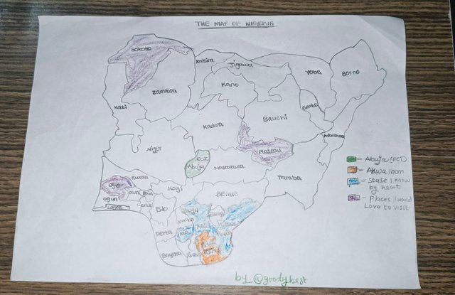
Hi Friends! It's a pleasure to join this amazing course; with it, I will be able to create maps using digital technology, unlike the manual ones I knew to be created on paper. Digital maps can be easily assessed because they are designed on a computer and are shared online. It can be easily understood because it allows us to visualize the geographical information better, thus making it easier for us to navigate the world around us. I think digital cartography is an important tool in this era.
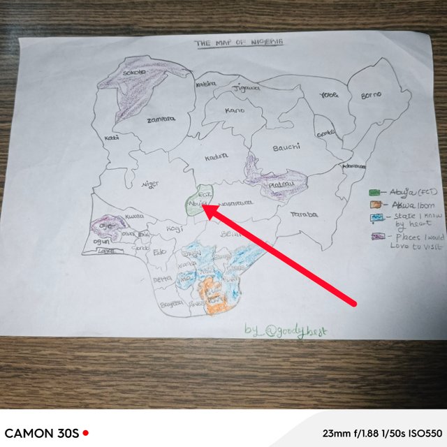
*As many of you already know, I'm from Nigeria, the giant of Africa! There are 36 states of Nigeria, and Abuja is the capital.
I'm from Akwa Ibom state of Nigeria and I live in the beautiful city of Uyo.
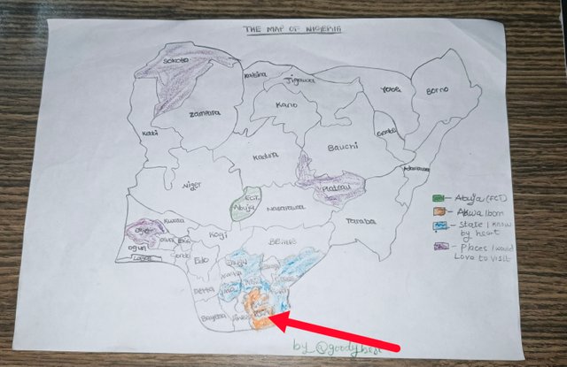
My state is one of the most beautiful and peaceful; you can see it in the above Map of Nigeria. I've shown you where the capital of Nigeria is, which is located in the North, likewise my state (Akwa Ibom), which is located in the South. I will also show you the states I've visited before, and three other states I wish to visit and my reasons.
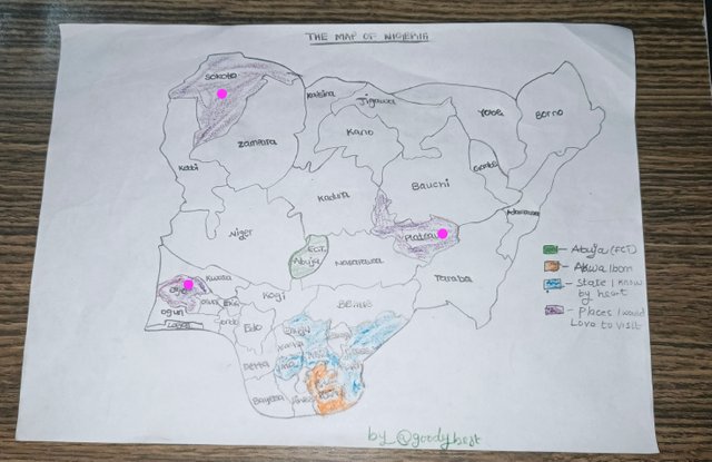
I would like to visit Plateau, it is located in the Northern part of Nigeria, this state is known for its beautiful landscape, like mountains and the weather there sometimes is like that of Europe and America; snow falling so I would love to experience it. Another state I would love to visit is Oyo Ibadan, located in the West; it's one of the ancient cities in Nigeria. I still recall my primary school years when I read about different cities. And the last state I would love to visit is Sokoto, oh the reason is not far fetch, I mean it's one of the longest standing states in Northern Nigeria!
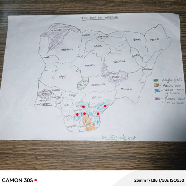
I've been to at least 4 states in my country, which are Imo state, I was schooling here, I've been to Abia, Enugu my Dad used to work here, I've been to Cross River State too, etc.
Map is the visual representation of a particular area, showing the geographic features of the area, the landmarks, and spatial relationships. Map is a guide to navigate and understand our surroundings it help us to us to interpret both locations and distances.

- Legend/Keys:these are symbols and colors used in a map, it shows what each color stands for for example roads, parks and water bodies.
- Scale: shows the relationship between distance on the map and our actual distance. It's used to measure real-world distances.
- *Compass Rose: shows the orientation, whether it's south, North, west, or East. Thus helping to understand directions.
- Topography: shows elevation changes and land form, which is good for knowing terrain.
- Grid System:provides reference framework. (Both latitude and longitude) which helps to pinpoint locations accurately.
Understanding the aforementioned elements is very important as it will allow users to interpret and utilize the map effectively.
Yes it is so important because it plays a vital role in:
- Navigation: helping us to find our ways in an unfamiliar area.
- Planning: it aids in urban, transportation, and environmental planning.
- It's good for interpretation?
- It's good for education teaching geography.
- Lastly, it's good for Data Visualization. Communicating, complex data in an understanding way (eg demographics studies, climate change).
I believe that digital cartography is an important skill we should acquire because it helps us to create accurate and accessible maps that improve our understanding of our environments. I'm in to learn the basics of mapping our world using these maps to have valuable insight.
Please, @soywilfredg, I decided to post this now because, unfortunately, my phone went off while I was typing it yesterday, and I couldn't do anything about it until I recharge it now. Thank you for understanding.
Congratulations, your post has been upvoted by @scilwa, which is a curating account for @R2cornell's Discord Community. We can also be found on our hive community & peakd as well as on my Discord Server
Felicitaciones, su publication ha sido votado por @scilwa. También puedo ser encontrado en nuestra comunidad de colmena y Peakd así como en mi servidor de discordia
Downvoting a post can decrease pending rewards and make it less visible. Common reasons:
Submit
Thank you🙏
Downvoting a post can decrease pending rewards and make it less visible. Common reasons:
Submit
You’re right
This even helps us know the bigger states and where each states fall
Nice one!
Downvoting a post can decrease pending rewards and make it less visible. Common reasons:
Submit
Thank you so much for the compliment dear!
Downvoting a post can decrease pending rewards and make it less visible. Common reasons:
Submit