|
|---|
Hope you all are doing well and good and enjoying the best days of your life. This is me @shahid2030 from Pakistan and you are here reading my post. You all are welcome here from the core of my heart.
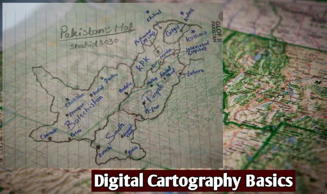
This is my participation in a contest Digital Cartography Basics organized in Shine with Steem by @soywilfredg.
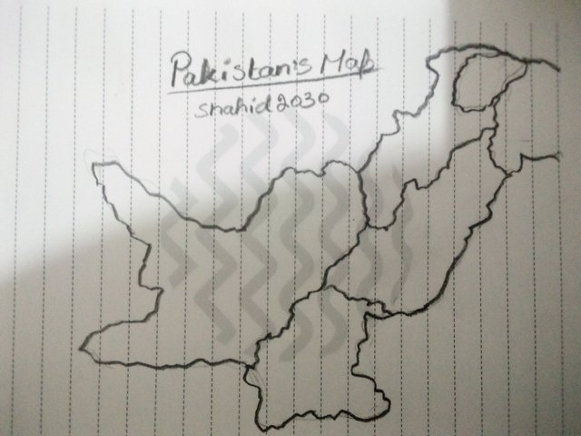
Make a freehand map of your country (It can be on paper, a computer or on your cell phone, the only condition is that it must not be traced. That is to say: The map does not have to be perfect ) |
|---|
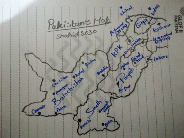
This is the general Map of Pakistan(my country).
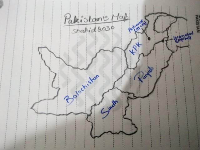
1. Within the freehand map that you made, locate where the capital of your country is and where the state/department/province where you live is. |
|---|
The city in very right corner is the capital of Pakistan (Islamabad), and my city is Peshawar. It has four provinces; KPK, Punjab, Sindh and Balochistan.
2. Locate within the map you made some states/departments/provinces that you know by heart (Only those that you know/remember at that moment, do not deceive yourself by cheating) |
|---|
The cities in square box are those I have visited and ofcourse I have good experience there so they are too close to my heart. If I talk about Peshawar it's my bith city, ofcourse it has great importance in my heart.
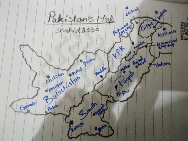
Mention 3 places in your country that you still don't know and that you would love to visit and why. |
|---|
You may see the cities with star signs. I have never been there, but they are my most favorite places. There are too much natural beauty in these places. Millions of tourist visit these places each year.
Q1 What is a map for you? |
|---|
A map is a visual representation of a special area or territory on a piece of paper or digitally drawn on computer. It gives us information about that place like; it's total land, geography, altitude and latitude, political and cultural conditions and other thematic characteristics of that place.
Map helps us knowing about an unknown place. For example if I go to America for the first time and I have to find where in Whitehouse. I can simply use USA map to figure it out.
Q2 In your opinion, what are the most relevant elements to understand a map and why? |
|---|
For designing a proper map we do need to understand many things making it. Let's talk about some important elements of the map we have learned here from the lesson.
Tittle the far most important thing is the tittle of the map. For example I have drawn my country map I should give it a tittle Pakistan's Map
Scale This is the toughest thing in designing a map. You have to divide your map into a proper scale. The smaller the scale the Minor will be the place in the map and the larger the scale a more clearer will be the area. Let's understand it through example.
A map with 1:1,000,000 means 1,000,000 cm (10 km) with in in 1cm on this map. It's a huge area accommodated in 1cm, so ofcourse their will be Minor details about that place. On the other hand, we have 1:100,000 map. It means 100,000 cm (1km) in 1cm on the map. Ofcourse it will give more details and information about that place.
Coordinates this is the reference system that allows us to know a specific location within the Earth's surface. We have many types of it and the most common are Geographic Coordinates ( expressed in degrees, minutes and seconds) and UMT ( Universal Transverse Mercator). They are expressed in meters.
Conventional Signs It is a specific and standard symbol used on maps to identify special aspects with in the map. These are universal signs can be read and understand worldwide.
Legend is the extra additional information shown on the map. It is not standardized and can be used according to the locality. For example for dessert we use yellow color, for fertile we use green and places with mineral resources we use brown colour and many other. The roads and Rivers are shaded blue. So these are the things that gives us extra confirmation and we make it according to our own well.
Relative Location It represent the location of the place you have drawn. It tells us in which country, province or state that place is situated
Toponym It gives us a brief details about the map by showing us the proper name of the city, name of the streets, rivers, shops, markets, etc.
Q3 In your opinion, is cartography important or not so important? Why? |
|---|
Ofcourse cartography do have a lot of importance. It facilitates us in many ways. Cartography helps us in self-orientation. We get to know where we are and what is around us. For example, we get to know about our resources, our proper geography, it's environment, the rivers, mountains, desserts etc.
It is also of a great historical importance. We can see our country or province or even city, how it gets evolved with the passage of time. It keeps us touched to our norms and tradition, which are about to finished.
Digital cartography software these days are of great importance too. It helps us reach our destination with only one click. The most popular one is Google which millions of people use to find their specific destination.
This is all about my blog for today, hope you guys have enjoyed reading it. See you soon with a new amazing and interesting topic, till take care.

| I would like to invite: @ripon0630, @beemengine, @janemorane, @svm038, @tommyl33, @alejos7ven to participate in this Contest |
|---|
Your presence here means alot
Thanks for being here
Regard shahid2030

