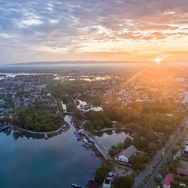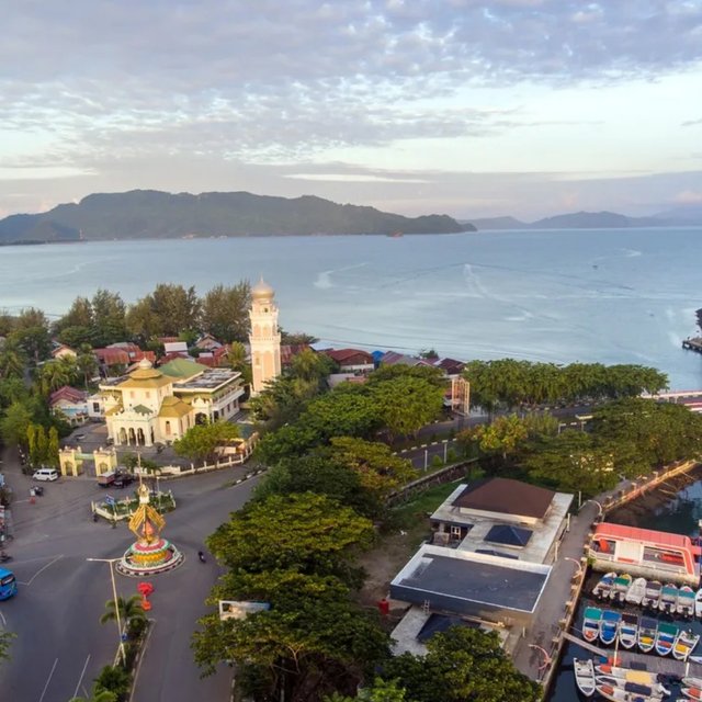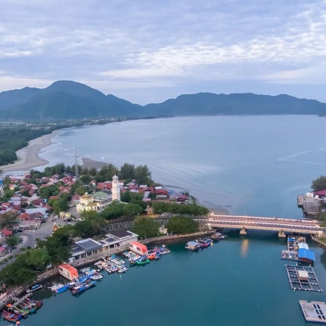


Aerial image of the northern tip of Sumatra Island, the last mainland in the form of a cape, also known as King's Point, which is located in Peukan Bada sub-district, Aceh Besar Regency. In the past, European sailors in their marine navigation reports, this group of hills was known as Acheen Head. The toponym commonly used by British marine navigators, but on Dutch navigation charts it says Atjeh Hoofd. Toponyms that indicate a place can now be expressed as the Ujong Pancu hill area and its surroundings as seen in the top image.
If interested, I can refer readers to the work of John Anderson (diplomatic writer) entitled: Acheen, And The Harbors On The North And East Coasts Of Sumatra: With Incidental Notices Of Trade In The East Sea, And Dutch Aggression, 1840.
The digital version of this book can be read and downloaded at the Staatsbibliothek zu Berlin
Below I quote two paragraphs about the road to Aceh by Thomas Forrest (navigator) in the book "A voyage from Calcutta to the Mergui Archipelago, lying on the east side of the bay of Bengal", which can be read on page 122. See the digital version of the book at the Staatsbibliothek zu Berlin
In August a ship could depart from Bengal to the south while remaining near the Coromandel coast; because then the fresh water of the Ganges River flows along the coast. After descending some distance, perhaps as far as Godewar point, it probably stopped when the wind blew hard to the west, and headed south and east simultaneously.
However, if the navigator falls to leeward of Atcheen Head (for on the Atcheen Road the wind blows through the Surat passage to the south-west towards the Straits of Malacca), let him anchor, the nearer to the shore the better; and by land and sea breezes it can easily reach the Atcheen Pass, where, in the calm waters, it can anchor and refresh itself: but it is unlikely that a ship will fall to leeward at this season.
Captain Thomas Forrest in his book admits that he was awarded the "Golden Order Sword", this medal was carried by the King of Aceh during his visit in 1762. An illustration of the order of the gold sword is contained in his book.
The picture above is a view of Aceh Bay and Ulee Lheue Lagoon which are separated by a bridge. It was in this bay that merchant ships used to anchor.
Ulee Lheue, an area that has a lot of history, is recorded as a busy port city, the first landing site for the Dutch East Indies invasion in 1873 and the worst site of the 2004 Indian Ocean tsunami disaster.
The photo below shows the Ulee Lheue lagoon at dawn, with the sun rising behind the foot of Mount Seulawah Agam, a natural landmark in Aceh.
I flew the drone at the tourist pier right in the courtyard of the Baiturrahim Mosque, Ulee Lheue on Saturday 15 June 2024 starting at 06.30.
It is a historic mosque as a tourist destination which was built in 1922 by the Dutch East Indies government with a European architectural style.
Ulee Lheue Banda Aceh
Let's visit the northern tip of Sumatra Island which is located in Ulèë Lheuë, Banda Aceh City, Indonesia.
Downvoting a post can decrease pending rewards and make it less visible. Common reasons:
Submit