Venezuela is a country with a gigantic tourist potential. Few countries offer such a diversity of landscapes (beaches, mountains, plain, jungle), such a favorable climate, and a privileged geographic location like Venezuela. Tourism in Venezuela has developed considerably in recent decades, particularly because of its favorable geographical position, the variety of landscapes, the richness of the flora and fauna, the artistic manifestations and the privilege of the country's tropical climate, which allows each region to be enjoyed. . Venezuela has 7 geological wonders thanks to its tourism.
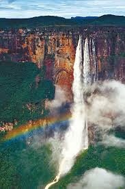
Angel jump
The Angel Falls is the highest waterfall in the world, with a height of 979 meters (807 meters of uninterrupted fall), generated by the fall of the Churùn River from the Auyantepui. It is located in the Canaima National Park in Bolivar state, Venezuela, which was established on June 12, 1962 and declared a World Heritage Site by UNESCO in 1994. The national park extends over 30,000 km² (larger than Belgium), up to the border with Guyana and Brazil, and because of its size is considered the largest in the world.
In 2009 he was nominated to compete in the 7 wonders being the third of the 77 most voted wonders. of 77 wonders happened to the 28 most popular, then placed in the top 10 places in the ranking being the eighth with the most votes.
There are two ways to see the Angel Falls. One of them is from the air by plane and the other is on an excursion that departs from the Ucaima port in Canaima, and lasts more than 3 hours navigating the Carrao river and then the Churún. From the Churún River, to the Angel Falls viewpoint, you should walk approximately one hour through the jungle.
The park has 3 million hectares which is the second largest protected area in Venezuela and sixth in the world. Just in front very close to the Salto del Ángel we can admire the jump "La Catira" a fall of three steps of water in golden color forms the largest "non-permanent" waterfall in the world.
Lightning of the Catatumbo
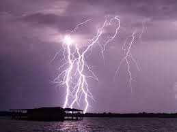
The lightning of the Catatumbo is a singular meteorological phenomenon that takes place in the south of the lake of Maracaibo in the Zulia state, whose name derives from the Catatumbo river. This phenomenon is characterized by an almost continuous and silent lightning that occurs in clouds of great vertical development forming electric arcs between 2 and 10 km in height or more.
They have an annual occurrence of 160 to 200 nights, for 10 hours per night it produces 280 downloads per hour. In addition, these electrical storms produce a percentage of the entire ozone layer generated worldwide by the lightning Catatumbo can be considered as one of the main individual regenerators of the planet's ozone layer, producing approximately 1,176,000 atmospheric electric discharges.
Catatumbo Lightning won a Guinness Award for "the highest global average of lightning per square kilometer per year." The record was recognized by a meteorologist who confirms that the phenomenon produces 250 lightning strikes per square kilometer per year, the highest average in the world.
"The study was presented at the XIII Congress of Atmospheric Electricity of Rio de Janeiro in 2011 and has among its conclusions the place of the planet with the greatest amount of electrical storms per square kilometer is in the lake of Maracaibo, in the municipality Catatumbo, Zulia state "
Medanos de Coro
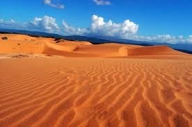
The Médanos de Coro National Park is located in the Falcón state, in the jurisdiction of the Miranda, Colina and Falcón municipalities in northwestern Venezuela. The park is constituted in its greater extension by the isthmus that unites the rest of the state in the Peninsula of Paraguana. The park covers an area of 91,280 hectares of which 42,160 are from continental lands and more than 49,120 from marine surfaces.
Los Médanos de Chorus is one of the most important natural representations of the Venezuelan Landscape. They were declared a national park on February 6, 1974.
In the Medanos de Tocópero and Puerto Cumarebo, beyond the limits of the park, you can see "dune fossils", hills of sandy substrate formed by the compaction of the dunes and covered by permanent vegetation. These are of different sizes and show different levels of vegetation development, so they probably represent the different stages of formation, previous to the current Médanos de Coro.
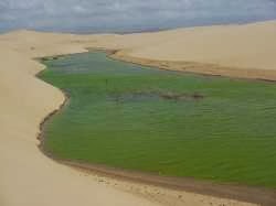
A unique event, which according to the memory of the park rangers consulted, had never occurred before. It is about the formation of 4 lagoons, following the rains that fell throughout Venezuela in December 1999, causing the tragedy of the Vargas State. We clarify that this was something that happened once and most likely will not be repeated in years. The waters evaporated little by little, and thus they were disappearing.
Sierra Nevada
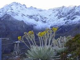
The Sierra Nevada National Park is an important National Park of Venezuela located between the states of Merida and Barinas in the west of the country, created on May 2, 1952, which makes it the second National Park decreed. It was created with the objective of protecting the Sierra Nevada de Mérida within the Andean Cordillera.
It constitutes the preservation of the highest ecosystem in the country, where the highest mountain ranges of the Venezuelan Andes are located, including Pico Bolívar, the highest geographical feature of the country with 5,007 masl.
The park covers parts of six municipalities of the Mérida states and three of the Barinas state. Its total area is 276,446 hectares, of which 185,886 hectares belong to the state of Merida, which means 67.2% of the total area, while the rest of 90,560 hectares correspond to the state of Barinas, 32.8% of the surface of the park.
Within this park are the main peaks of the country, such as Pico Bolivar (5,007 masl), Pico Humboldt (4,942 masl), Pico la Concha (4,922 masl), Pico Bonpland (4,883 masl), Pico Espejo (4,880 masl), Pico León (4,740 masl), El Toro Peak (4,729 masl) and Mucuñuque Peak (4,609 masl).
Monte Roraima
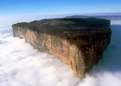
Its name comes from a voice of the Pemón indigenous language, which means mountain or abode of the gods. The Roraima is the highest of the tepuyes (tabular mountains). Located on the border of Venezuela, Guyana and Brazil, it constitutes a vertex on the border between the three countries and, at 2,810 meters, is the highest elevation in Guayana.
The tepuyes, elevated and isolated rock formations of vertical slope and flat peaks. They are the oldest geographic features of the planet (it is estimated that they were formed two thousand million years ago) and more than 85% of them are in Venezuela. The highest of all is the Roraima, is located in the eastern sector of Canaima National Park within the immensity of the mountain are the jacuzzis, a natural pools circulating, and the pit that is a huge hole of orange mineral walls formed by the Fall of an old cave. Tepuis tend to be individually isolated instead of being part of a common chain. This characteristic frequently makes them the environment where unique evolutionary forms, both animal and vegetal, develop.
Roraima is a plateau of sandstone that stands out more than a thousand on the surrounding wooded savannas. It is the highest and easiest to climb of the whole park, and the Auyantepui, the most visited since in this one is the waterfalls or higher waterfalls.
Archipelagos de los Roques
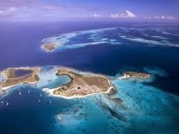
The Archipelagos de los Roques National Park was founded in 1972, an extensive coral atoll 36 km from west to east and 24.6 km from north to south, consisting of 50 islands and 292 cays and banks. Of great diversity and scenic beauty is located in the Caribbean Sea, almost in a straight line north of Caracas and Guaira its most important port.
The park has one of the most diverse and best preserved coral reefs in the Caribbean Sea. The greatest limitation for tourism development, in addition to its status as a national park that establishes rigid controls on commercial activities, is the lack of rivers and other permanent freshwater sources.
The highest point is just 130 meters above sea level. The south of the archipelago has depths of up to 1700 m, with lower progressive levels towards the north, where the average depths do not exceed 15 m. Of the Roques comes 90% of the lobsters that are consumed in Venezuela, since the 1990s the fishing was displaced by tourism as the main economic activity.
The only island with permanent population is Gran Roque of 1.7 km and with about 1200 inhabitants. Other islands and important keys are Francisquí, Crasquí, Madrisquí, Pirata, Fernando, Noronquí and Dos Mosquises.
Cave of the Guácharo
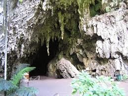
El Guácharo National Park, located in the Eastern Interior Mountain Range, between Monagas and Sucre States, Venezuela. The Guácharo Cave, is carved in sedimentary rocks that were formed 130 million years ago in the second era in an old sea, The sea is removed due to the lifting of the earth's crust, giving rise to the Eastern Massif. Hydric erosion produces leaks that originate a network of interconnected branches and galleries.
The cave has an entrance of 23 meters high and 28 meters wide, also about 10.2 kilometers long, which is considered one of the most interesting cave formations on the continent. The natural continuity of the hydrogeological and biological processes that occur in the Cueva del Guácharo are unique and are important so it was declared a Natural Monument in 1949.
The Guacharo is a frugivorous bird that inhabits the first gallery of the cave, goes out at night in search of its food. Its name is onomatopoeic, it is derived from Quechua waqay (scream or cry), for its characteristic song. Its color is brown with white and black spots and with bristles around the beak. It measures about 48 cm long and is about 91 cm in span. The Guácharo produces in the cave an organic layer called guano, formed by vomited seeds and excrement that constitutes the basic nutrient of the ecosystem of the cave. The most important daily event in the park occurs in the afternoon when the birds leave the cave in large flocks, to find their food. This same species gives its name to another natural park: The Cueva de los Guácharos National Natural Park on the western slope of the Eastern Cordillera, in Colombia.
THESE ARE ONLY 7 OF THE WONDERS WITH WHICH THIS NATION COUNTS, WHEREEVER EACH ONE WITH HER MAJESTIC MAJESITY, SHOWS THAT IT DOES NOT MISS VERY FAR TO WONDER BEFORE NATURE, SHE WAS GENEROSA WITH OUR COUNTRY GIVING US THESE BEAUTIES, OF WHICH SENSES GREAT PRIDE ALL VENEZUELANS.
Nice post! I would love to visit Venezuela. Hey, I think you accidently included the Angel Jump section twice though.
Downvoting a post can decrease pending rewards and make it less visible. Common reasons:
Submit
when you can do it, venezuela you have very beautiful sites to know. Thanks for your quotation, I already corrected it. Happy day, regards ...
Downvoting a post can decrease pending rewards and make it less visible. Common reasons:
Submit