
In the final section of his description of Ireland—Geography, Book 2, Chapter 2, § 10—Claudius Ptolemy records the names and coordinates of nine islands, five of which lie to the north of Ireland and four to the east. The former are known collectively as αἱ Αἰβουδαι [Hai Aboudai], or The Aiboudai. The third of these, counting from west to east, is Ῥικινα [Rhikina] (Latin: Rhicina, Ricina).
In his 1883 edition of the Geography, Karl Müller records only one variant reading of Ῥικινα. This variant is also recorded by Friedrich Wilberg in his edition of 1838. In his edition of 1845, Karl Nobbe agrees with Müller and Wilberg’s critical choice. According to Müller, two manuscripts omit Rhikina and the two following islands altogether:
| Source | Greek | English |
|---|---|---|
| Most MSS | Ῥικίνα | Rhikina |
| X, Σ, Φ, Ψ | Ἐγγαρίκεννα | Engarikenna |
| D, Ξ | - | - |
| Source | Latin |
|---|---|
| 4803 | Engaricenna |
D is one of the Codices Parisini Graeci in the Bibliothèque nationale de France in Paris: Grec 1402.
X is Vaticanus Graecus 191, which dates from about 1296. It is thought that this manuscript preserves a very ancient tradition. Ptolemy’s description of Ireland is on folia 138v and 139r.
Ξ is Barberinus, a codex from the library of Cardinal Francesco Barberini. It is now housed in the Vatican Library
Σ, Φ and Ψ are three manuscripts from the Laurentian Library in Florence: Florentinus Laurentianus 28, 9 : Florentinus Laurentianus 28, 38 : Florentinus Laurentianus 28, 42.
Arg is the Editio Argentinensis, an early printed edition based on Jacopo d’Angelo’s Latin translation of Ptolemy (1406) and the work of Pico della Mirandola. Many other hands also worked on it—Martin Waldseemüller, Matthias Ringmann, Jacob Eszler and Georg Übel—before it was finally published by Johann Schott in Straßburg in 1513. Argentinensis refers to Straßburg’s ancient Celtic name of Argentorate.
4803 is one of the Codices Parisini Latini in the Bibliothèque nationale de France in Paris. It is a Latin translation of Ptolemy’s Geography by Jacopo d’Angelo: Latin 4803.
The only variant reading of this toponym is Ἐγγαρίκεννα [Engarikenna], a bizarre corruption of Ptolemy’s Greek:
| Greek | English |
|---|---|
| ειτα Ῥικινα ιζ ξβ | then Rhikina 17° 62° |
Clearly, somewhere along the line of transmission a scribe misread the two Greek words ειτα Ῥικινα [eita Rhikina = then Rhikina] as the name of this island, conflating them to create the illiterate Ἐγγαρίκεννα [Engarikenna]. It could be that this error was the result of a scribe writing down the names as they were dictated to him by another scholar. In other words, the error was one of mishearing rather than misreading. Whatever its source, it must have been made quite early in the history of the Geography, as it occurs in Vaticanus Graecus 191, which is thought to preserve a very ancient tradition.
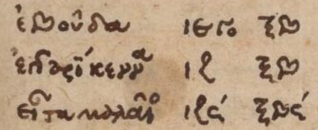
The Scottish toponymist William John Watson offered and immediately retracted the following suggestion:
The curious variant Eggarikenna (Enga-?) would suggest ‘Eigg and Rhikenna,’ were it not that this would make up six islands instead of five. (Watson 37)
Note that in ancient Greek, the combination -γγ- [-gg-] represents the sound -ngg- [ŋg]:
| Greek | Latin | English |
|---|---|---|
| Αγγελος | Angelus | Angel |
According to Müller, the form Engaricenna was adopted by Jacopo d’Angelo when he translated the Geography into Latin in 1406. In Nicholaus Germanus’s map (see the thumbnail at the top of this article) the spelling is Engaricena.
A Note on Ptolemy’s Use of Breathings
In ancient Greek, an initial rho, Ρ, always took a rough breathing as a matter of course:
13. Every initial ρ has the rough breathing:_ ῥήτωρ orator_ (Lat. rhetor). Medial ρρ is written ῤῥ in some texts: Πυῤῥος Pyrrhus.
14. The sign for the rough breathing is derived from Η, which in the Old Attic alphabet (2 a) was used to denote h. Thus, ΗΟ ὁ the. After Η was used to denote η, one half (ⱶ) was used for h (about 300 B.C.), and, later, the other half (˧) for the smooth breathing. From ⱶ and ˧ come the forms ῾ and ᾽. (Smyth 10)
This explains why Ptolemy’s Ῥικινα is sometimes transcribed into Roman script as Rhicina (Müller, Wilberg) and sometimes as Ricina (Pliny). The latter is probably closer to the original name, so the introduction of the rough breathing here is simply the result of Ptolemy or one of his transcribers applying Smyth’s general rule.
Pliny the Elder
The island of Ricina is mentioned by Pliny the Elder in his encyclopaedic Natural History:
Among these [islands of Britain and Ireland] there are the Orcades, forty in number, and situate within a short distance of each other, the seven islands called Acmodæ, the Hæbudes, thirty in number, and, between Hibernia and Britannia, the islands of Mona, Monapia, Ricina, Vectis, Limnus, and Andros. (Pliny, Bostock & Riley 351)
In their critical edition of the Natural History, Ludwig von Jan and Karl Friedrich Theodor Mayhoff give several variant readings of this toponym:
- Riginia (their critical choice), Rignea, Ricnea, Richea, Ricina (Pliny, Jan & Mayhoff 348).
The only significance of this fleeting reference is that it supports the spelling Ricina rather than Rhicina, implying that the rough breathing in Ptolemy’s text is incorrect. None of the variant readings has Rh-. But Pliny does not tell us where precisely this Ricina lay other than somewhere between Hibernia and Britannia. He does not even clarify whether it was considered an Irish or a British island.
Antonine Itinerary
The Antonine Itinerary is an anonymous itinerarium, or Roman roadmap, of the early Christian centuries. It comprises lists of places along various routes with the distances between them. In an appendix there is also a Maritime Itinerary, in which we have the following:
In the ocean which lies between Gaul and Britain: The 3 Orcadian Islands, the Island of Clota in the Irish Sea [in Hiverione], Vecta, Riduna, Sarmia. Caesarea, Barsa, Lisia. Andium, Sicdelis, Uxantis, Sina. (Wesseling 508-509, Reynolds 396, Freeman 89-90)
The identities of these islands are still matters of scholarly debate. Wesseling identifies Riduna with Ptolemy’s Ῥικινα and Pliny’s Ricina, and cites the Spanish scholar Hieronimo Surita to the effect that in Pliny’s text Ricina and Vectis are also listed next to each other (albeit in the opposite order to the Antonine Itinerary’s Vecta, Riduna). William Camden suggested that Riduna was a misreading of Riclina, as Racline was the English name of the island in his day (Camden 1462, Baxter 202).
Ravenna Cosmography
The Ravenna Cosmography comprises lists of toponyms of the known world compiled by an anonymous cleric in Ravenna around 700 CE. The description of Britain concludes with a number of lists of offshore islands. The second island in a list of fourteen islands in the western ocean [in ipso Oceano occidentali] is called Regaina (Pinder & Parthey 440). The only variant reading recorded is regama, which is probably no more than a simple misreading of regaina. Few of the islands in this list have been identified, and it is not even clear whether the author enumerates them in any particular geographical order.
There is also the question of the orientation of the source map of Britain used by the anonymous Cosmographer. Initially, he describes Ireland as lying to the north of Britain, the Orkneys to the east, Gaul to the west and ancient Germany to the south (Pinder & Parthey 439). Clearly, his map of Britain was rotated by 90° in a clockwise direction:
The Cosmographer rounds off his list of names on the British mainland with an overview of the island. He has got his cardinal points wrong by ninety degrees: the Orkneys are to the north, not east, Gaul is to the south, not the west, Ireland to the west, not the north, and Old Germany to the east, not south. This perhaps indicates that the Cosmographer’s map of Britain was a stand-alone, not connected to his source for mainland Europe; the cardinal points do not seem to have been shown on this map and it is possible that Cosmographer oriented it with reference to the direction of most of the writing on it. At any rate, he probably guessed and, being the Cosmographer, guessed wrongly. (Fitzpatrick-Matthews 79)
Strabo, too, misplaced Ireland to the north of Britain (Strabo et al 298-299).

Identity
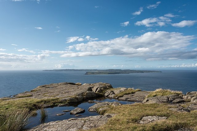
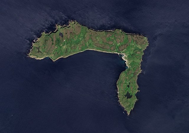
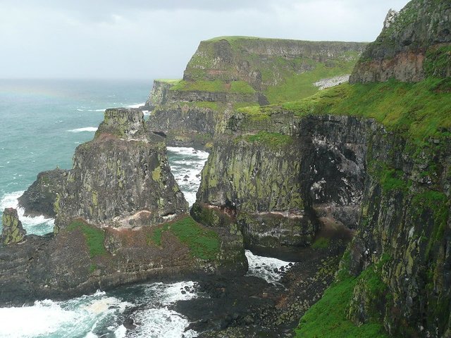
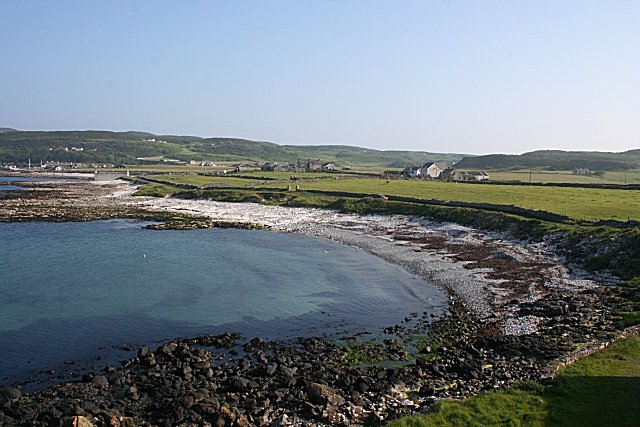
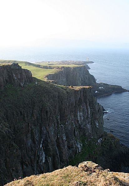
The most popular, but by no means unanimous, candidate for Ptolemy’s Rhikina is Rathlin Island, which lies off the northeast coast of Ireland. This small island is in the correct position—more or less—and while it is clearly an Irish island, it could easily be regarded as the southernmost of the Hebrides, or Ptolemy’s Aiboudai.
Ricina or Ricena, which appears in Pliny as Riginia or Ricnea, is probably Rathlin Island, Ir. Rechrann, [Footnote 4: This seems to be the oldest form of the nominative, later Rechru (cf. Ó Máille, Lang. of the Ann. of Ulster 149] which might go back to *Rikorinā. (O’Rahilly 14)
The problem with this identification is linguistic. If O’Rahilly is correct, the earliest native name for Rathlin is Rechrann , the meaning of which is unknown. This is certainly close to the Latin Ricina, but we can only derive one from the other if we accept that the name has been corrupted in transmission:
In his analysis of the Ravenna Cosmography, Keith Fitzpatrick-Matthews acknowledges this problem:
The next name after Mona is the same as Ptolemy’s Ῥικίνα (Geography II.2, 10), usually, but by no means certainly, identified with Rathlin (Rivet & Smith 1979, 132). Rathlin occurs in Adomnan’s Vita Columbae as ‘insula quae uocatur Rechru’ [an island which is called Rechru (Reeves 11)], but there is no linguistic connection between the two forms (Watson 1926, 37). (Fitzpatrick-Matthews 80)
Karl Müller is also doubtful:
The location of this island is uncertain. According to some, Ricina is today’s Rathlin, a small island next to the Rhobogdian Promontory. I prefer to identify it with either Rum or Tirree which are certainly between the two Æbudas (Uist) and Malæus (Mull) ... (Müller 81)
Rùm is one of the Inner Hebrides, while Tiree is the most westerly of the Inner Hebrides. Müller’s identification of Rhikina with one of these rests on his belief that the two islands called Aibouda are North Uist and South Uist, and that Malaios is Mull, and the fact that Ptolemy’s coordinates place Rhikina between these. But if, as I suspect, the two Aiboudas refer to Islay and Jura, then the identification of Rhikina with Rathlin would make perfect sense. As I pointed out in an earlier article, the coordinates Ptolemy assigns to the nine Irish islands have all the appearance of artificiality—four of these islands have identical latitudes and four have identical longitudes—and should not be taken seriously.
Goddard Orpen accepts the Rhikina-Rathlin identification as probable:
Ῥικίνα [Rhikina]is probably Rathlin Island, off the coast of Antrim, Ir. Rechra, gen. Rechrainn. It is called by Pliny, Rignea (Ricnea Riginia), and by the Ravenna Geographer, Regaina. (Orpen 127)
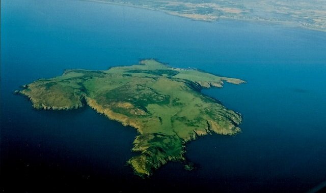
The toponym Rechru, however, also referred to Lambay Island, which lies off the coast of County Dublin:
Lambay is merely an altered form of Lamb-ey, i.e. Lamb-island ... Its ancient Irish name was Rechru, which is the form used by Adamnan [Reeves 70], as well as in the oldest Irish documents; but in later authorities it is written Rechra and Reachra. In the genitive and oblique cases, it is Rechrinn, Reachrainn, &c. ... Though the name Rachra, as applied to the island, is wholly lost, it is still preserved, though greatly smoothed down by the friction of long ages, in the name of Portraine, the parish adjoining it on the mainland ... Other islands round the coast were called Rachra which are now generally called Rathlin, from the genitive form Rachrann, by a change from r to l ... The best known of these is Rathlin on the Antrim coast, which Ptolemy calls Rikina, and whose name has been modified in various ways by foreign and English writers; but the natives still call it Raghery, which correctly represents the old nominative form. (Joyce 111-112)
Note that Joyce takes Rechru as the original nominative, with the genitive Rechrainn being later taken as the nominative. This is the opposite of O’Rahilly’s opinion.
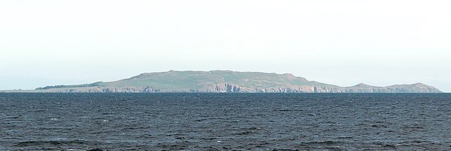
The principal objection to Lambay Island is its location. It is not remotely close to the Hebrides.
Etymology
Early attempts to explain the name of this island were hampered by the uncertainty of the earliest form of the name. In the 18th century, the Welsh scholar William Baxter offered the following, accepting Racline as the correct form of the name:
REGLINA: ... is Racline Island, in Ireland, as though one might say in Brittonic Rhag lyn, or before the liquid of the sea. Even amongst the Irish, Lean means liquid. (Baxter 202)
Few modern scholars seem willing to hazard a guess as to the possible meaning of Rechru, Rechrann, or whatever the original native name of this island was. O’Rahilly does not even attempt to interpret his hypothetical *Rikorinā. The contributors to Roman Era Names, however, have offered the following tentative analysis of the Ptolemaic name:
Welsh rhygnu ‘to saw, to cut into pieces’ (favoured by Celtic scholars, as possibly conveying a sense of ‘notched’) appears not previously to have been linked with Greek ρηγνυμι [rhēgnumi] ‘to break asunder’ (previously suggested here in the sense of shipwreck), but presumably they both descend from PIE *wreg- ‘to break’. Hence perhaps an overall meaning of ‘broken part’. Εγγα [Enga] meant ‘near’.
Notes: This analysis owes a lot to the original date of about AD 400 for the Irish name versions suggested by McCarthy (2001) where Rechrann apparently ends in rann ‘part’. However, if Ptolemy’s spelling was a typical 2-element name, with first part like ρεω [rheō] ‘to flow’ and second like κινεω [kineō] ‘to set in motion’, that might refer to the strong tidal streams around Rathlin Island, where a remarkable number of ships have been wrecked. An alternative meaning based on PIE *reig- ‘to reach, to stretch out’ is also possible, and actively favoured for Ρεριγονιον [Rherigonion] at the Rhins of Galloway, but the etymology there is confused by frigid and ρικηνεις [rhikēneis] ‘shrivelled with cold’. (Roman Era Names)
Conclusion
Notwithstanding the etymological and linguistic problems, I find it hard to resist identifying Ptolemy’s Rhikina with Rathlin Island. However, Fitzpatrick-Matthews’ warning is worth bearing in mind:
The lists of islands that follow this overview are very obscure. Renaming of most islands during the Scandinavian period (if not earlier, during the period of Scottish settlement [from Ulster]) has meant that few islands retain names which can be equated with Romano-British forms preserved not only in the Cosmography, but also in Ptolemy and Pliny. (Fitzpatrick-Matthews 79)
References
- Adamnan, William Reeves (translator & editor), Life of St Columba, Founder of Hy, Edmonston and Douglas, Edinburgh (1874)
- William Baxter, Glossarium Antiquitatum Britannicarum, sive Syllabus Etymologicus Antiquitatum Veteris Britanniae atque Iberniae temporibus Romanorum, Second Edition, London (1733)
- William Camden, Britannia: Or A Chorographical Description of Great Britain and Ireland, Together with the Adjacent Islands, Second Edition, Volume 2, Edmund Gibson, London (1722)
- Keith J Fitzpatrick-Matthews, Britannia in the Ravenna Cosmography: A Reassessment, Academia (2013)
- Philip Freeman, Ireland and the Classical World, The University of Texas Press, Austin TX (2001)
- Patrick Weston Joyce, The Origin and History of Irish Names of Places, Volume 1, Longmans, Green, & Co, London (1910)
- Karl Wilhelm Ludwig Müller (editor & translator), Klaudiou Ptolemaiou Geographike Hyphegesis (Claudii Ptolemæi Geographia), Volume 1, Alfredo Firmin Didot, Paris (1883)
- Karl Friedrich August Nobbe, Claudii Ptolemaei Geographia, Volume 1, Karl Tauchnitz, Leipzig (1845)
- Karl Friedrich August Nobbe, Claudii Ptolemaei Geographia, Volume 2, Karl Tauchnitz, Leipzig (1845)
- Tomás Ó Máille, The Language of the Annals of Ulster, Manchester University Press, Manchester (1910)
- Thomas F O’Rahilly, Early Irish History and Mythology, Dublin Institute for Advanced Studies, Dublin (1946, 1984)
- Goddard H Orpen, Ptolemy’s Map of Ireland, The Journal of the Royal Society of Antiquaries of Ireland, Volume 4 (Fifth Series), Volume 24 (Consecutive Series), pp 115-128, Dublin (1894)
- Moritz Pinder, Gustav Parthey (editors), Ravennatis Anonymi Cosmographia et Gvidonis Geographica [The Cosmography of the Anonymous of Ravenna and the Geography of Guido of Pisa], Friedrich Nicolai, Berlin (1860)
- Pliny the Elder, John Bostock, Henry Thomas Riley, The Natural History of Pliny, Volume 1, Henry G Bohn, London (1855)
- Pliny the Elder, Ludwig von Jan, Karl Friedrich Theodor Mayhoff, C. Plini Secundi Naturalis Historiae Libri XXXVII, Volume 1, Georg Teubner, Leipzig (1906)
- Claudius Ptolemaeus, Geography, Biblioteca Apostolica Vaticana, Vat Gr 191, fol 127-172 (Ireland: 138v–139r)
- Thomas Reynolds, Iter Britanniarum; Or That Part of the Itinerary of Antoninus which Relates to Britain, With a New Comment, J Burges, Cambridge (1799)
- Albert Lionel Frederick Rivet, Colin Smith, The Place-Names of Roman Britain, Batsford, London (1979)
- Herbert Weir Smyth, A Greek Grammar for Colleges, American Book Company, New York (1920)
- Strabo, Hans Claude Hamilton, William Falconer, The Geography of Strabo, Volume 1, Henry G Bohn, London (1854)
- William John Watson, The History of the Celtic Place-Names of Scotland, Edinburgh (1926)
- Petrus Wesseling (editor), Vetera Romanorum Itineraria, sive, Antonini Augusti Itinerarium [Ancient Itineraries of the Romans, or, The Itinerary of the Emperor Antoninus Pius], J. Wetstenium & G. Smith, Amsterdam (1735)
- Friedrich Wilhelm Wilberg, Claudii Ptolemaei Geographiae, Libri Octo: Graece et Latine ad Codicum Manu Scriptorum Fidem Edidit Frid. Guil. Wilberg, Essendiae Sumptibus et Typis G.D. Baedeker, Essen (1838)
Image Credits
- Ptolemy’s Map of Ireland: Wikimedia Commons, Nicholaus Germanus (cartographer), Public Domain
- Greek Letters: Wikimedia Commons, Future Perfect at Sunrise (artist), Public Domain
- Ἐγγαρίκεννα (Vat Gr 191 f 139r): Vaticanus Graecus 191 folio 139r, © Vatican Library, Fair Use
- Rathlin Island from Fair Head: © Giorgio Galeotti, Creative Commons License
- Rathlin Island (Sentinel-2B): Copernicus Programme, © ESA, Contains Modified Copernicus Sentinel Data 2018, Creative Commons License
- Rathlin Island Tors: © Theyoungones1994, Creative Commons License
- Rathlin Island Cliffs: © Brian O’Neill, Creative Commons License
- Lambay Island: © Joseph Mischyshyn, Creative Commons License
- Lambay Island (From the South): © Robert Linsdell, Creative Commons License
- Mill Bay, Rathlin Island: © Anne Burgess, Creative Commons License
- Park Cove, Rathlin Island: © Anne Burgess, Creative Commons License
