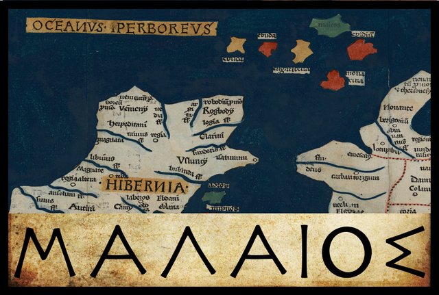
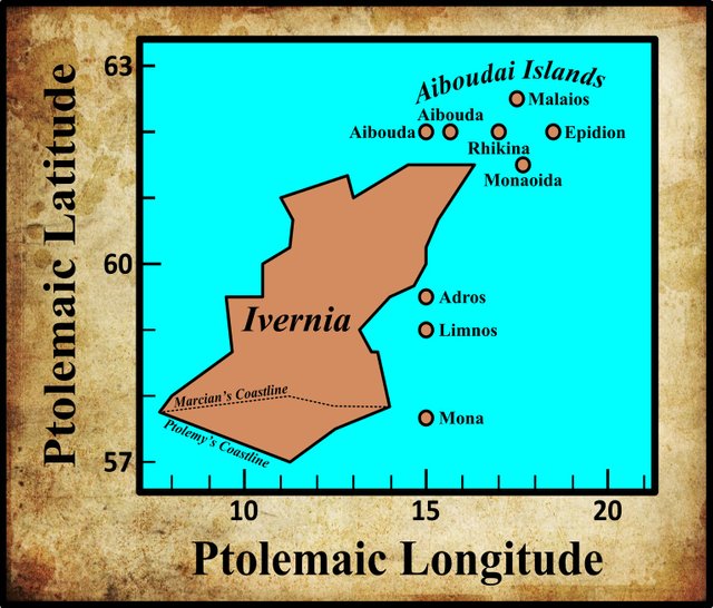
In the final section of his description of Ireland—Geography, Book 2, Chapter 2, § 10—Claudius Ptolemy records the names and coordinates of nine islands, five of which lie to the north of Ireland and four to the east. The former are known collectively as αἱ Αἰβουδαι [hai Aboudai], the Aiboudai. The fourth of these is the most northerly and is called Μαλαιος [Malaios].
In his 1883 edition of the Geography, Karl Müller records two variant readings of Μαλαιος. In his 1838 edition of the Geography, Friedrich Wilberg records all three of Müller’s readings but chooses one of Müller’s variants as the critical choice. In his edition of 1845, Karl Nobbe agrees with Wilberg’s critical choice.
| Source | Greek | English |
|---|---|---|
| Müller, X, Σ, Φ, Ψ, Arg | Μαλαῖος | Malaios |
| Nobbe, Wilberg, Most MSS | Μαλεός | Maleos |
| C | Μελεός | Meleos |
C is Parisiensis Supplem 119. Presumably this is one of the Codices Parisini Graeci in the Bibliothèque nationale de France in Paris, though I have not been able to confirm this.
X is Vaticanus Graecus 191, which dates from about 1296. It is thought that this manuscript preserves a very ancient tradition. Ptolemy’s description of Ireland is on folia 138v and 139r.
Σ, Φ and Ψ are three manuscripts from the Laurentian Library in Florence: Florentinus Laurentianus 28, 9 : Florentinus Laurentianus 28, 38 : Florentinus Laurentianus 28, 42.
Arg is the Editio Argentinensis, an early printed edition based on Jacopo d’Angelo’s Latin translation of Ptolemy (1406) and the work of Pico della Mirandola. Many other hands also worked on it—Martin Waldseemüller, Matthias Ringmann, Jacob Eszler and Georg Übel—before it was finally published by Johann Schott in Straßburg in 1513. Argentinensis refers to Straßburg’s ancient Celtic name of Argentorate.
Although Μαλαῖος [Malaios] is a minority reading, this is the reading Müller chooses in his critical edition of the Geography, while Nobbe and Wilberg opt for Μαλεός[Maleos], which is the commonest reading. Müller’s choice appears to have been coloured by the Ravenna Cosmography. As we saw in the previous article in this series, the Ravenna Cosmography comprises lists of toponyms of the known world compiled by an anonymous cleric in Ravenna around 700 CE. Book V § 30 is a description of the northern ocean, in which are to be found Scandinavia, Britain and Ireland. This section concludes with a list of four islands, the second of which is called Malaca (Pinder & Parthey 423). In a critical note, the editors comment:
Malaca] perhaps to be read Malaea: for Ptolemy has Μαλαῖος or Μαλεός. (Pinder & Parthey 423 fn)
Müller references this passage in defence of his choice of Μαλαῖος (Müller 81). In his Reassessment of the Britannic sections of the Cosmography, Keith Fitzpatrick-Matthews identifies these four islands:
| Cosmographer | Fitzpatrick-Matthews |
|---|---|
| Vectis | Isle of Wight |
| Malaca | Mull |
| Insenos | Isle of Sein |
| Taniatide | Thanet |
A small group of island names precedes the main British listing. It is an odd group, naming three islands separated from the British mainland by only a short distance, while the other is off the western coast of Brittany ... Why Malaea, Mull, was included in this group cannot be ascertained. However, it is possible that these names, occurring in an earlier section of the work, derive from a different source from that used by the Cosmographer for Britain generally. (Fitzpatrick-Matthews 82-83)
Identity
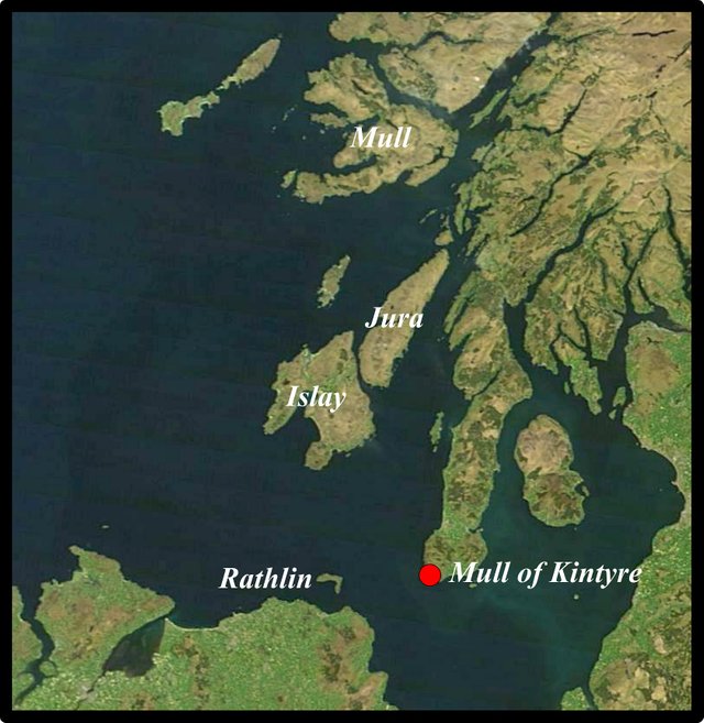
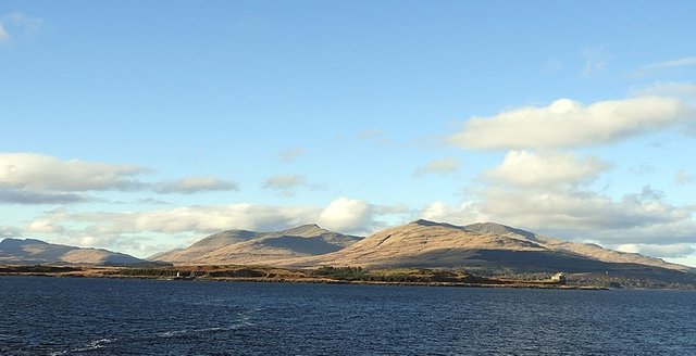
Müller identifies Ptolemy’s Malaios with today’s Mull, the second-largest of the Inner Hebrides. I made the point in a previous article that the coordinates Ptolemy assigns to his nine Irish islands have all the appearance of being artificial: four of them have the same latitude, and four the same longitude. Malaios, however, is the most northerly of the Aiboudai (Hebrides) and does not share its coordinates with any of the other eight islands. Its identification with the Isle of Mull, therefore, is quite in keeping with our earlier identification of the two Aiboudas and Rhikina as Islay, Jura and Rathlin respectively:
Goddard H Orpen concurs:
Μαλαῖος is Mull, the Malea insula of Adamnan. (Orpen 127)
The reference is to Adomnán’s Vita Columbae [Life of Colm Cille] (Reeves 19, 52).
The consensus that Ptolemy’s Malaios or Maleos refers to the Isle of Mull is so nearly unanimous that it is quite challenging to find any dissenting opinions. One, however, is provided by Louis Francis, whose assignment of Ptolemy’s nine Irish islands is quite idiosyncratic:
§11/12 are concerned with offshore islands that Ptolemy associates with Hibernia. However from the north-easterly co-ordinates given it is clear that all are more closely associated with the island of Albion than Hibernia. §11 is concerned with a group of five under the general heading of ‘Ebuda’ which would appear to be the Outer Hebrides, while further to the east another group, among which another island also called ‘Ebuda’, would appear to be the Inner Hebrides and finally ‘Epidium’, taken to be the Kintyre peninsula. §12 lists another group of islands not considered to be associated with one another, Monasida [sic] which could be Mull, two uninhabited islands, Edra and Limnos which could be Jura and Islay and lastly, Mona which would seem to the Isle of Man. (Francis Section 2)
Note that he does not actually mention Malaios or Maleos, but as he identifies the sixth of Ptolemy’s Irish islands with Mull, he must have identified Malaios with one of the more northerly Inner Hebrides.
Etymology
The Scottish toponymist William J Watson had much to say concerning the Celtic etymology of Malaios:
Malaios is now Muile, anglicized into Mull. It shows the common suffix -aios, which becomes in Gaelic -e; compare Gaul[ish] Bed-aios, corresponding to Bede in the Book of Deer, and, for the change in the first syllable, Lat[in] badius, G[aelic] buidhe, yellow. The intermediate stage appears in Adamnan’s Malea insula, ‘the Malean isle,’ or, as we say now, ‘an t-Eilean Muileach,’ where Malea is an adjective fem. from Maile, the form which would be assumed quite regularly in Adamnan’s time by E[arly] Celt[ic] Malaios; compare E.Celt. magos, neut., a plain (stem mages-); O[ld] Ir[ish] mag, gen. maige (for mage(s)os); G. muighe. The first part, mal-, may perhaps be compared with G. mol-adh: W[elsh] mawl, praise ; G. muileach, dear, beloved. If these are connected with Ch[urch] Slav[onic] iz-moleti, ‘eminere,’ ‘to stand prominent,’ the E.Celt. Malaios might have the very satisfactory meaning of ‘Lofty Isle,’ foreshadowing our Muile nam Mór-bheann, ‘Mull of the Great Peaks.’ (Watson 38)
The etymologists at Roman Era Names are also attracted to the ‘eminere’ provenance:
Malea
Attested: Ptolemy 2,2,11 Μαλεος (or Μαλαιος), one of 5 Εβουδαι listed with Ireland; Adomnan Malea (3 times in Life of St Columba, see pp 128,129,167 here)
Where: Almost certainly the Isle of Mull, around NM5732.
Name origin: See here for a general discussion of M-vowel-L ‘protruding, sticking out or up’ in ancient names, one of which was Μαλεα, Cape Maleas, the southern tip of the Peloponnese in Greece. The similarity in shape is strong, and even extends to both having islands with religious/mythological reputations off their tips: Iona and Kithira.
Notes: R[avenna] C[osmographer]’s Maiona is within manuscript-miscopying range of Latin maiora ‘greater’ (or possibly ‘add-on’) and may also refer to Mull, so maybe Greek μαλεω equated with αυξανω [auxanō] ‘to increase’, should not be ruled out. See here for some general comments on Scottish island names.
Following up their link to the Name origin, we learn that they derive Malaios from the proto-Celtic *malo-, which means rising, or prominent.
Earlier Scholarship
From early times, scholars have been almost unanimous in identifying Ptolemy’s Malaios or Maleos with the Isle of Mull. William Camden was in no doubt about the identity (Camden 1463). William Baxter (196) believed that Malaios and Maleos were corrupt forms of Maleninos, which he glossed as Malen inis, the latter word being the Gaelic for island (used only in toponyms)—an unlikely etymology. Baxter was satisfied, however, that the Isle of Mull was meant.
Irish scholars, however, generally had little if anything to say about this toponym, considering it more British than Irish.
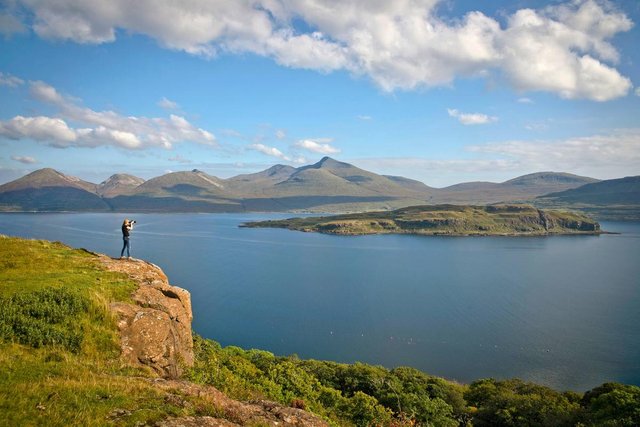
For once, I find myself in agreement with the general consensus. Malaios is clearly the Isle of Mull.
References
- William Baxter, Glossarium Antiquitatum Britannicarum, sive Syllabus Etymologicus Antiquitatum Veteris Britanniae atque Iberniae temporibus Romanorum, Second Edition, London (1733)
- William Camden, Britannia: Or A Chorographical Description of Great Britain and Ireland, Together with the Adjacent Islands, Second Edition, Volume 2, Edmund Gibson, London (1722)
- Patrick S Dinneen, Foclóir Gaedhilge agus Béarla: An Irish-English Dictionary, New and Revised Edition, Irish Texts Society, M H Gill & Son, Ltd, Dublin (1927)
- Keith J Fitzpatrick-Matthews, Britannia in the Ravenna Cosmography: A Reassessment, Academia (2013)
- Ptolemy, Louis Francis (editor, translator), Geographia: Selections, English, University of Oxford Text Archive (1995)
- Karl Wilhelm Ludwig Müller (editor & translator), Klaudiou Ptolemaiou Geographike Hyphegesis (Claudii Ptolemæi Geographia), Volume 1, Alfredo Firmin Didot, Paris (1883)
- Karl Friedrich August Nobbe, Claudii Ptolemaei Geographia, Volume 1, Karl Tauchnitz, Leipzig (1845)
- Karl Friedrich August Nobbe, Claudii Ptolemaei Geographia, Volume 2, Karl Tauchnitz, Leipzig (1845)
- Goddard H Orpen, Ptolemy’s Map of Ireland, The Journal of the Royal Society of Antiquaries of Ireland, Volume 4 (Fifth Series), Volume 24 (Consecutive Series), pp 115-128, Dublin (1894)
- Moritz Pinder, Gustav Parthey (editors), Ravennatis Anonymi Cosmographia et Gvidonis Geographica [The Cosmography of the Anonymous of Ravenna and the Geography of Guido of Pisa], Friedrich Nicolai, Berlin (1860)
- Claudius Ptolemaeus, Geography, Biblioteca Apostolica Vaticana, Vat Gr 191, fol 127-172 (Ireland: 138v–139r)
- Adamnan, William Reeves (translator & editor), Life of St Columba, Founder of Hy, Edmonston and Douglas, Edinburgh (1874)
- William John Watson, The History of the Celtic Place-Names of Scotland, Edinburgh (1926)
- Friedrich Wilhelm Wilberg, Claudii Ptolemaei Geographiae, Libri Octo: Graece et Latine ad Codicum Manu Scriptorum Fidem Edidit Frid. Guil. Wilberg, Essendiae Sumptibus et Typis G.D. Baedeker, Essen (1838)
Image Credits
- Ptolemy’s Map of Ireland: Wikimedia Commons, Nicholaus Germanus (cartographer), Public Domain
- Greek Letters: Wikimedia Commons, Future Perfect at Sunrise (artist), Public Domain
- The Scottish Isles: Jeff Schmaltz, MODIS Land Rapid Response Team, NASA GSFC (Goddard Space Flight Center), Public Domain
- The Isle of Mull: © Reading Tom, Creative Commons License
- Island of Eorsa, Loch na Keal, Mull: © 2019 VisitScotland, Fair Use
