Hi everyone, Let's we take a technical look at geography of Izmir

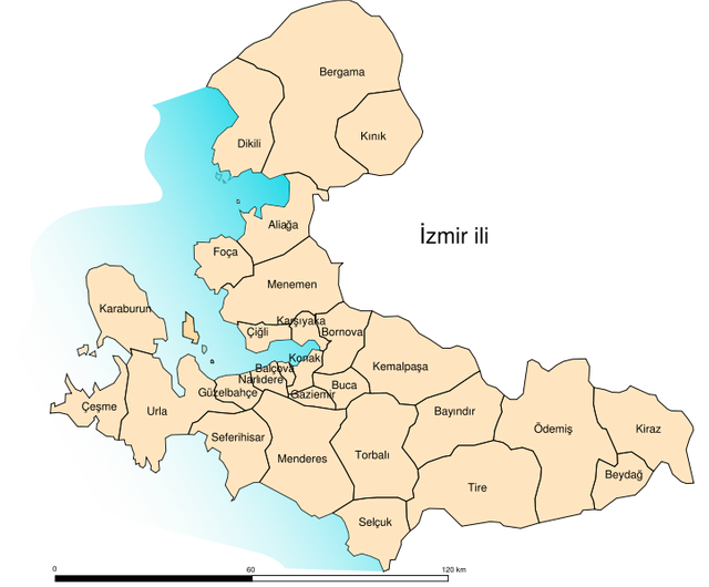
There are thirty impressive districts.
Aliağa, Bayraklı, Bornova, Çiğli, Gaziemir, Karaburun, Kınık, Menderes, Ödemiş, Tire, Balçova, Bergama, Buca, Dikili, Güzelbahçe, Karşıyaka, Kiraz, Menemen, Seferihisar, Torbalı, Bayındır, Beydağ, Çeşme, Foça, Karabağlar, Kemalpaşa, Konak, Narlıdere, Selçuk, Urla.
And also, Transportation of Izmir;

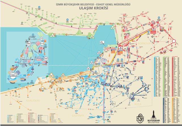
Transportation is provided by city buses and metro lines in Izmir. Your first choice can be HAVAS (direction of be ALSANCAK) from the airport and then you can use taxi or other transportation routes that have links as below. Also if you wish, you can use directly below public transportation.
HAVAŞ Web Site: http://www.havas.net/en/OurServices/BusServicesAndCarParkingFacilities/ServicePoints/Pages/Izmir.aspx
ESHOT General Direcorate Web Site:
http://www.eshot.gov.tr/en/UlasimSaatleri/289
İZBAN - İzmir Banliyö Transport System Web Site:
http://www.izban.com.tr/Sayfalar/SeferSaatleri.aspx?MenuId=22
İzmir Metro Web Site:
http://www.izmirmetro.com.tr/SeferPlani/35
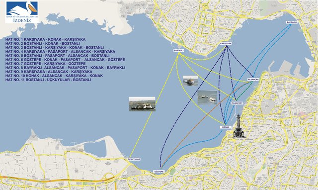
This city is the most comfortable with transportation networks on all sides. As well as sea road transportation is becoming increasingly important.

This post has received a 2.94 % upvote from @drotto thanks to: @mamicco.
Downvoting a post can decrease pending rewards and make it less visible. Common reasons:
Submit