Rain Approaching Long Island Warm Front Woes Tonight Wednesday
<iframe style="border: none;" src="//rcm-na.amazon-adsystem.com/e/cm?o=1&p=12&l=ez&f=ifr&linkID=431c1e7be66bc52a4e7193969dcff192&t=meteorologisj-20&tracking_id=meteorologisj-20" width="300" height="250" frameborder="0" marginwidth="0" scrolling="no"></iframe>
Rain Approaching Long Island Warm Front Woes Tonight Wednesday
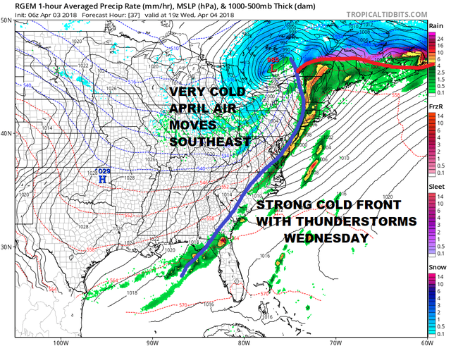
Looking at the satellite and radar we can see rain headed our way across Pennsylvania and it should be moving in shortly. Rain will be with us on and off this afternoon and it could come down steady for a time going into this evening. This is a typical warm front cold front springtime battle that is underway. The onshore flow means temperatures will be in the raw 40s all day long and hold there or even rise a bit tonight with some dense fog developing.
US SATELLITE


Wednesday we battle the warm front and whether it makes it through. It should push north of us during the morning which would take temperatures up toward or even into the 60s but this is always a tough sell with a gusty south wind and a 40 degree ocean. Then here comes a cold front with the risk for downpours and perhaps a thunderstorm.
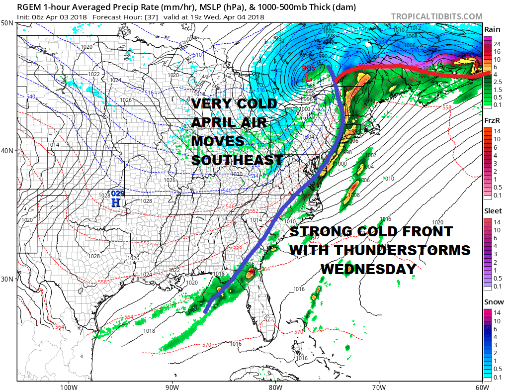
Long Island thunderstorms in the spring have a strange way of falling apart before they get here unless the upper air dynamics are strong enough to overcome the cool marine layer. The RGEM model says yes this could happen. It all depends on whether the marine layer gets out of the way. Downpours and a thunderstorm will occur between 1 and 4 am after which weather conditions improve going into the evening.
Thursday will be dry and cold and then another cold front approaches for Friday with the chance for some rain Friday morning. Over the weekend there is the chance for snow or rain from another in a seemingly endless parade of late winter spring storms. We will talk more about this later.
NATIONAL WEATHER SERVICE SNOW FORECASTS
JOIN JOESTRADAMUS ON YOUTUBE!
LATEST JOESTRADAMUS ON THE LONG RANGE
<iframe style="border: none; overflow: hidden;" src="https://www.facebook.com/plugins/post.php?href=https%3A%2F%2Fwww.facebook.com%2Fmeteorologistjoecioffi%2Fposts%2F10160293154820387&width=500" width="500" height="547" frameborder="0" scrolling="no"></iframe>
Posted from my blog with SteemPress : https://www.weatherlongisland.com/rain-approaching-long-island-warm-front-woes-tonight-wednesday/