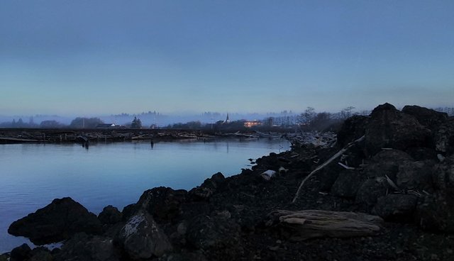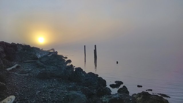
A foghorn echoed through Hoquiam, Wash., on Friday morning at around 6:30 a.m., spurring me out of my morning walk into a jog.
We were having our second day of early morning fog, and I was heading out to “Dog Marsh,” on the harbor between Eighth and K streets, for the Morning Pic. The last time I heard a foghorn and hurried down to get a pic, I ended up “missing the boat” (story), so I knew I’d better run.
I got there just in time, but the fog was so thick that I didn’t immediately realize the ship was right in front of me, maybe only 300 yards away. I took some video, which I’m calling “Ghost Ship,” because the ship felt ghostly gliding past, and because you can’t see it even as well as I could in the video. But if you like foghorns, it’s worth a listen.
According to Kayla Dunlap, public affairs manager for the Port of Grays Harbor, the ship is the Amstel Falcon, and it is carrying soybean meal to Vietnam.
Dog Marsh

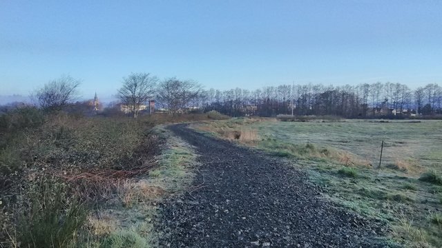
When I first wrote about this area last fall, I could not find a definitive name for the place. “Dog Marsh” comes from a column written by local author Kristine Lowder in 2018. The name is apt, because the gravel walk surrounds marshy ground, and because the area basically serves as Hoquiam’s dog park – it’s rare to walk out there without running into someone walking their dog.
The ground is unusually dry right now, especially for this time of year. There’s often standing water and waterfowl inside the walk, but we just came through the driest winter I’ve seen in the past five years. It’s dry enough that they recently mowed it.
In 1997, an inventory of Hoquiam wetlands identified just over 25 acres of the 45-acre site as wetland, using Washington state criteria. The Hoquiam Wetlands Inventory report describes the area as “filled with dredge material and diked” with “small patches of emergent wetland” that contain “scrub willow, slough sedge, and birdsfoot trefoil.”
The HWI report calls the wetland, Wetland 5.
The site is Port of Grays Harbor property. In her email to me, Kayla referred to it as IDD-1, which stands for Industrial Development District 1.
By far the most interesting name I’ve uncovered is on a National Wetland Inventory map, which labels this narrow strip of rock and dirt between the water and the dike Hoquiam Beach.

Photo Notes
After the Amstel Falcon disappeared completely, I set up to take some photos, but my camera battery died before I really got started. It was too beautiful to just give up, so I stashed the camera and used my phone for all the photos in today’s Morning Pic.

References
City of Hoquiam Department of Public Works. City of Hoquiam and Area of Proposed Annexation Wetland Inventory. Hoquiam Timberland Library local files. Copalis Beach, Wash., 1997.
Lowder, Kristine. “8 Great Dog Friendly Places to Walk in Grays Harbor.” Grays Harbor Talk. January 9, 2018. http://www.graysharbortalk.com/2018/01/09/8-great-dog-friendly-places-to-walk-in-grays-harbor/.
Port of Grays Harbor. “IDD-1 Hoquiam Riverfront.” Port of Grays Harbor. Accessed March 30, 2019. https://www.portofgraysharbor.com/properties/IDD1.php.
U.S. Fish and Wildlife Service. “National Wetlands Inventory: Surface Waters and Wetlands.” U.S. Fish and Wildlife Service. October 15, 2018. https://www.fws.gov/wetlands/Data/Mapper.html.