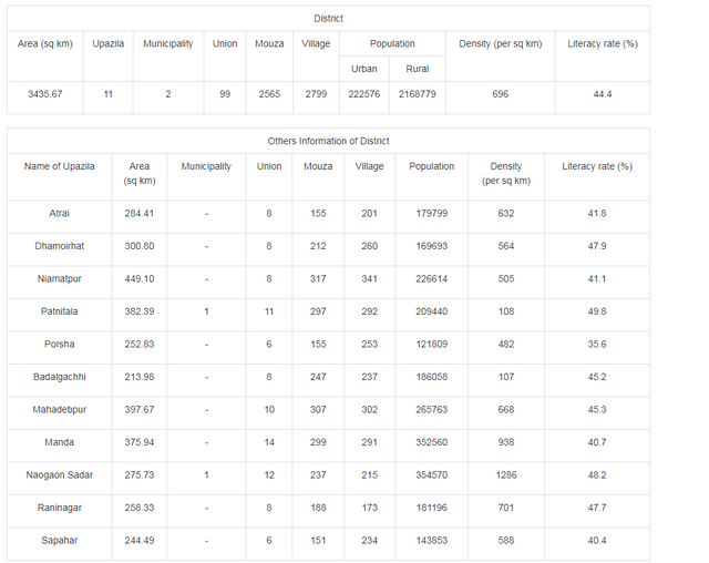
Naogaon District (rajshahi division) area 3435.67 sq km, located in between 24°32' and 25°13' north latitudes and in between 88°23' and 89°10' east longitudes. It is bounded by west bengal state of India on the north, natore and rajshahi districts on the south, joypurhat, bogra and Natore districts on the east, nawabganj district on the west.
Population Total 2391355; male 1228253, female 1163102; Muslim 2062616, Hindu 256596, Buddhist 14313, Christian 336 and others 57494. Indigenous communities such as santal, oraon, munda belong to this upazila.
Water bodies Main rivers: atrai, punarbhaba, little jamuna, nagar, Shib; chalan beel is notable.
Administration Naogaon Sub-division, under Rajshahi district, was established in 1877 and was turned into a district in 1984. Municipality was formed in 1963. Of the eleven upazilas of the district niamatpur is the largest (449.10. sq km, it occupies 13.07% of the total area of the district) and badalgachhi is the smallest upazila (213.98 sq km).
