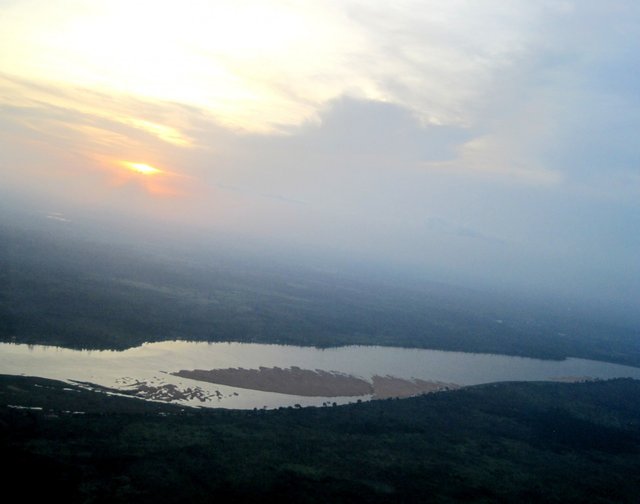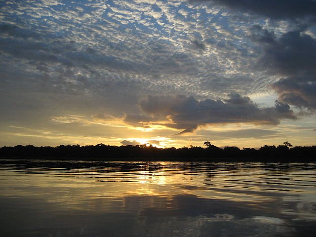
The mighty Congo River (Zaire), arc stretched across the middle of Africa.
Numerous tributaries feed the great river Zaire on its long journey from savannahs on the border of Zaire and Zambia to the Atlantic. In total they collect water from the territory of tropical forests and mountain plains about the size of India. On its long journey of 4,700 kilometers, the river is gaining such strength that it spills about 41,700 tons of water every second. In this it is second only to the Amazon.
When in 1482 the Portuguese traveler Diego Chao opened the mouth of this river, he could not overcome the thundering rapids located on the river just near the sea (now known as the Livingstone Falls). Almost 400 years the mighty river remained practically unknown to the world.
The name "Zaire" comes from the local word meaning "river". But European researchers of the XVII century called her Congo: the so-called people who lived in the lower reaches of the river. In 1971, the former Belgian Congo was renamed Zaire, and the river also received this name.

David Livingstone, a Scottish missionary and researcher of the nineteenth century, considered the Congo the source of the Nile or the Niger. However, the horrific stories of cannibals living in a forest bowl stopped even the fearless Livingstone and prevented him from testing this assumption. And only in 1876-1877 the American journalist and traveler Henry Morton Stanley first went to investigate this river.
In the Upper Current, the Congo is now called the Lualaba River and is only partially suitable for navigation. It first flows north through deep rocky ravines, then winds through the reed swamps before merging into the fish-rich Kisale Lake, the habitat of herons, osprey and kingfishers. In Kongolo, the ever-accelerating river becomes wider by a factor of 6 and reaches 500 m; located here the road and railway bridge is the only one for the next 2800 kilometers. Next lies the gorge with steep walls and boiling whirlpools — the Gates of Hell.
Downstream, up to Nyangwe, there are several shipping sites, and further the river enters the terrible jungle, through which, advancing north in 1871, David Livingston did not dare to go. It was from Nyangwe began his journey down the Congo in October 1876, Stanley after a two-year journey from the east coast of Africa. The way from Nyangwe to the mouth of the river took ten months from Stanley, and during the journey on the banks of the river he had to fight several times with the natives.

Stanley was fascinated by the battle, when he heard the alarming sound of the waterfall ahead. It was the first of seven waterfalls stretching for 90 kilometers, at which the water level in the river is reduced by 60 meters in total. Approximately a month it took an expedition to bypass them overland. Stanley called the waterfalls his name, but now they are better known as Toyohama waterfalls. Through them, a record amount of water flows — 166,850 tons per second. Behind the waterfalls, Stanley discovered a village that also named it Stanleyville, but now it's called Kisangani.
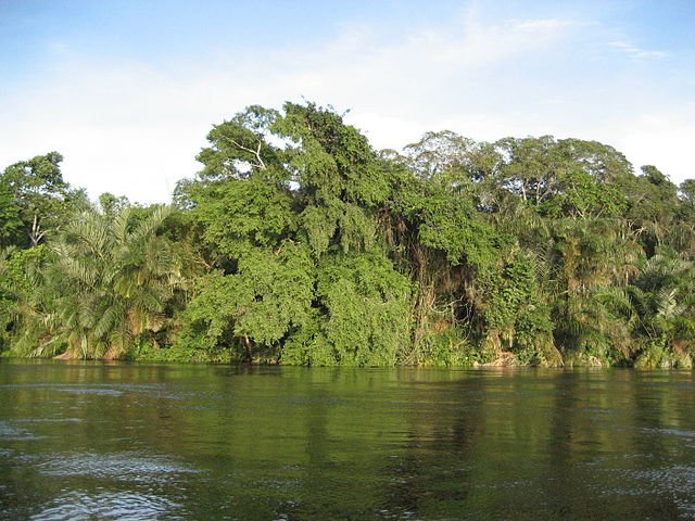
Starting from Kisangani, where the Congo River turns to the west, it serves as the main connecting artery with Kinshasa, the capital of the state, located 1600 kilometers downstream. Along the way, the river turns to the south-west, winding through a dense tropical forest, full of monkeys and colorful birds.
To the west of Kisangani, after the confluence with Aruwimi, the river expands, thousands of alluvial islets break the river into a labyrinth of ducts, a dark network of dark lagoons overgrown with water hyacinth over which the branches of trees hang low. In the Heart of Darkness, Joseph Conrad described the journey along the river as follows: "It's like a return to the beginning of the universe, when plants raged on the ground and huge trees were the kings of nature — pure water, absolute silence, an unseen thicket of forest."

Hardly the most unusual vessel in the world is cruising along the river between Kisangani and Kinshasa — a steamer, nicknamed the Great Pusher. This awkward vessel, the floating village of traders, pushes an entire army of barges, rafts, pontoons and canoes connected to each other and accommodating 5,000 people at the same time.
The pusher comes only to the largest trading ports. In other places, it just slows down the course, and canoes and dolbs just surround it, like a swarm of insects. Within minutes, mountains of different goods grow on the decks — dried fish, antelope meat, fruits and smoked monkey carcasses. And the floating village again continues its journey. Behind Mbandaka, in the second half of the way to Kinshasa, the forest becomes less frequent, and the river gathers strength for the last throw to the sea, spilling 16 km wide, with extensive swampy banks on either side.
Kinshasa, located on the southern shore of the Malebo creek, is a rapidly growing city with a population of about 340,000 people. The calm waters of the Congo are only a respite before the storm. Immediately west of Kinshasa, the Congo reaches the last leg of its journey — breathtaking waterfalls of Livingston — and again becomes unpopular. These waterfalls became the last obstacle on Stanley's long journey along the river, and he described them as "descent into the water hole".
great pictures, great read ! Thanks for your post !!
I found you on my daily nature top list and strongly believe your post is undervalued, so I upvoted and resteemed your post ! All the best !!
Downvoting a post can decrease pending rewards and make it less visible. Common reasons:
Submit
Thank you very much =)
Downvoting a post can decrease pending rewards and make it less visible. Common reasons:
Submit
you are welcome ^^ - keep going ! Great post !!
Downvoting a post can decrease pending rewards and make it less visible. Common reasons:
Submit
wherever there is water , there is beauty! Thanks for sharing.
Downvoting a post can decrease pending rewards and make it less visible. Common reasons:
Submit