This post is still discussing my article a few days ago that is https://steemit.com/photography/@ahmadzaki/benteng-kuta-lubok-the-royal-heritage-of-aceh-darussalam which kak @cicisaja advise me to discuss a little about the map distribution of sites and objects of cultural heritage in the area of cultural conservation lamuri.
And this is the map.
▶Location of Kuta Lubok, Lamreh.
▶Distribution of Nisan Aceh. Blue pin marked the Location of Nisan Aceh, while red pin signify the Distribution of ceramics and surface findings.
Kuta Lubok, Lamreh is located in the regency (Kabupaten) of Aceh Besar, 4 kilometers east of Banda Aceh (Map 1). The average topography is 33-40 m above sea level, with a series of hillocks, valley and coastline at the north of the Straits of Malacca.
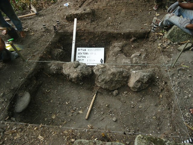
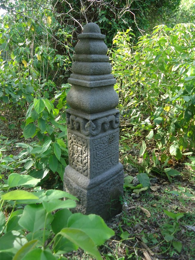
A systematic and comprehensive mapping and survey of Nisan Aceh in Lamreh would help in shedding light to answer those questions. Total station and handheld GPS were used mainly to map the location (latitude, longitude and altitude) of the complete and fragmented Nisan Aceh, as well as area topography. The raw data were then processed with AutoCAD Map 3D and Google Earth Pro software. Visible inscription, decoration and motif on the Nisan Aceh were stencilled on a paper for further identification and interpretation of grave ownership and date of burial (if available).


And most special for bg @dipoabasch who is curious about some of the questions he asked me like “Tidak ditemukan yg lain seperti kuburan misalnya? Ada kah sumber cerita yg bagus untuk benteng ini, maksudnya apa ada peperangan yg terjadi di sana pasca Iskandar Muda? Belum ketahuan tahun berapa dibangunnya juga yaa?” I will answer in the future post InshaAllah. Because I have to learn more.
By the way if you come to aceh and want to see the circumstances at Lamreh, I can help you. Because I manage a travel business. For mor information check https://www.instagram.com/ellamuri_tourtravel
Nisan Aceh instead of Gravestone is the first thing that I found it as unique in your post. did you know that Nisan came from turkish language? anyway.. I forgot to ask you about this area before, was it affected by tsunami? when it's named as kuta, it does really mean there were dwellers despite the fact that it was a fortress, but when I observed the red and green spot.. I think no other dwellers except the army in that time.
well,... this is getting more interested to follow @ahmadzaky, I rwally want to know more ... hope that you and the team will find more evidence about the fortress and look at that Nisan/gravestone.. it must be belongs to someone from the higher class, well.. you know that not everyone in that time can afford such as beautiful gravestone I supposed.
have you all interprete the words? looks like arabic or turkish word isn't it? but it could be in acehnese too?
thank you for mentioned us in this post.. I really enjoy to read more about my homeland, at least about the ancient history and glued the pieces of time and story that has so many worm hole in it.
Downvoting a post can decrease pending rewards and make it less visible. Common reasons:
Submit
You're welcome kak @cicisaja. I'm glad if you like my post. in the future I will share about other things about the gravestone of aceh. to answer the questions you asked about the tsunami in the lamreh area.
this is the answer, there are some areas with low topography exposed to tsunami while graveston that located in the highlands only affected by the earthquake.
because in the past if kings and ulama died, they were buried in the highlands. to glorify and honor their spirits.
Downvoting a post can decrease pending rewards and make it less visible. Common reasons:
Submit
So kuta lubok not really affected by tsunami 😕 ok, that will be a great opportunity to find more information on that area. Hope that you and your team able to collect more evidences and government will help to restore all the precious treasures of our ancient history.. so, do you think, the gravestone owners probably from other place and burried there for some reasons?
It become more interesting now, will you stop using photography tag😂 heey.. why don't you try using #ccc you can find the rules in one of my post. We need to expose your post more.. and keep steem it on at least 2-3 times a week. Will find a best way to support you grow your account.
Downvoting a post can decrease pending rewards and make it less visible. Common reasons:
Submit
okay, in the next post I will use the tag #ccc.
thanks for all his advice and support kak
Downvoting a post can decrease pending rewards and make it less visible. Common reasons:
Submit
Ahh one other thing... you should explore the steemworldmap or steemmapworld tag too.. I think your map and topography like that will be avgreat contribution to the world too😉 wish you continued succeed!
Downvoting a post can decrease pending rewards and make it less visible. Common reasons:
Submit