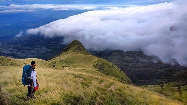
 The highest peak on Mount Merbabu reaches about 3,145 meters above sea level. Mount Merbabu is located between 4 regions in Central Java namely Boyolali District, Magelang Regency, Semarang Regency and Salatiga City. Travel to the top of Mount Merbabu can be done from several paths that are in Magelang, Salatiga and Boyolali.
Mount Merbabu is a volcano whose status is resting so this mountain does not have volcanic activity like the neighbor, Mount Merapi is known to be very active. This is one factor why this mountain is never deserted from climbing activity. This mountain last erupted in 1797. Mount Merbabu in the area of Mount Merbabu National Park which has an area of 5,725 hectares
Mount Merbabu has several peaks. The three highest peaks are Puncak Trianggulasi, Puncak Kenteng Songo and Puncak Syarif. Each peak has almost the same landscape.
From Puncak Merbabu we can see the landscape is so spectacular. From there, Sporto's best friend can see the white clouds that clot and it feels like standing on a cloud.
Some other mountains will look so beautiful from Puncak Merbabu. Among others Mount Merapi, Mount Andong, Mount Lawu, Mount Prau, and Triple S Mountain (Sindoro, Sumbing and Slamet).
When Sporto friends look down, it will be treated to a landscape that is so incredible. Green grassland will be a magnificent dish on top of Merbabu Peak. The beautiful green scenery is the savannas that we will pass if we climb through the Selo line, Boyolali.
foto + voto
Downvoting a post can decrease pending rewards and make it less visible. Common reasons:
Submit
=fotovoto
Downvoting a post can decrease pending rewards and make it less visible. Common reasons:
Submit