What's going in Sweden?
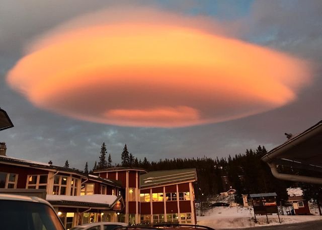
Photo credit: lorenzotti
Man made or natural features i.e.
Buildings and bridges and mountains, hills and valleys all disrupt the flow of air into eddies (small whirlpools.)
The strength of the eddies depends on the speed of the wind and the size of the objects
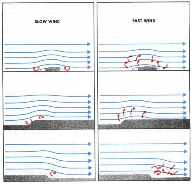
What happens next is called

"mechanical" turbulence = "mechanical disruption of the ambient wind flow.
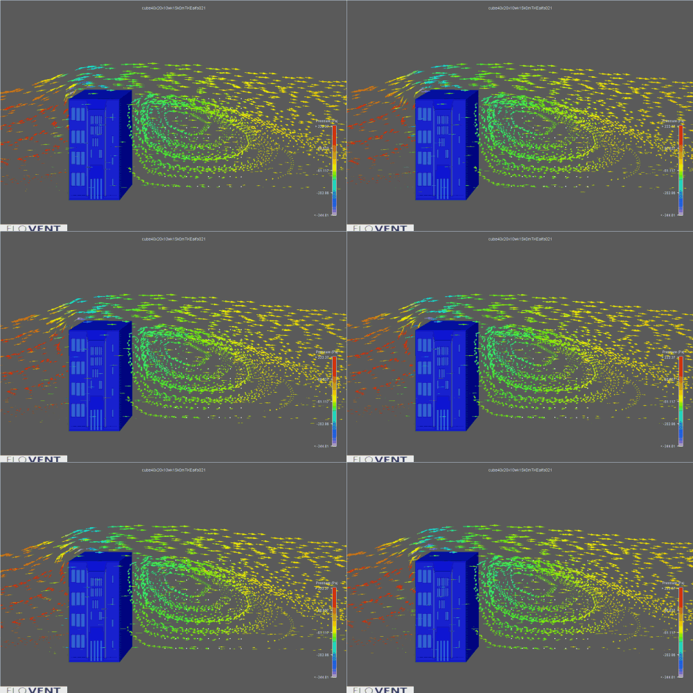
The stable moist air flows over a man made construction or natural mass or depression,
a series of large-scale standing waves may form on the downwind side.
If the temperature at the crest of the wave drops to the saturation point (dew-point) moisture in the air may condense to form lenticular clouds.
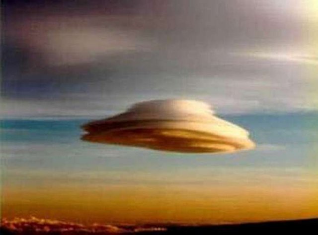
Lenticular clouds, technically known as
altocumulus standing lenticularis,
stationary lens-shaped clouds that form at high altitudes, normally aligned at right-angles to the wind direction:
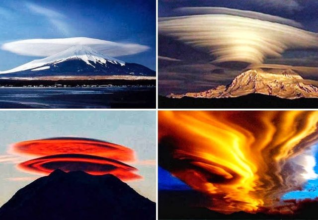
Credit: lenticular-clouds-gallery
As the moist air moves back down into the trough of the wave, the cloud may evaporate back into vapour.
Under certain conditions, long strings of lenticular clouds can form near the crest of each successive wave, creating a formation known as a "wave cloud."
The wave systems cause large vertical air movement, enough that water vapour may condense to produce precipitation.
OMG that is when . . .
the lenticular clouds have been mistaken for UFOs
What a freekin' relief!!!!!!Especially the round "flying saucer"-type, because these clouds have a characteristic lens appearance and smooth saucer-like shape;
Lenticular clouds ordinarily don't form over flat terrain.
The bright colors (called irisation) are sometimes seen along the edge of lenticular clouds.

Powered aircraft tend to avoid flying near lenticular clouds
due to the turbulence of the rotor systems that accompany them.
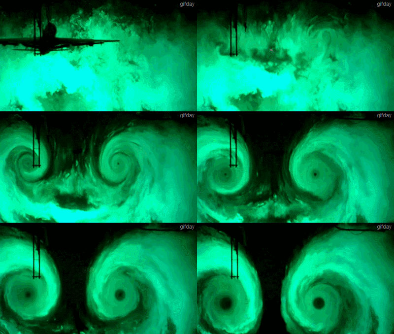
Airplane flying through fog example
Glider pilots actively seek lenticular clouds out. The precise location of the rising air mass is fairly easy to predict from the orientation of the clouds.
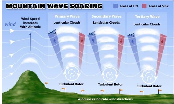
"Wave lift" of this kind is often very smooth and strong, and enables gliders, wingsuits and birds to soar to remarkable altitudes and to great distances.
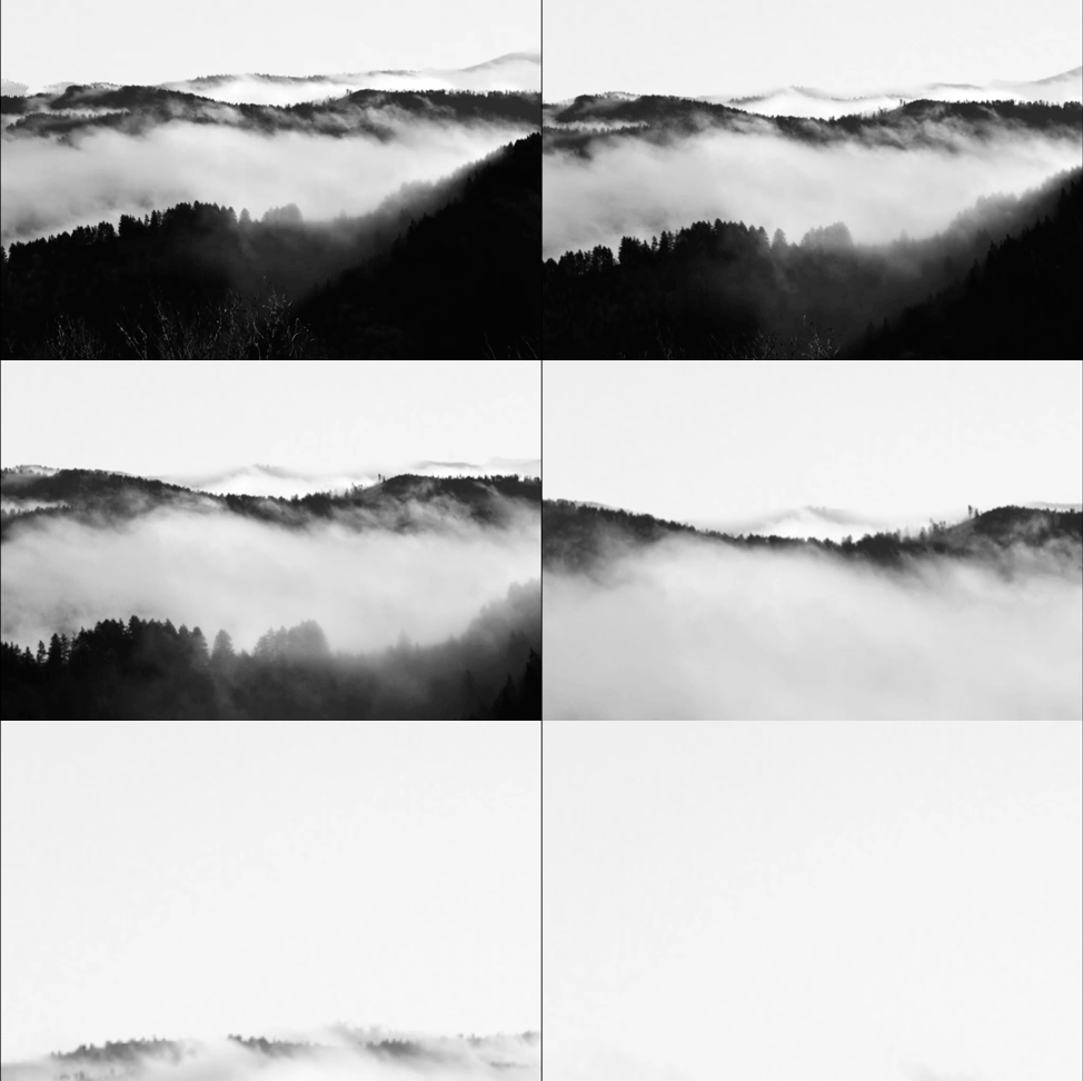
Now look up and capture the 24/7 show while you can.
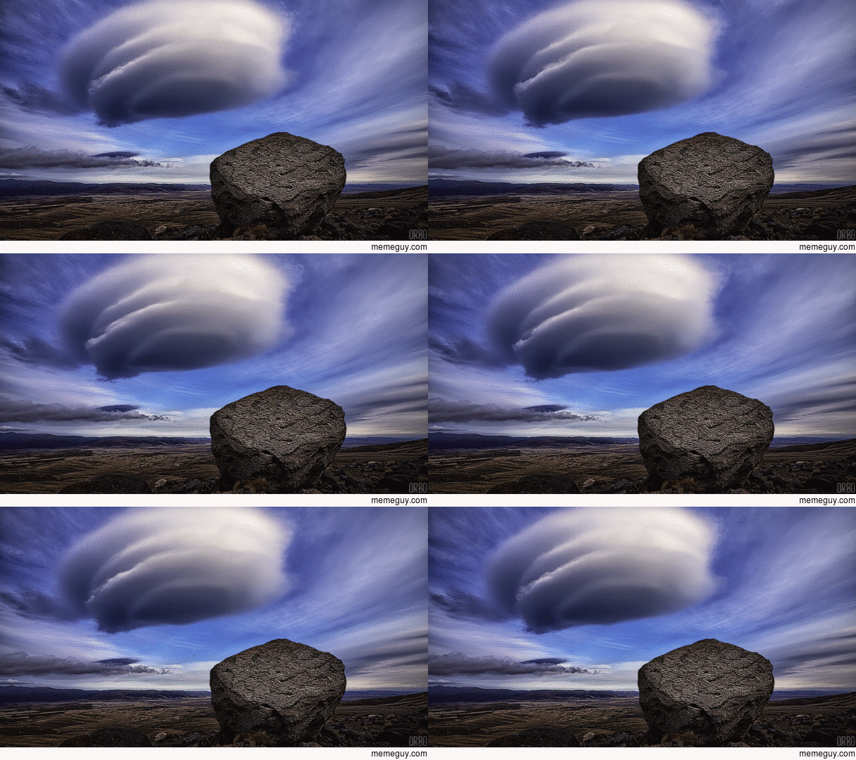
There are many people who might see it differently.
ONE PERSPECTIVE AS GIVEN TO US BY Alien Sky Ships at
http://www.alienskyships.com/UFO_clouds.html
"There are many photos on the web of the UFO clouds, as they are quite frequent in the sky. Meaning extraterrestrial beings are always close at hand watching over us. For we are the specimens in their petri dish. "
Whatever your perspective is > go out and have fun this weekend!

Great article and info about the lenticullar clouds! Living near the Sierra Nevada in Spain I was able to see a lot of them and it's always a wonder to behold!
Downvoting a post can decrease pending rewards and make it less visible. Common reasons:
Submit
Thank you so much for your kind words. Did you ever take photos?
Downvoting a post can decrease pending rewards and make it less visible. Common reasons:
Submit
Informative. Thanks!
Downvoting a post can decrease pending rewards and make it less visible. Common reasons:
Submit
Thank you, @abit.
Downvoting a post can decrease pending rewards and make it less visible. Common reasons:
Submit
Thanks for sharing... So informative and interesting! :)
Downvoting a post can decrease pending rewards and make it less visible. Common reasons:
Submit
Thanks, @lonewalker.
Downvoting a post can decrease pending rewards and make it less visible. Common reasons:
Submit
Superb post Upvoted and following
Downvoting a post can decrease pending rewards and make it less visible. Common reasons:
Submit
Wow I am grateful and I'm interested at what you are sharing. Follow back and thank you.
Downvoting a post can decrease pending rewards and make it less visible. Common reasons:
Submit
Forgot to say.. Love the Gif. Brill
Downvoting a post can decrease pending rewards and make it less visible. Common reasons:
Submit
hehe yeah... wish I thought of that one!
Downvoting a post can decrease pending rewards and make it less visible. Common reasons:
Submit