
This is the second post of the SoCal Steemit Fire Report. The main goal is to provide information about the numerous fires during fire season. Additionally, our mission is to report any natural disasters and provide a hub for supporting any steemian displaced by a natural disaster in Southern California
Heat
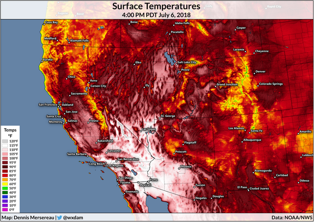
In addition to UCLA, other locations that set all-time records in Southern California include:
Hollywood Burbank Airport, 114 degrees.
Van Nuys Airport, 117 degrees.
Ramona, 117 degrees.
Santa Ana, 114 degrees.
Riverside, 118 degrees (tying record from 1925).
The excessively hot conditions combined with very low humidity and gusty winds would allow any brush fires ignited to spread rapidly. Most of Southwest California is under a red flag warning, the alert for dangerous fire weather.

Fires
Thirty-four homes were destroyed when a devastating vegetation fire tore through the foothill community of Alpine in San Diego's East County on Friday.
The latest numbers released by Cal Fire Sunday said 20 other structures were damaged and 21 accessory buildings and a commercial building were also destroyed by the 505-acre West Fire that sparked at about 11:30 a.m. Friday near Willows Road and Alpine Boulevard.
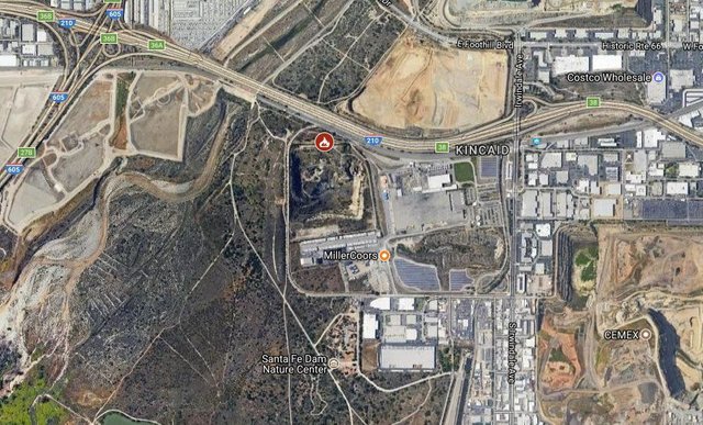
The blaze, dubbed the Arrow Fire, was initially said to be more than 5 acres in the area of the 15500 block of E Arrow Highway. The estimated size was later increased to 35 acres with 50 percent containment, according to the Los Angeles County Fire Department.
Firefighters made water drops on the second-alarm blaze from the air, as other fire crews fought the flames from the ground.

The blaze burned 113 acres, destroyed 10 homes and 14 additional structures and damaged three others, according to the Santa Barbara County Fire Department. The fire was fully contained Tuesday night.
Firefighters and other emergency responders from across the state, including crews from Ventura County who were sent less than an hour after the fire was first reported, battled the Holiday Fire, which cost an estimated $1.5 million.
U.S. Forest Service fire officials said containment on the blaze had reached 29 percent without it consuming any additional acreage, according to a news release. The has fire consumed 1,348 acres of vegetation — the same number of acres reported since Monday.
Containment, a term for getting a fire break or line around the fire, was announced at 24 percent on Wednesday and 13 percent on Tuesday. Factors like rough terrain and weather have made the firefight a tough go.
Flooding and Mudslides
Dozens of cars were stranded for hours in floodwaters and mud Thursday afternoon, prompting authorities to shut down Highway 38 near Valley of the Falls Drive in the Forest Falls and Highway 18 on the backside of Big Bear in Lucerne Valley, California Highway Patrol officials said.
Flood waters had subsided as of 2:30 p.m., and Caltrans crews worked to clear the roadway, according to CHP and San Bernardino County fire officials. By 4:45 p.m., the closed section of Highway 18 was reopened, according to the CHP.
This week’s king tides caused water to breach a seawall on Balboa Peninsula, flooding the streets late Wednesday. Swell with sizable surf and onshore winds in the region likely helped contribute to the flooding.
The National Weather Service issued a flood advisory through 11 p.m. Saturday, warning of minor coastal flooding that could happen during the high tide in low-lying areas like Sunset and Seal Beach, Newport and Oceanside.


yes, this is so helpful! Thank you!
Downvoting a post can decrease pending rewards and make it less visible. Common reasons:
Submit
Great report! Thanks @csusbgeochem1 for putting this together for the SoCal Steemians.
Downvoting a post can decrease pending rewards and make it less visible. Common reasons:
Submit