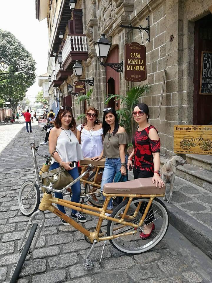
Hi! @juliank this is my entry for street photography contests.
Intramuros is the 0.67 square kilometers historic walled area within the modern city of Manila, the capital of the Philippines. It is administered by the Intramuros Administration, which was created through the Presidential Decree No. 1616 signed on April 10, 1979. Intramuros is also called the Walled City, and at the time of the Spanish Colonial Period was synonymous to the City of Manila. Other towns and arrables located beyond the walls are referred to as "extramuros", the Spanish for "outside the walls". It was the seat of government and political power when the Philippines was a component realm of the Spanish Empire. It was also the center of religion, education and economy. The standard way of life in Intramuros became the standard way of life throughout the Philippines. The Manila Galleons which sailed the Pacific for 250 years, carried goods to and from Intramuros and Acapulco, Mexico. Construction of the defensive walls was started by the Spanish colonial government in the late 16th century to protect the city from foreign invasions. The Walled City was originally located along the shores of the Manila Bay, south of the entrance to Pasig River.

We explored the place last April 8, 2017 to reminisce the history of Intramuros over 500 years.
@juliank
@potocontests
Source: Smartphone
nice and beautiful! nakalimutan mo nga lang yung source ng post mo tita.
Downvoting a post can decrease pending rewards and make it less visible. Common reasons:
Submit
Thank you @lesteemit nailagay ko na ha ha :D
Downvoting a post can decrease pending rewards and make it less visible. Common reasons:
Submit
Hi! I am a robot. I just upvoted you! I found similar content that readers might be interested in:
https://en.wikipedia.org/wiki/Intramuros
Downvoting a post can decrease pending rewards and make it less visible. Common reasons:
Submit
Thank you so much @cheetah! :)
Downvoting a post can decrease pending rewards and make it less visible. Common reasons:
Submit