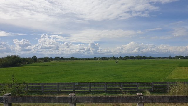
On my way back to Metro Manila from Baguio City yesterday, I was just remembering the sights as they are today and when they still looked barren from the natural disaster when Mt. Pinatubo errupted in 1991.
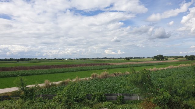
The volcano is located in Central Luzon which is northern part of Metro Manila. This region is mostly agricultural area where different crops are tilled. Pampanga province is the one that was most impacted during the eruption. Back then, I remember the then governor of Pampanga province, Lito Lapid, said on national television that Pampanga is about to be erased from the map. That was because the whole province was covered with ashes from the volcano. I can't imagine how life was back then in that place. I wished everyone had a place to go to somehow escape the nightmare.

In early 2000 when I started traveling from home to Manila and back, wide portion of the region was still whitish due to ashes. That was more than a decade after. The agricultural land was not recognizable anymore. This time after three decades from the eruption, the plains change color with the season just like they are mostly green this time.
These ones are not fish ponds, by the way. These are paddies with newly planted rice seedlings. Do you see them?
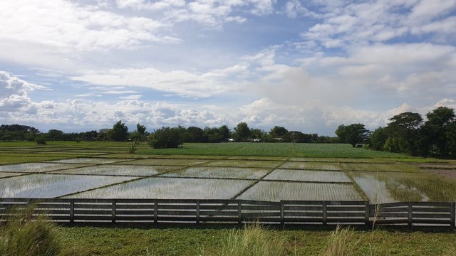
I remember the early times before the eruption when crops were varied. Major portion of the fields has rice. Others have corns, sugar canes and tobacco. However with the government regulations in the last decade prohibiting smoking in public places, tobacco plantation siezed to exist anymore in this area. Still, rice dominates the fields.

The ash fall was dreaded back then. Somehow this time, people learned to make the most of what it left. The river that no longer run out of ashes and sand became a quary site.
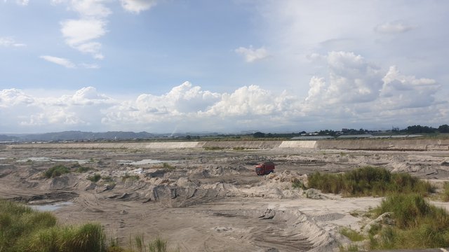
Majority of the region, or at least what's visible from the North Luzon Expressway or commonly called NLEX, is already back to being productive. Other areas remain the opposite. A few are left to grow grasses.
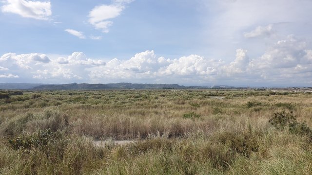
Along the NLEX is an exit road to Clark International Airport in Angeles City. This has become a regular drop and take off point for many people in the north with the attempt to avoid the congested traffic in Metro Manila. Though, I still hear stories that people get stuck for hours in traffic to this airport.
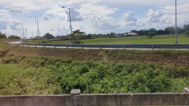
While I was enjoying the views, little did I know that while I was enjoying the sights along the way, it was also the time when another active Taal volcano in our country started spewing ashes and sands. Evacuation has immediately been ordered to residents in the nearby areas. The ashes have reached as far as almost 600 kilometers away from the volcano.
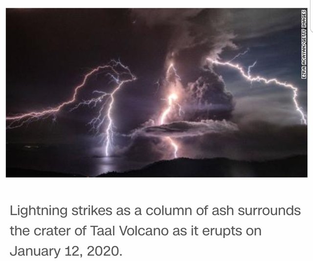
The volcano has not erupted. It is just spewing ashes and sand. That is a warning and greatest consolation. It is not like Mt. Pinatubo that immediately erupted. With the countries experience from Mt. Pinatubo, I can imagine the terror of what can happen next. I hope and pray that Taal calms down instead of erupting. And may everyone be kept safe.

Join #ccc for Guaranteed 👍 Daily Income 💵 and Payout 💸 for Newbies (2.0) 🐟 🐜 🐛 in #ccc 👣 and Follow 👣 the Honor Code 🏅 - the Creed (Conditions and Limits Inside) AND the latest update <<< please click to read.


View this post on TravelFeed for the best experience.
Very interesting.
Reminds me of when Mount St. Helens erupted in Washington.
Downvoting a post can decrease pending rewards and make it less visible. Common reasons:
Submit
I haven't followed through history and have mo idea about intensity of Mt. Helen's eruption but just imagining a volcano eruption is terrifying. I hope volcanoes just sit calmly. 😊
Downvoting a post can decrease pending rewards and make it less visible. Common reasons:
Submit
As they should!
Fingers crossed for Mt. Rainer (another volcano in the PNW) lol :)
Downvoting a post can decrease pending rewards and make it less visible. Common reasons:
Submit
Wow macoolette, I sure hope that volcanoe doesn't erupt. Those are some really good pictures of the countryside you have here, so much of the land looks recovered!
Downvoting a post can decrease pending rewards and make it less visible. Common reasons:
Submit
Yap, most part of the land are productive now. The challenge that I heard was irrigation though that is not something new. It has been like that even before the volcanoe erruption. I just hope it is not worse after.
Taal volcano has not erupted and spewing of ashes have subsided. I hope it will eventually calm down.
Do you have any volcanoes near your place?
Downvoting a post can decrease pending rewards and make it less visible. Common reasons:
Submit
Howdy today macoolette! I'm glad that volcano did not erupt! I hope it stays asleep.
No, we have no volcanos in this part of the country. In fact, I think the only volcano that has been active in the main body of the country in the last hundred years is way up North in the state of Washington, Mount Saint Helens.
Alaska has alot of them but I don't think we have any in the lower states.
Downvoting a post can decrease pending rewards and make it less visible. Common reasons:
Submit
Good for you then. You won't experience the terror of volcanoes when they get mad.
Downvoting a post can decrease pending rewards and make it less visible. Common reasons:
Submit
That is true and I hope yours over there don't act up. Alaska has many active volcanos which are frequently rumbling and smoking!
Downvoting a post can decrease pending rewards and make it less visible. Common reasons:
Submit
I can't imagine living in ice world. Much more with volcanoes... 🥺
Downvoting a post can decrease pending rewards and make it less visible. Common reasons:
Submit
I agree. They also have many earthquates, small ones but still. lol. No thanks!
Downvoting a post can decrease pending rewards and make it less visible. Common reasons:
Submit
Congratulations, Your Post Has Been Added To The Steemit Worldmap!
Author link: http://steemitworldmap.com?author=macoolette
Post link: http://steemitworldmap.com?post=erupting-thoughts-on-the-run-under-a-clear-blue-sky
Want to have your post on the map too?
Downvoting a post can decrease pending rewards and make it less visible. Common reasons:
Submit
Congratulations @macoolette! Your post made the TravelFeed team happy so we have sent you our big smile. Keep up the good job. 😃
Thanks for using TravelFeed!
@for91days (TravelFeed team)
PS: You can now search for your travels on-the-go with our Android App. Download it on Google Play
Downvoting a post can decrease pending rewards and make it less visible. Common reasons:
Submit