And this is the day, I'll never forget! Don't get me wrong, I'll remember every day on this trek until the end of my life, but THIS DAY was more special. We ejected most of the possible fluids on our way - blood, tears, sweat and even some vomit, fortunately not enough for panic! We all touched our mental and physical capability limits on very hard way and some of us even crossed them, but we all survived and everyone can be proud about that. Looks like a perfect day to die on this pic, isn't it?
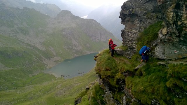
Day 6 began as usual - wake up alarm at 6 AM, started to walk at 8 AM. The first few kilometers of trail was a big mess due to lots of unmapped trails and some construction works. After almost two hours later we could still see our campsite at the distance:
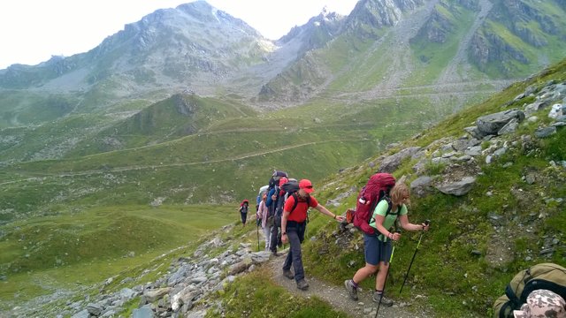
Slow start wasn't good, because we had three mountain passes to cross today and very dramatic landscape ahead. Rapid changes of weather made this fantastic scenery even more dramatic...
The way to first pass was mostly a long traverse on very steep slope:
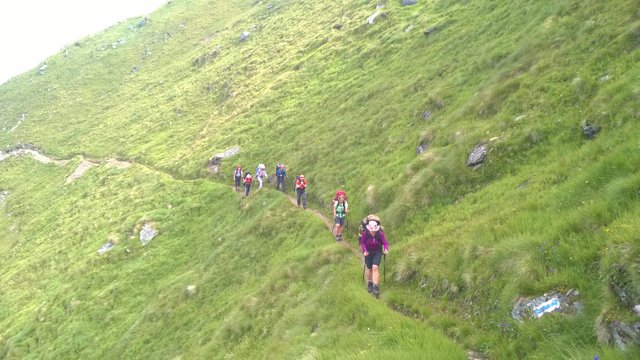
There were occasionally some warning-signs... Actually, they were more like direct orders not to waste your time and risking with your life in rockfall-zone:
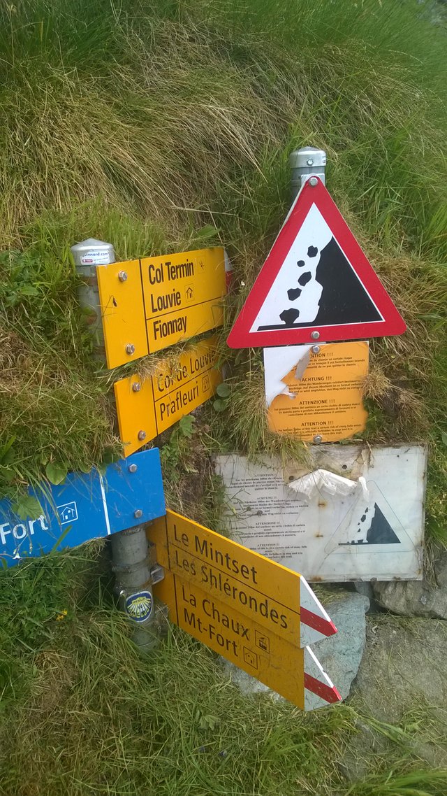
And on the other side was another sign. Here you can see other trekkers crossing the danger-zone, while I'm already waiting for them:
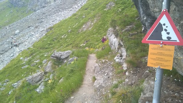
Here is a good sample about combination of terrain and weather, we had to deal on this day:
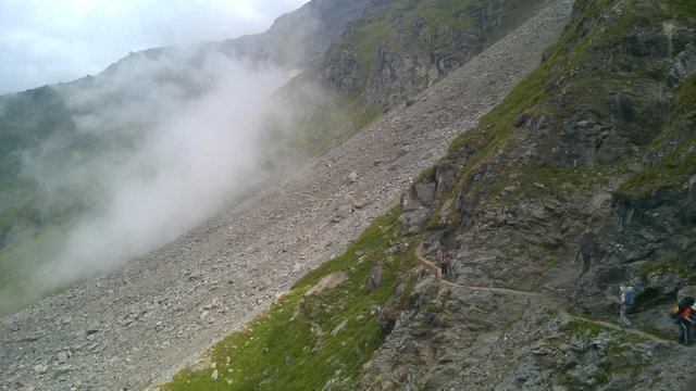
...and this was just a beginning...
It took us almost 4 hours, but finally we reached to our first pass this day, Col Termin at 2648 m asl:
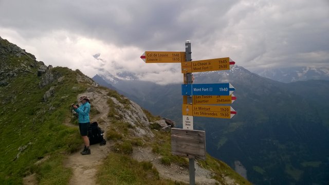
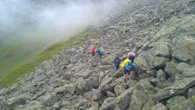
Four hours on the way and this was just a fractional part of our goal today!! No long break here, we were behind the schedule already... The journey to second pass was even more fantastic, you can look again the first picture of this post. It was shot about 10 minutes after leaving Col Termin. Very soon we were entered to Mordor! Here are some examples of new combinations between trail, boulderporn and constantly-rapidly changing dramatic weather:
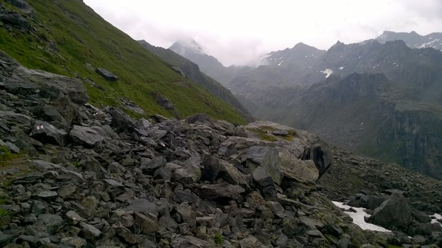
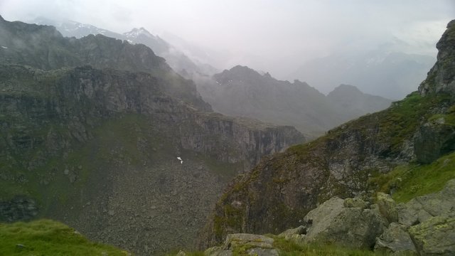
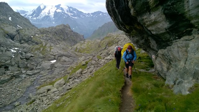
And there was about a time to reach our second mountain pass this day... Can you see, how exhausted they look?
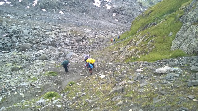
Do I have to remind, its just on the half way today, we have walked almost 7 hours already and there is a looooong way ahead today! I remember, I performed some motivational speech right after this moment. It could be the theory I had heard somewhere about 40%-rule: "If you think, you can't do any move anymore, you have used only about 40% of your real resources! So we had a perfect time to try the other 60% today...". Or it could be simply: "The first dead body will pay for all beers in our next bar!". Doesn't matter, it worked and we all survived!
Very soon we stood on the second mountain pass - Col de Louvie at 2921 m asl:
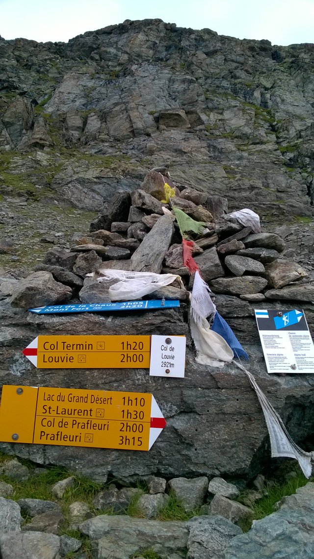
This pass was a gateway to another world, as you can see:
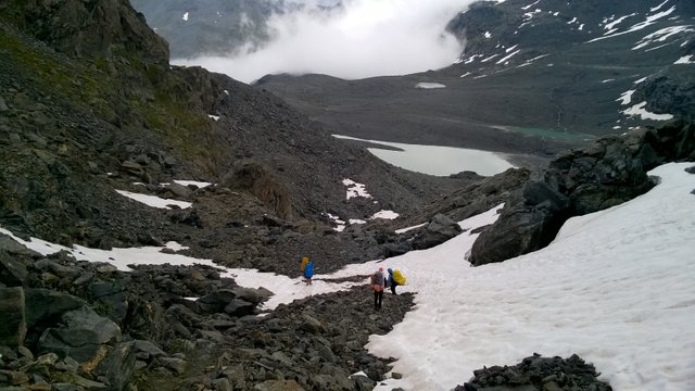
And don't forget, it was in middle of the August!
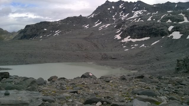
The only signs of humane existence were trailmarks on boulders:
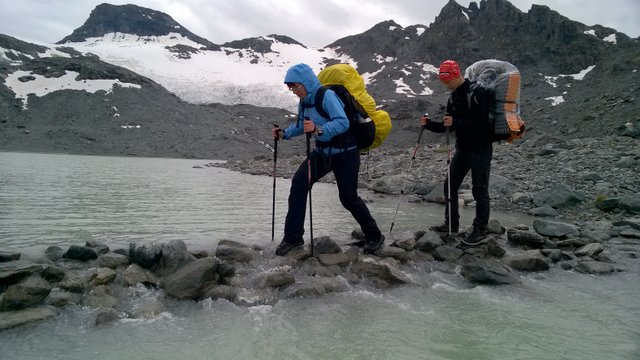
There was no room for mistakes while crossing some wet obstacles:
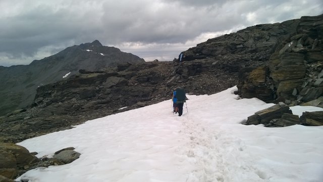
We had many snowfields on our way this day:
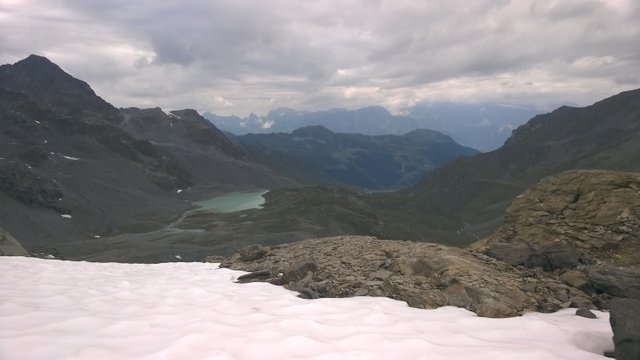
But our way was still uphill:
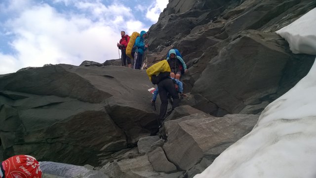
And some short climbs as well:
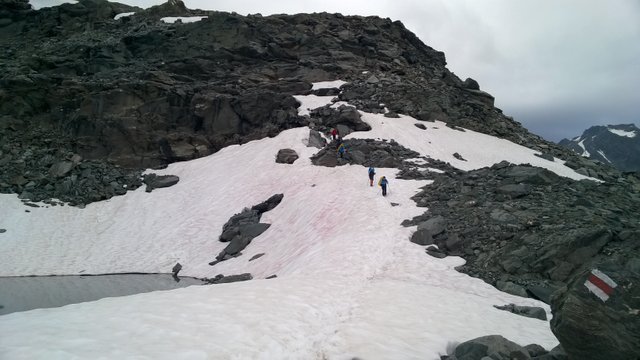
At this moment, after 9 hours and 15 minutes of walking, we were more like crawling zombies, but we still moved towards our third and final mountain pass this day, highest on the whole trek:
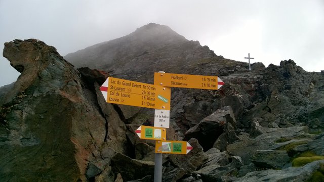
It took another 40 minutes, before i took this picture on Col de Prafleuri at 2987 m asl:
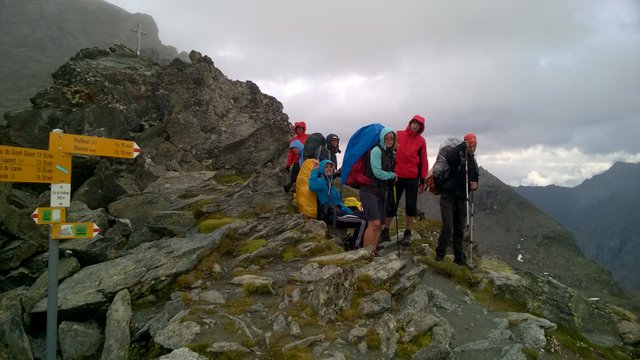
And couple of minutes later I could shoot the rest of happy and exhausted faces on the pass:
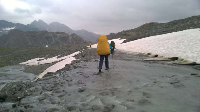
We still had to descent and find a campground for us and there was one more water to cross:
This extremely long day still just refused to end... I don't even know our exact distance this day, because GPS-logger had limites as well and it missed my motivational speech. Anyway, it recorded 13,6 km and stopped working 2,5 hours before our journey was completed! So about 18 km is a fair calculation and we were on our way 11 hours!
Don't take too seriously all the above drama, this trail is the best kick-ass weekend hike with light backpack. Just drive to Le Chable on friday afternoon, take a ride to Les Ruinettes, and walk to Mont Fort hut for overnight without heavy trekking gear. Walk to cabane de Prafleuri on saturday and finish in Arolla on sunday. But check the weather forecast carefully, because its too easy to get Darwin Award on slippery stones or losing the trail in unexpected summer snowstorm! And don't forget to book your beds in huts well in advance...
Thanks for your time and I hope you liked it and got inspired for adventure!
thanks for sharing sounds like an interesting trip! Upvoted and following. Looking forward to more adventures
Found your post on the @steemitworldmap's Daily Travel Digest
Downvoting a post can decrease pending rewards and make it less visible. Common reasons:
Submit
Thank you! :)
Followed you too. I haven't visited Australia yet and I'm looking forward as well to get some inspiration :)
Downvoting a post can decrease pending rewards and make it less visible. Common reasons:
Submit
I was never a fan of trekking posts until I started reading yours! Maybe your stories are just too dangerous, they're extreme lol
Downvoting a post can decrease pending rewards and make it less visible. Common reasons:
Submit
Thanks a lot! This could be the best compliment a blogger can ever get! :)
Downvoting a post can decrease pending rewards and make it less visible. Common reasons:
Submit
Good stuff mate. Like the depth and feeling involved. Congrats on the big vote ;)
Downvoting a post can decrease pending rewards and make it less visible. Common reasons:
Submit
Thank you very much! I almost got a heart attack this morning, when I saw the number of votes and predictable reward :D
Downvoting a post can decrease pending rewards and make it less visible. Common reasons:
Submit
I take it you guys are experienced and not just anyone can do this walk? The views are spectacular up there. I'm glad I spent the time to read about this trip and see the photos.
Downvoting a post can decrease pending rewards and make it less visible. Common reasons:
Submit
Thank you!:)
Some members in my group were beginners in trekking. It's fine, if just 1-2 members of team are experienced in trekking. There is a need of some navigation skills and choosing campsites. We had all the gear with us, this made it physically more challenging, but there is an option to sleep in huts and hotels every night.
Downvoting a post can decrease pending rewards and make it less visible. Common reasons:
Submit
Congratulations @martinsu! You have completed some achievement on Steemit and have been rewarded with new badge(s) :
Click on the badge to view your Board of Honor.
If you no longer want to receive notifications, reply to this comment with the word
STOPTo support your work, I also upvoted your post!
Do not miss the last post from @steemitboard!
Participate in the SteemitBoard World Cup Contest!
Collect World Cup badges and win free SBD
Support the Gold Sponsors of the contest: @good-karma and @lukestokes
Downvoting a post can decrease pending rewards and make it less visible. Common reasons:
Submit
You have a minor misspelling in the following sentence:
It should be existence instead of existance.Downvoting a post can decrease pending rewards and make it less visible. Common reasons:
Submit
Yes, thanks! :)
Downvoting a post can decrease pending rewards and make it less visible. Common reasons:
Submit
Väga hea post, seda oli meeldiv lugeda :)
Downvoting a post can decrease pending rewards and make it less visible. Common reasons:
Submit
Suured tänud! :)
Downvoting a post can decrease pending rewards and make it less visible. Common reasons:
Submit
Anna tead kui uus post üleval, ma tulen vaata veel... ;) ok.
Downvoting a post can decrease pending rewards and make it less visible. Common reasons:
Submit
Saab tehtud! :)
Täna puhkan või siis alustan, loodan homme postitada.
Downvoting a post can decrease pending rewards and make it less visible. Common reasons:
Submit
Congratulations, Your Post Has Been Added To The Steemit Worldmap!
Author link: http://steemitworldmap.com?author=martinsu
Post link: http://steemitworldmap.com?post=trekking-from-chamonix-to-zermatt-walkers-haute-route-day-6
Want to have your post on the map too?
Downvoting a post can decrease pending rewards and make it less visible. Common reasons:
Submit
Congratulations @martinsu!
Your post was mentioned in the Steemit Hit Parade for newcomers in the following categories:
I also upvoted your post to increase its reward
If you like my work to promote newcomers and give them more visibility on Steemit, consider to vote for my witness!
Downvoting a post can decrease pending rewards and make it less visible. Common reasons:
Submit
Thank you very much! :)
Downvoting a post can decrease pending rewards and make it less visible. Common reasons:
Submit
What a beautiful trek. I never heard of the 40% rule. Will keep that in mind the next time I'm too exhausted to set another foot =)
Downvoting a post can decrease pending rewards and make it less visible. Common reasons:
Submit
Some army-dude explained this theory somewhere and it got stuck in my head since then. Usually works :D
Downvoting a post can decrease pending rewards and make it less visible. Common reasons:
Submit
Stunning climb! I loled at the "boulderporn". As a rockhound, I would have been stopping every couple of feet checking the rocks for some collectible minerals.
BTW, I found your post via @steemitworldmap's Daily Travel Digest.
Downvoting a post can decrease pending rewards and make it less visible. Common reasons:
Submit
Thank you! We called those chaotic boulders so, but they were named to boulderfields in our guidebook :D
Downvoting a post can decrease pending rewards and make it less visible. Common reasons:
Submit
By scrolling through your previous hike parts, I saw a familiar clothing and face in ur pics. There is a guy named Enri. He is my neighbour as well as my childhood friend, Estonia is small lol :D
Downvoting a post can decrease pending rewards and make it less visible. Common reasons:
Submit
Yes, he is my co-worker! :D
Downvoting a post can decrease pending rewards and make it less visible. Common reasons:
Submit
Hi martinsu,
LEARN MORE: Join Curie on Discord chat and check the pinned notes (pushpin icon, upper right) for Curie Whitepaper, FAQ and most recent guidelines.
Downvoting a post can decrease pending rewards and make it less visible. Common reasons:
Submit
Thank you very much! :)
Downvoting a post can decrease pending rewards and make it less visible. Common reasons:
Submit
Heya, just swinging by to let you know you're being featured in our Daily Travel Digest!
Downvoting a post can decrease pending rewards and make it less visible. Common reasons:
Submit
This is great, thank you very much! :)
Downvoting a post can decrease pending rewards and make it less visible. Common reasons:
Submit