Open Chart Plotter Navigator (OpenCPN) is a free software project for creating a navigation software and compact plotter charts, for ongoing usage or as a planning tool. OpenCPN is developed by an active seaman team which uses the conditions of the real world for testing and repair program. OpenCPN uses GPS data input to determine the position of the ship itself and data from the AIS receiver to plan the position of the ship in the neighborhood.
source
Links related to the translation
Source Language
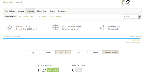
The source language of the project is English.
Translated Language
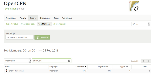
Indonesian Language.
Number Of Words
Number of words translated on this contribution: 1127 words


Proofread Words
I am one of the proofreaders in the Indonesian language
Previous translation on the same project
Number of words translated on the project before this report: 1127

Previous translation on the same project
This my first contribution on this project
Posted on Utopian.io - Rewarding Open Source Contributors
Thank you for the contribution. It has been approved.
You can contact us on Discord.
[utopian-moderator]
Downvoting a post can decrease pending rewards and make it less visible. Common reasons:
Submit
Hey @shamuel I am @utopian-io. I have just upvoted you!
Achievements
Suggestions
Get Noticed!
Community-Driven Witness!
I am the first and only Steem Community-Driven Witness. Participate on Discord. Lets GROW TOGETHER!
Up-vote this comment to grow my power and help Open Source contributions like this one. Want to chat? Join me on Discord https://discord.gg/Pc8HG9x
Downvoting a post can decrease pending rewards and make it less visible. Common reasons:
Submit