Components
Basic Air Data / GPSLogger is an open source application offered by BasicAirData befungsi to record your position of your accuracy. This is your positioning gps tracking which is a lightweight app on android, after i used this app, i did not find the features MTRS (Military Grid Reference System) & UTM (universal tranverse mercator) and status & location.
Proposal
I would like to propose to the developer of the BasicAirData / GPSLogger application to add features MTRS (Military Grid Reference System) & UTM (universal tranverse mercator) and status & location.
Mockups / Examples
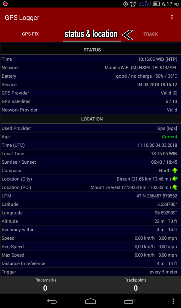
this is how it looks on the BasicAirData / GPSLoggger app after adding the features MTRS (Military Grid Reference System) & UTM (universal tranverse mercator) and status & location.
- before
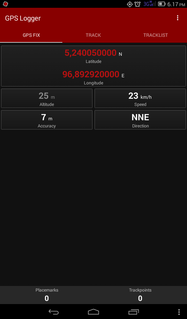
- before
features MTRS (Military Grid Reference System) & UTM (universal tranverse mercator) and status & location.
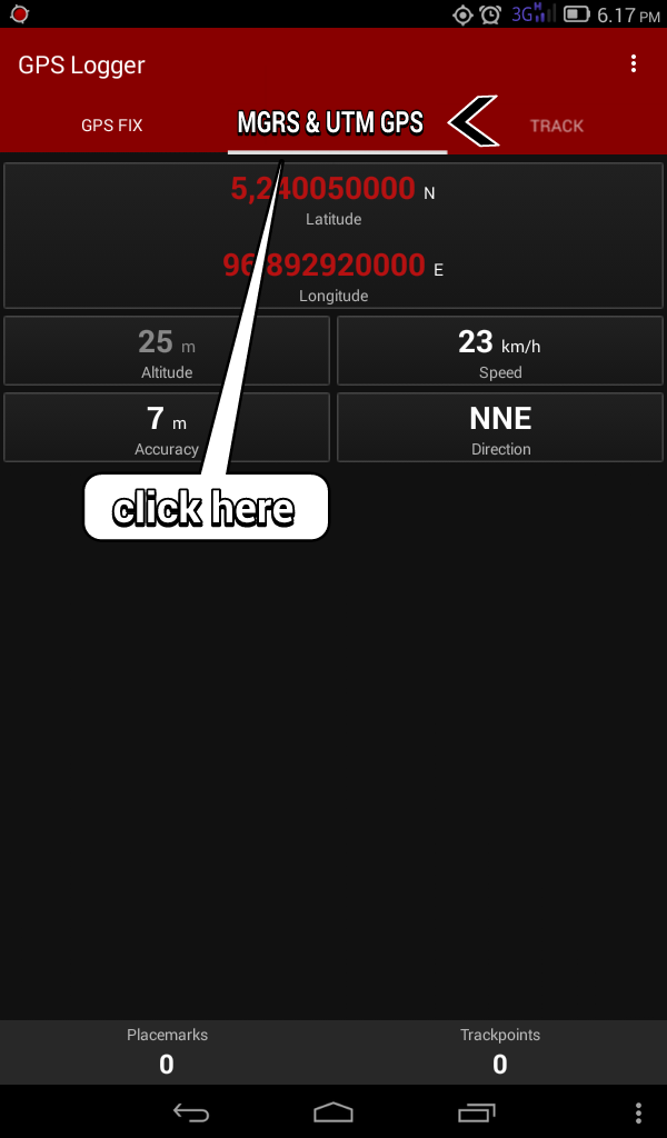
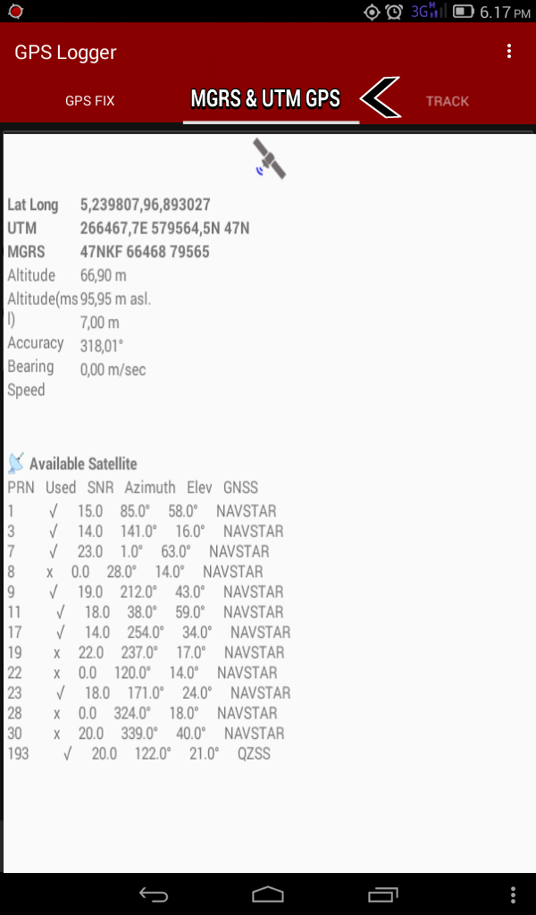
feature status and informtion
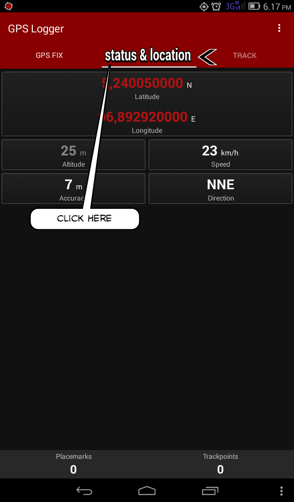
Benefits
the feature advantage I propose is that the MGRS (Military Grid Reference System) & UTM (universal tranverse mercator) feature can see the gps height alignment point, accuracy speed, MSL elevation, satellite providers and location (azimuth and angle elevation) are amazing features and users of BasicAirData / GPSLogger applications can view all of the information directly, for the status and location feature the user can see the direct position of himself automatically and this is very helpful to the user application BasicAirData / GPSLogger, with the presence of these two features will make the application BasicAirData / GPSLogger more perfect and more donwload this app.
Posted on Utopian.io - Rewarding Open Source Contributors