Virtual Reality as a home entertainment option is of the future. Yes VR is being used right now across various industries and solving problems for some business who are forward thinking enough to implement it, yet fewer than 10 million people have the most advanced VR hardware in their home. As a result, the content available on VR systems is thin and underfunded. That said, there is one VR experience that’s completely exhilarating. Actually, It’s the family member of a program that many of us now use and rely on every day (and in some cases every time we leave the house).
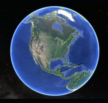
Google maps puts the entire world on a phone screen and helps us travel anywhere we want. Google Earth makes the world big again. It’s an immersive and more visually realistic version of Google maps available in a VR headset. In Google Earth you can fly above the world, descend on your destination, and move through city streets anywhere on our planet.
The images are gathered by satellites and airplane cameras. With multiple lenses and varying angles, Google has captured all 196.9 million square miles of the globe, arranging the images together through a process called photogrammetry to create a digitally immersive replica of the earth. The number of photos that make up the program is “in the order of 10s of millions” and the globe is shown to us as an 800 billion pixel image (if this many pixels were printed on a physical object, it would fit across an entire city block).
Graphicists working in a game engine photo edit the images to remove shadows, clouds, and in some cases objects that may impede our clear view of the earth. Once the photos are arranged properly (not out of order) objects like trees, buildings, and bridges are stitched together through a software called “mesh.” This transforms them from flat images into 3D models that sprout from the earth’s surface.
It’s all created to scale and inside a digitally immersive world. By pressing the buttons of the VR controls you move like a drone. You can view the earth as though you’re standing on the moon, zoom all the way in to the mailbox in front of your house, or stop anywhere in between.
By updating some of the images multiple times per year, Google is able to look back at the data — across the program’s 10-year lifespan — and notice changes in forestation, human foot and auto traffic, and use heat maps to evaluate variation in temperature patterns across the world.
It may be the only VR experience we’ll never fully explore.
Much of the info in this article comes from this video. It’s really well done. https://www.spar3d.com/blogs/the-other-dimension/tech-google-earth-use-generate-3d-imagery/