The NAM was onto something.
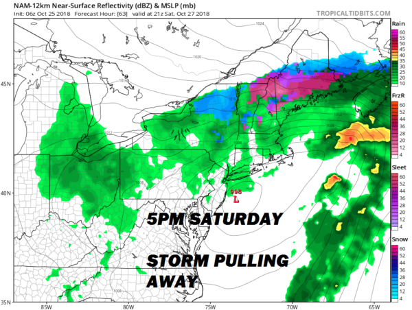
All indications from this morning have this weekend's nor'easter only ruining half of it. Saturday will be a good day for indoor plans.
First, a quick look at today. Expect plenty of sunshine but below normal temperatures by about 10°. A tad on the breezy side but a little less than yesterday. Clear skies overnight means widespread 30s tomorrow morning. There is a frost advisory in effect for the eastern half of the island.
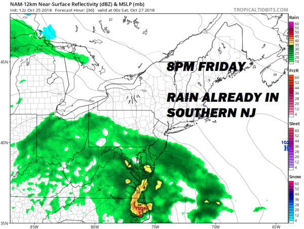
Clouds will increase during the day tomorrow and rain will begin late Friday night (close to midnight for you night owls) and become steady and heavy Saturday morning. The wind will really get going then as well, with northeast gusts over 40 mph likely. That driving rain coupled with temperatures around 50 means that being outside will not be pleasant.
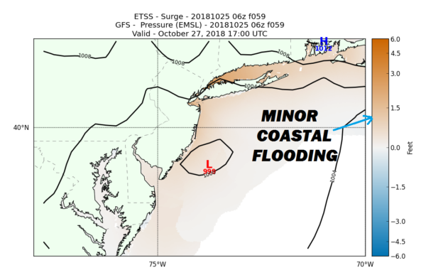
With a strong high to the northeast tightening the pressure gradient, coastal flooding will likely occur. While it looks like most low-lying spots will see minor flooding (1-2' above normal), there could be a few locations that see some moderate flooding (2-3' above normal). Those in low-lying areas along the south shore and Long Island sound should consult local high tides beginning Friday evening. Beach erosion and rough seas of over 10' are to be expected.
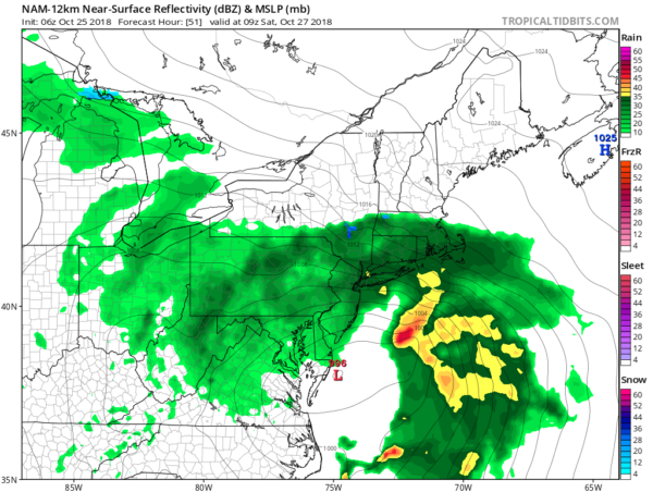
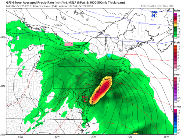
The only model discrepancies as of right now are the position of the heaviest rain early Saturday. The NAM RPM and ECMWF believe the worst will pass off to the east, with the GFS is the outlier and bringing it further west. While 1-1.5" is expected for most, there could be a few places on the east end that pickup 2"+ if the storm were to trend westward.
With the storm's faster movement means rain will begin to lighten Saturday evening and taper off Saturday night. This means Sunday will be salvageable! Expect lots of clouds and maybe some drizzle early on with some breaks of sun during the afternoon. The dry weather will be short-lived as another weather system brings rain and breezy conditions back on Monday.
We will take another look at the long-range and Halloween this evening.
Posted from my blog with SteemPress : https://www.weatherlongisland.com/other-models-join-nam-with-faster-weekend-storm/

I upvoted your post.
Keep steeming for a better tomorrow.
@Acknowledgement - God Bless
Posted using https://Steeming.com condenser site.
Downvoting a post can decrease pending rewards and make it less visible. Common reasons:
Submit