Read this post on TravelFeed.io for the best experience
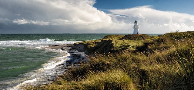
We drove South Island almost to the southernmost point called Slope Point. From there, to the South Pole is about 4800 km, and to the coast of Antarctica about 2700 km. It's very close, and the breath of the icy continent is already felt: in these places there are quite strong winds and waves. We saw the signpost to Slope Point, but decided to take a walk in a more interesting place nearby, at the Waipapa Point Lighthouse. What can I say ... it was a great choice!
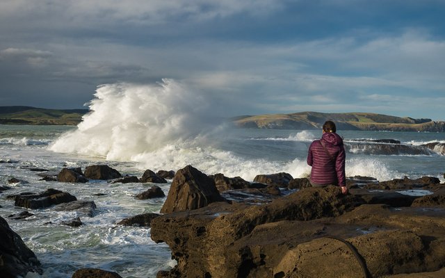
Some of the biggest waves I've seen in my life so far are in Curio Bay, also on the southern coast of the island. The ocean rages on the stones with fury, and the ramparts, which cannot be counted, rise to enormous heights — a sight that will never be boring!
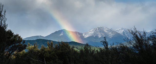
Lake Te Anau, which is hidden behind the trees in this photo, is the second largest in New Zealand. This is not a great achievement, but the remarkableness of this area is another thing...
2500px
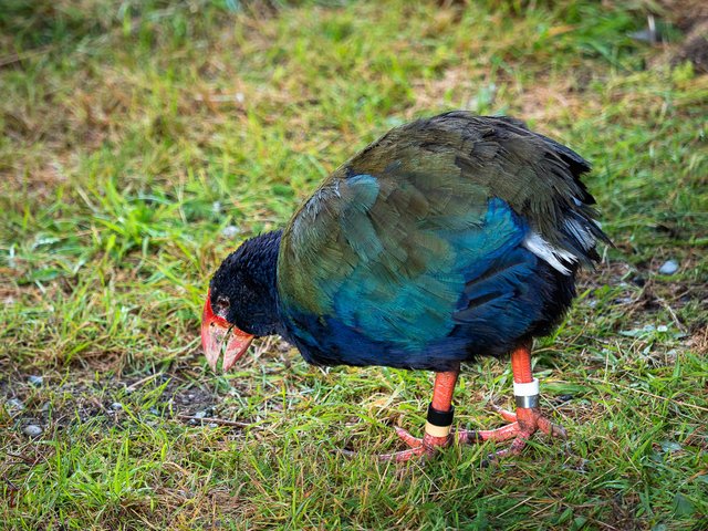
The fact is that a very beautiful bird (which was considered extinct) was found here in the middle of the 20th century. Like kiwi, it is also flightless, but much more beautiful! Just look at the color of the plumage! This is Takahe. Maori hunted them because of the bright feathers, which they later used in holiday dresses, and overdid it a bit in their hunt.
Now we can see them in the Te Anau Bird Sanctuary. But I heard a rather sad story that supposedly all the remaining birds are in this reserve in open enclosures, and they do not breed well there. I hope that this is not so and birds can survive!
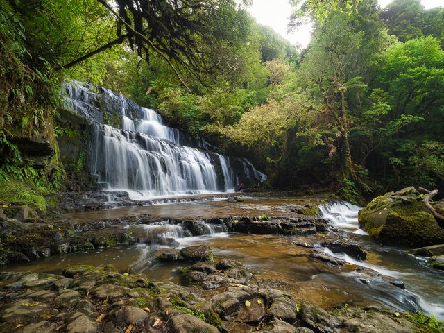
Here you can see a cascading Purakaunui Falls in the Catlins region, a beautiful and easily accessible waterfall. A picturesque walking trail leads to it, and the waterfall has a good viewing platform.
2500px
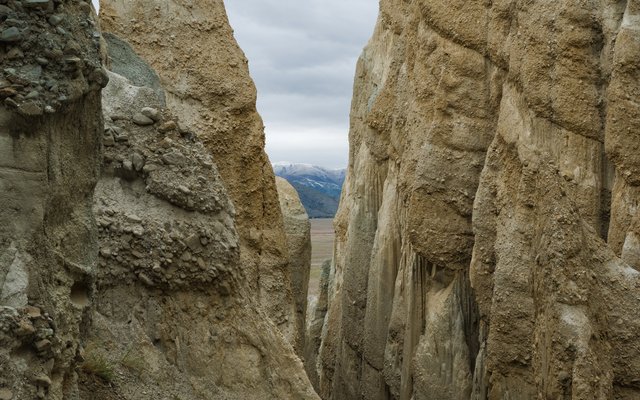
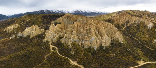
Clay Cliffs is a very surprising place near Omarama town. From the parking lot they are not very visible, you are walking along a path among shrubs and before your eyes appears a passage into the rocks.
2500px
Once upon a time, about two million years ago, streams formed from melting glaciers flowed here. They carried sand, silt and gravel, and these rocks are the result of their work.
2500px
To be continued... ;)
Part 1
Part 2
Part 3
Part 4
Part 5
Part 6
Part 7
Part 8
Part 9
Camera: OLYMPUS E-M1 MarkII and DJI Mavic 2 Pro
P.S.One small but important note. Because this post was made for the TravelFeed.io project through its interface, it seems to me that all links work correctly only when viewing through TravelFeed.io. This applies to both text links and high-resolution image links. So, if some links don't work, but you are interested in them — follow the links at the beginning or at the end of the post.
You can also see my photos in my blogs on LJ and Golos and in my profile on NatGeo
View this post on TravelFeed for the best experience.
Congratulations @sharker! You received a bright smile from TravelFeed. Our eyes were beaming while reading your post. 😁
Thanks for using TravelFeed!
@invisusmundi (TravelFeed team)
PS: You can now search for your travels on-the-go with our Android App. Download it on Google Play
Downvoting a post can decrease pending rewards and make it less visible. Common reasons:
Submit
Thanks for your support!)
Downvoting a post can decrease pending rewards and make it less visible. Common reasons:
Submit